

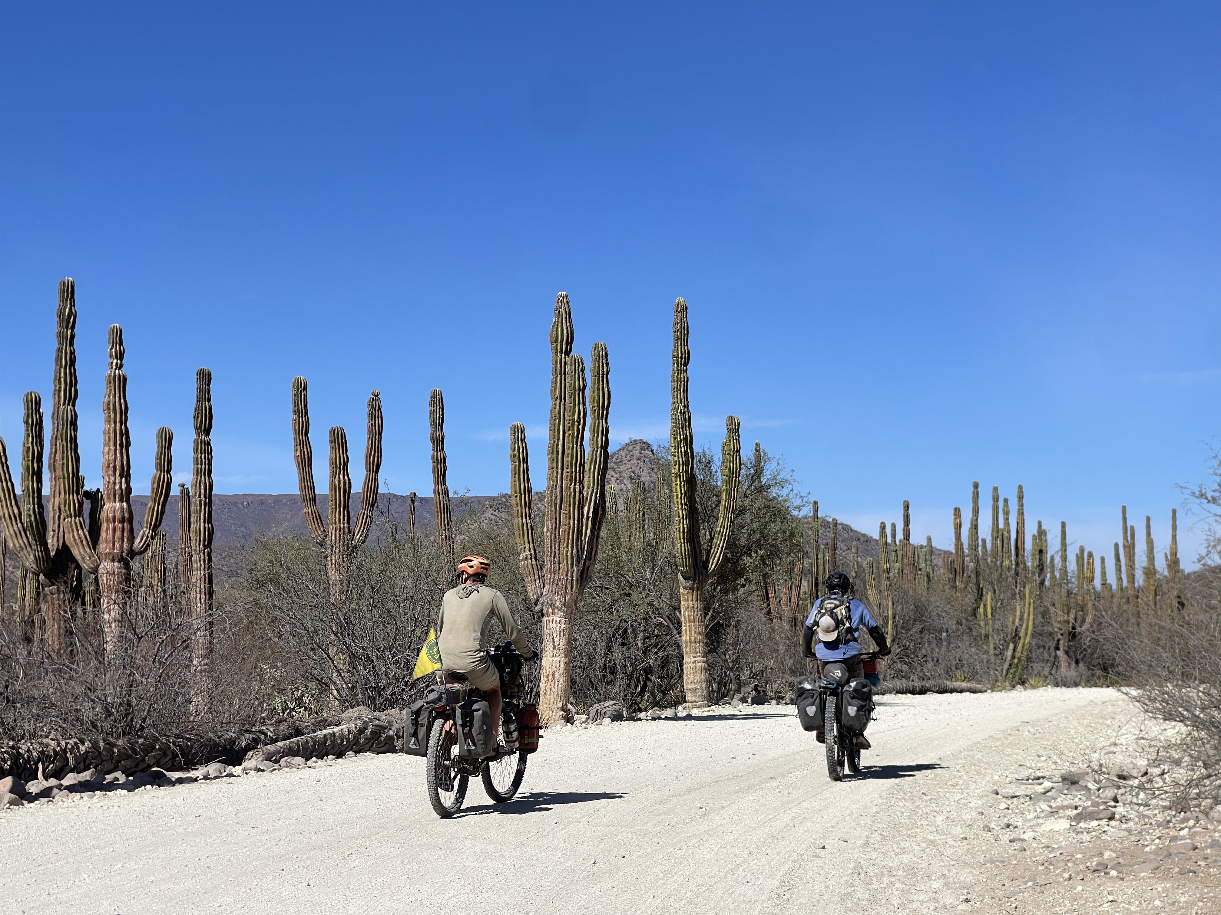
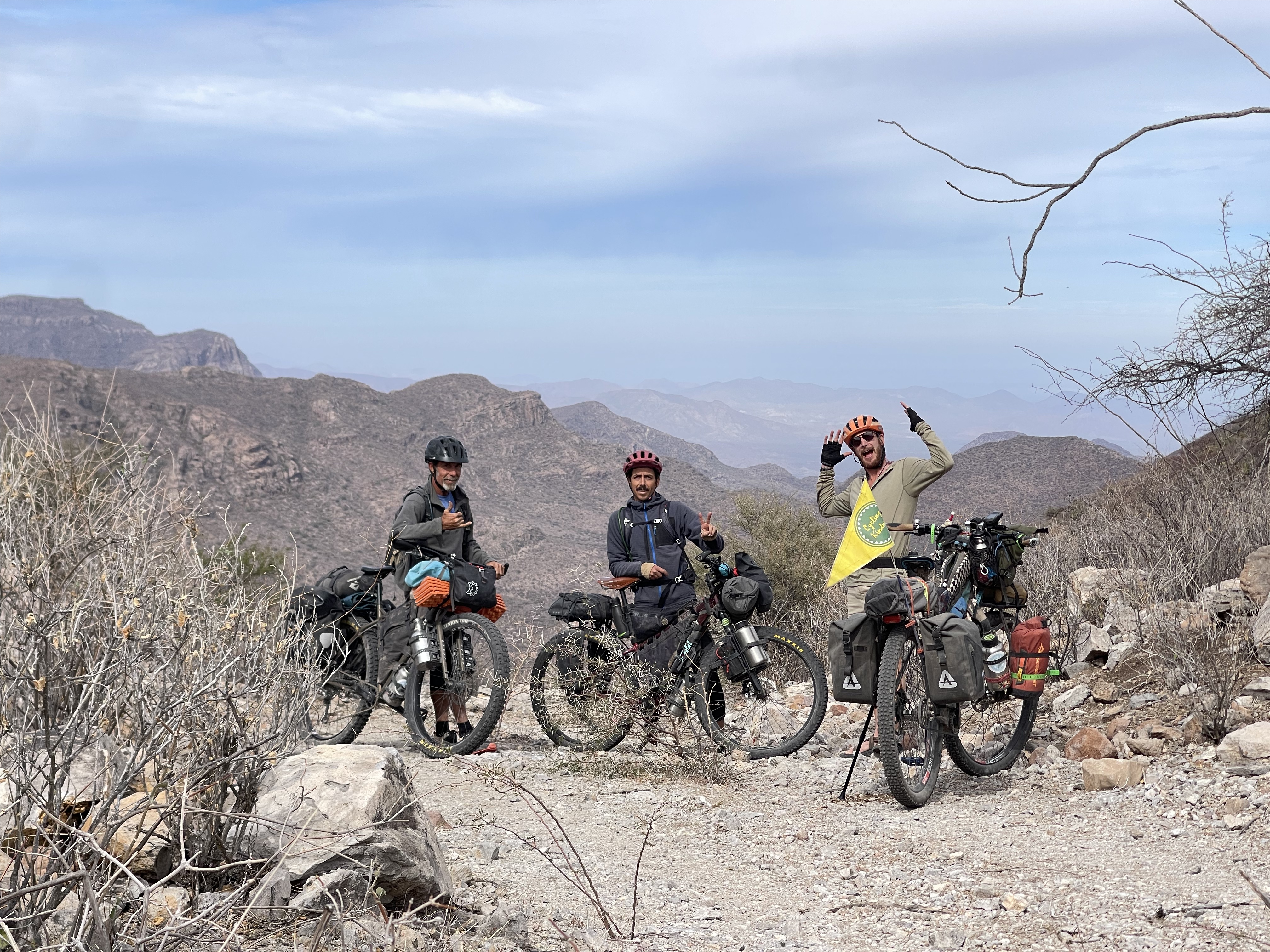
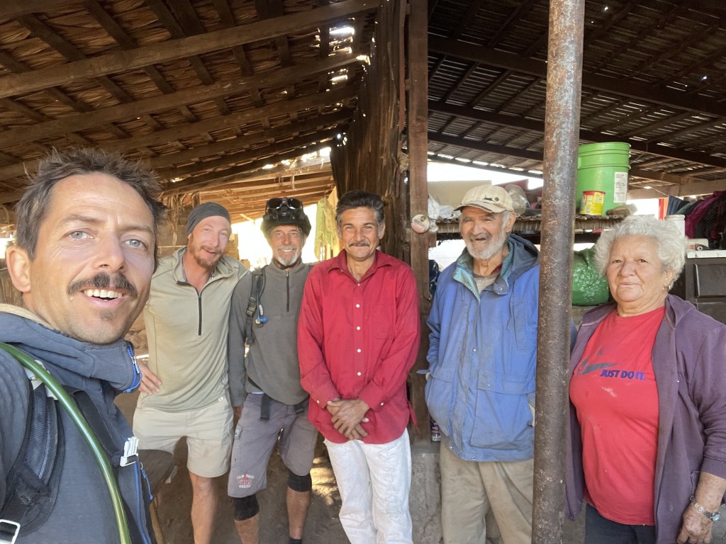
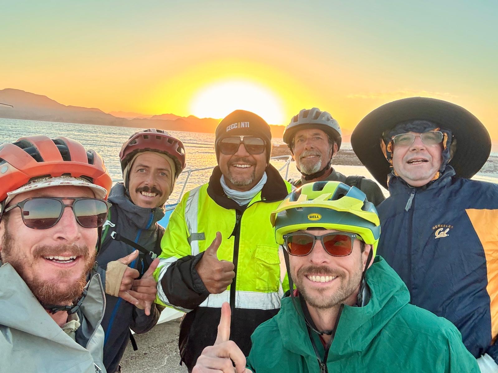
Recently Mattia Dalvit (@busyerode), his cycling partner Kevin and friend Indiana Schulz (@cycling_kindness), explored a new incredibly beautiful way, with many very furnished resupply spots, iconic little villages, cave paintings and oasis to reach Mulegé coming from the Pacific Ocean that includes some serious climbing, an unmatchable high pass view, a radical 1.5h hike-a-bike and a 1h long technical 4 miles downhill. Keep reading to find out all the details.
– We don’t include WAYPOINTS in our gpx files due to their unreliablility especially regarding water, ranches and road conditions markers –
Terms of use: The routes listed are intended solely as travel planning resources and route suggestions. Bikepackingbaja.com, its partners, associates, and contributors are in no way liable for personal injury, damage to personal property, or any other such situation that might happen to individual riders cycling or following any of these routes.
* you will download a compressed .zip file. Once downloaded open it to decompress it. It will now show the GPX file as a text. Click the share button and share it in the GPS navigation app that you normally use.
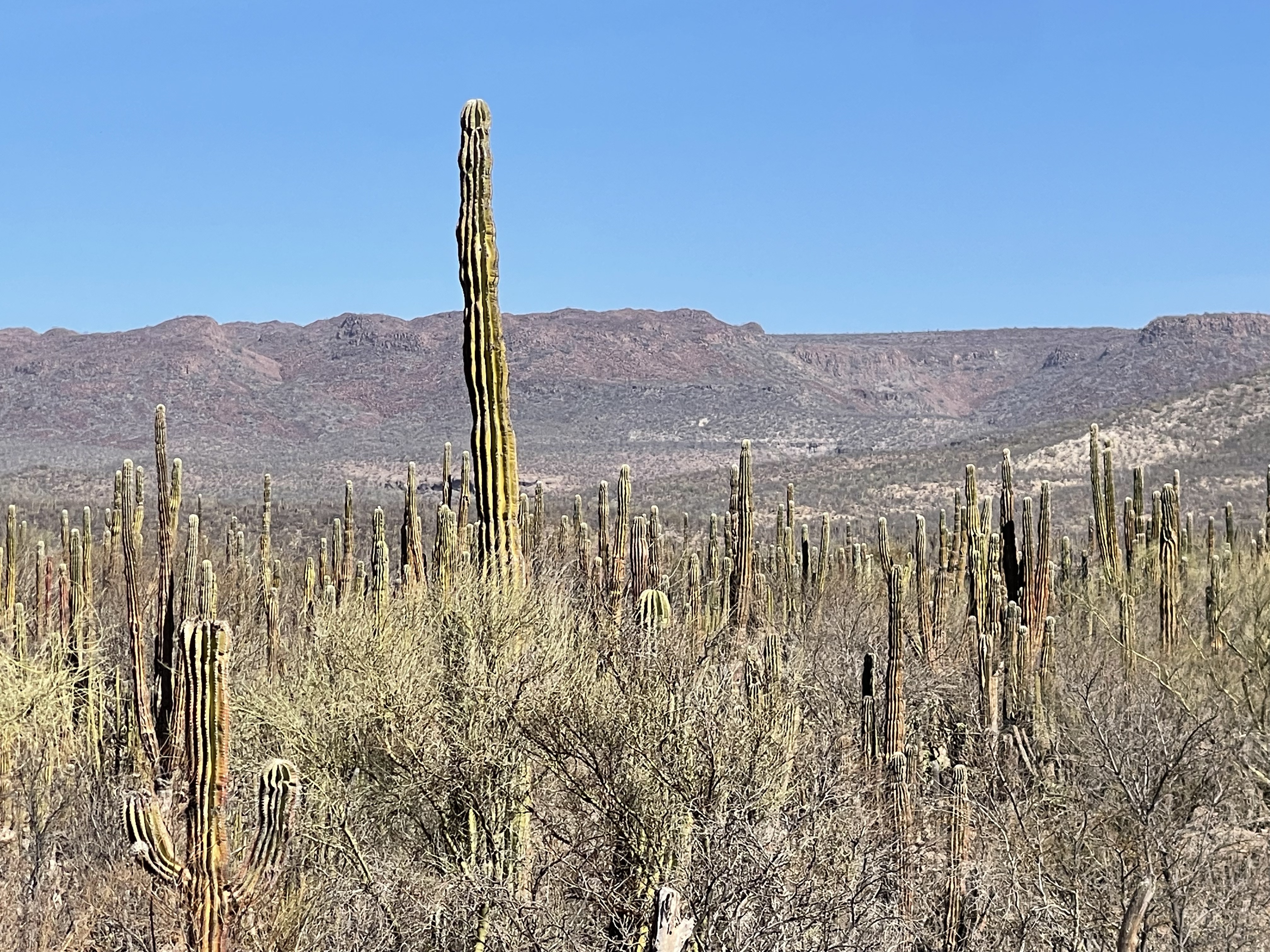
Upon reaching the La Ballena River/Ranch after El Datil, cyclists will finally have the option to choose between the classic route to Mulegé, which follows the Ballena River with its repetitive and taxing crossings of the rocky riverbed and deep sand, or take this extraordinary alternative route filled with points of interest and some challenging technical sections. This route is about 38 miles longer than the original one. Considering that normally cyclists have almost no big resupply spots and main cultural hubs between San Ignacio and Muleje ( 100 miles ), the price is worth the shot.
TOWNS YOU’LL BE VISITING (CLICK ARROW):
SAN JUANICO
Aka “Scorpion Bay”, used to be a small beach fish camp until surfers in the 60s discovered the incredible potential of its mind blowing perfect long waves and started to settle here. Now the town is equipped with a firefighter station and ambulance, a Friday morning farmers market, 3 hotels, a Warmshowers host, 1 bed&breakfast, 1 cafè, many Airbnbs, a campground, about 10 restaurants, welders that can fix steel and aluminum racks and 6 very well furnished grocery stores where you can find even fancy products like Blues cheese, Organic granola or craft beer and even withdraw cash. Besides all the infrastructures San Juanico offers a very chilled out vibe compared to all others surf towns/villages in Baja. Being still kind of remote and far from airports and main highways, this town still holds a live fish-camp-ranch soul and at the same time has an international healthy sport-minded local community that gives a relaxed cosmopolitan vibe to the place. Riders that will decide to stop here will have the chance to try to practice surfing, explore local trails, do horseback riding or simply recover in a very welcoming small community that have seen travelers from all around the world go by since very long time. Camping is possible for free along the main beach passed the fishermen boats or at surf spot Point 2 campground for a small fee with showers, toilet and restaurant.
LA PURISIMA
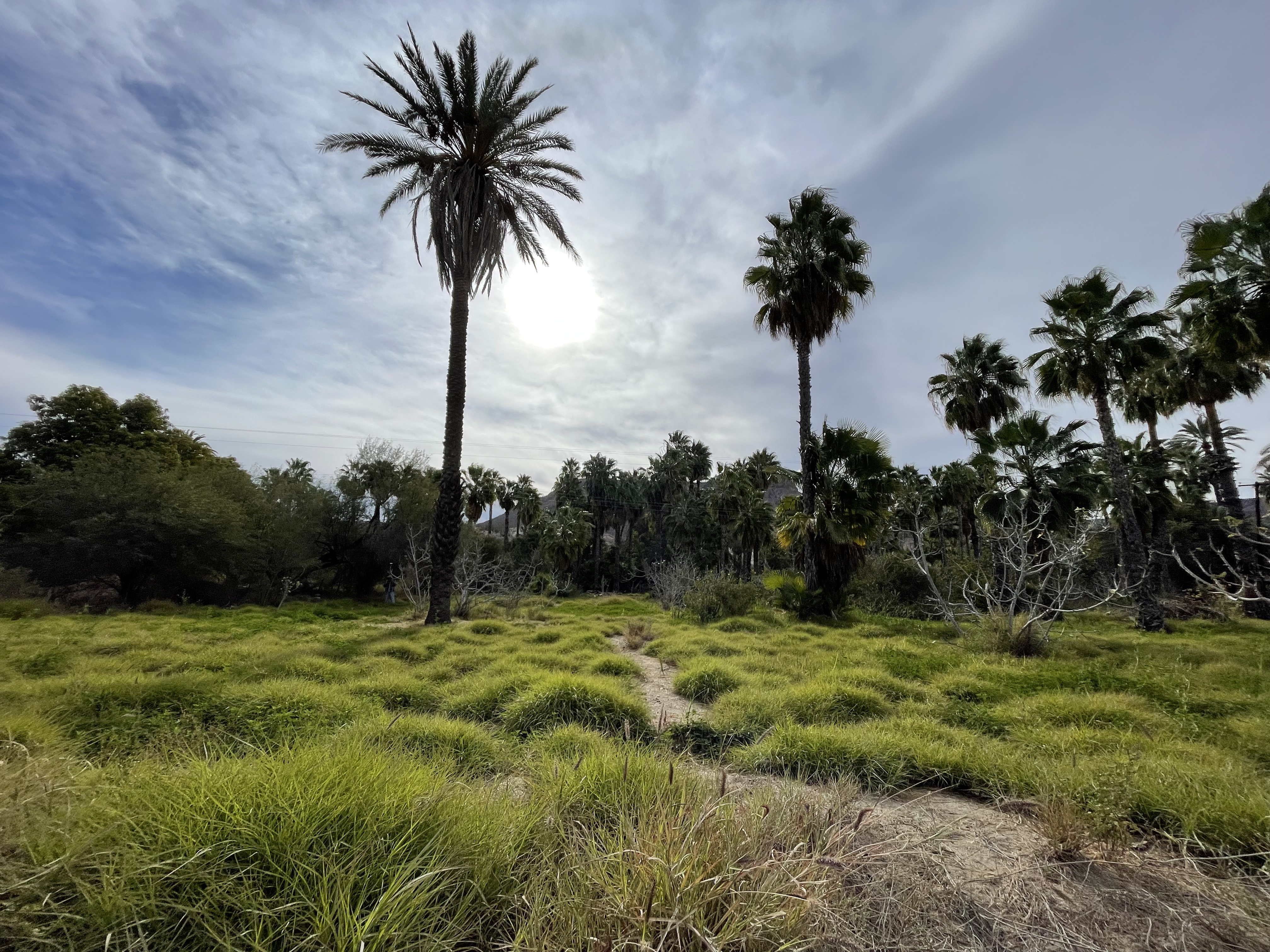
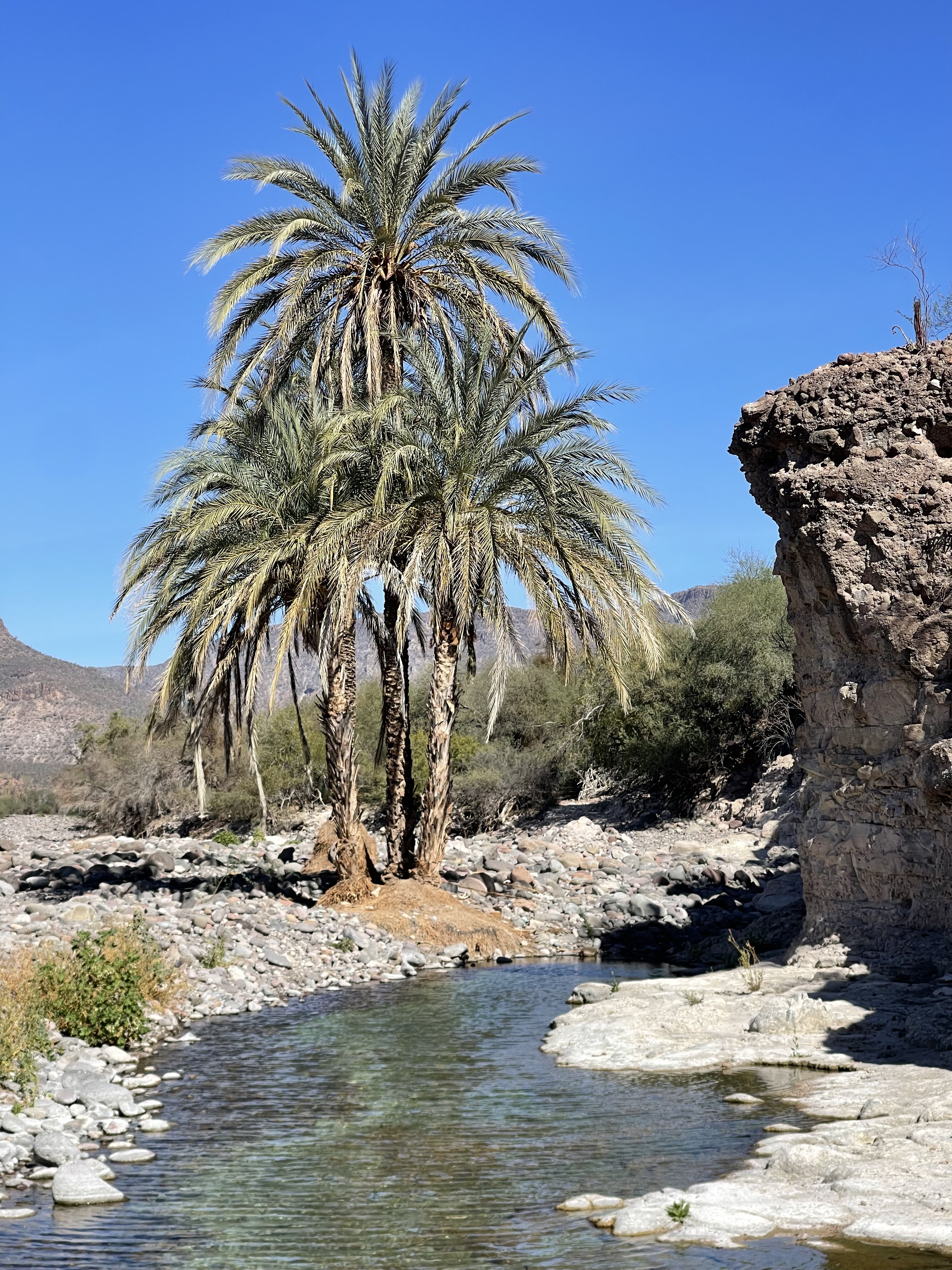
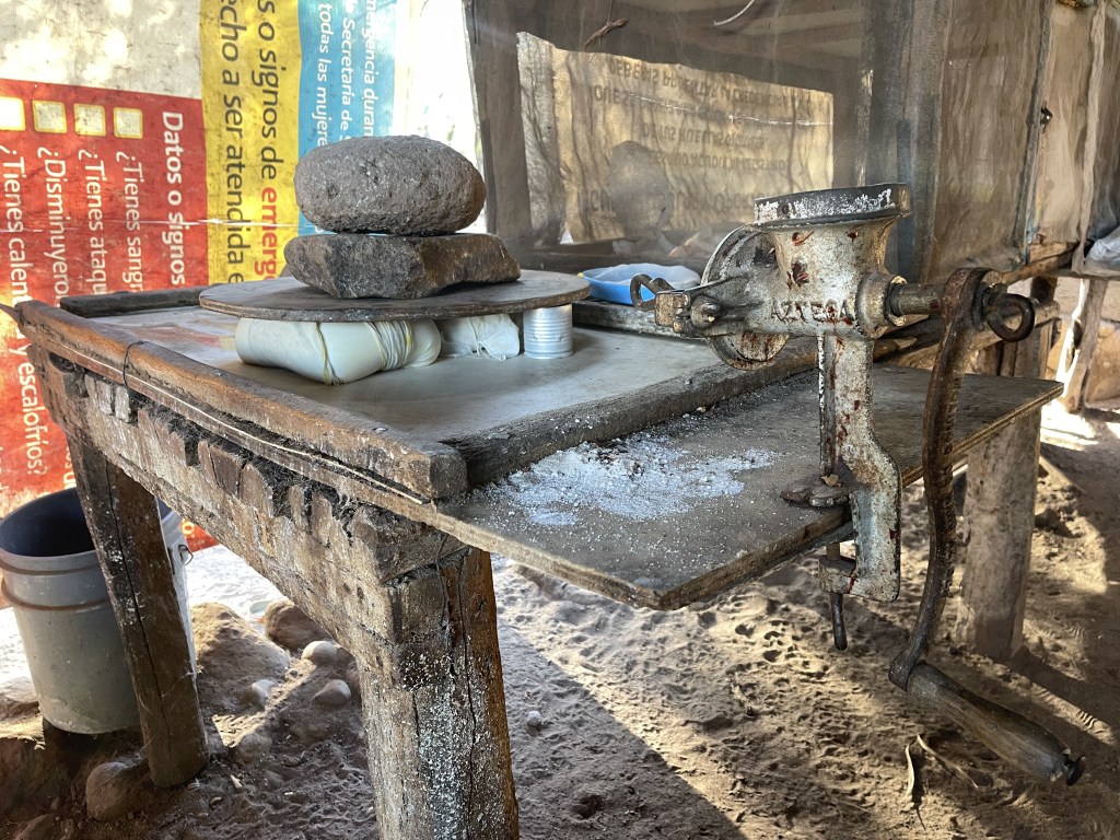
Part of the charming Mission villages network of the Californias, the town was founded after the 1717 visit of a Jesuit mission led by Father Nicolas Tamaral, who, having seen the impressive El Pilón peak surrounded by so much vegetation in the middle of the desert decided to build the Mission de la Purísima Concepción de Maria Cadegomo there. The hike up on this iconic peak is one of the main activities for visitors and infos on the hiking trail can be asked to pretty much any people in town. The village counts with a couple of hotels and cabañas lodges and a quite big very well furnished grocery store, the Minisuper “El Pilon” ran by Diego who’s also a great guy to ask informations about what is going on in town. The naturally ever running river forms a lagoon where tourists can swim or enjoy the all day renting a kayak. This town is big in dates production being almost 99% of the palms trees of the oasis dates palms, so fresh dates bags and dates muffins are available almost year round. Depending what month you’ll ride through La Purisima, the dates sun drying procedure on big raised palm leafs carpets can be seen along the roads of the village. We really recommend to purchase a piece of fresh goat cheese, probably the best in the all region, from Miss Berta at her little white tiny home on the left side of the pavement at the very last speed bump exiting town going towards San Isidro.
This route can be divided in 3 parts:
1. LA BALLENA – LA PURISIMA

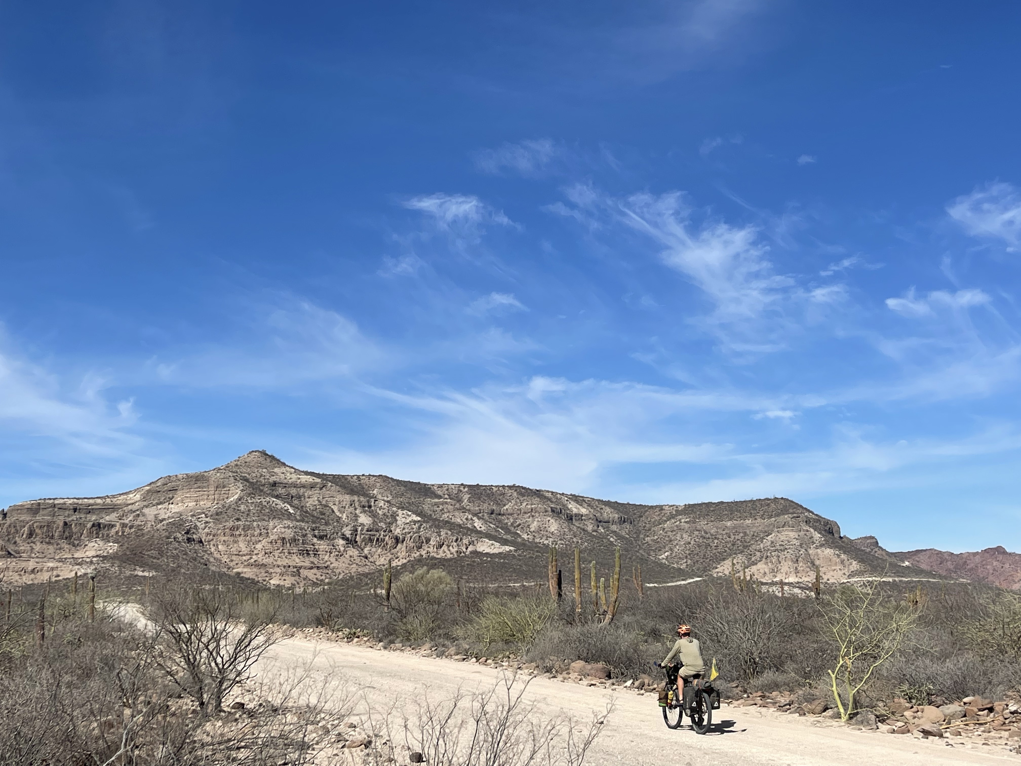
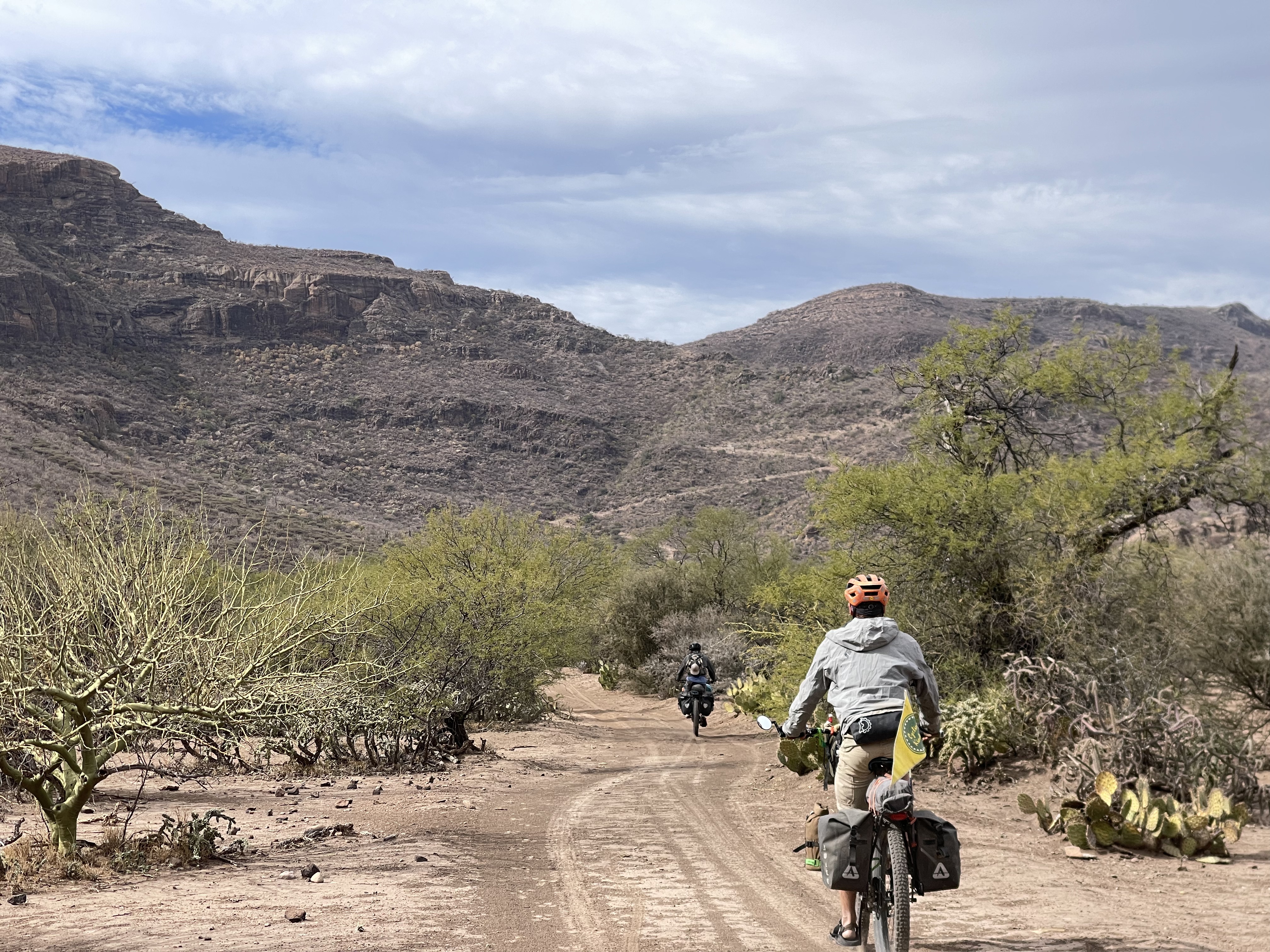
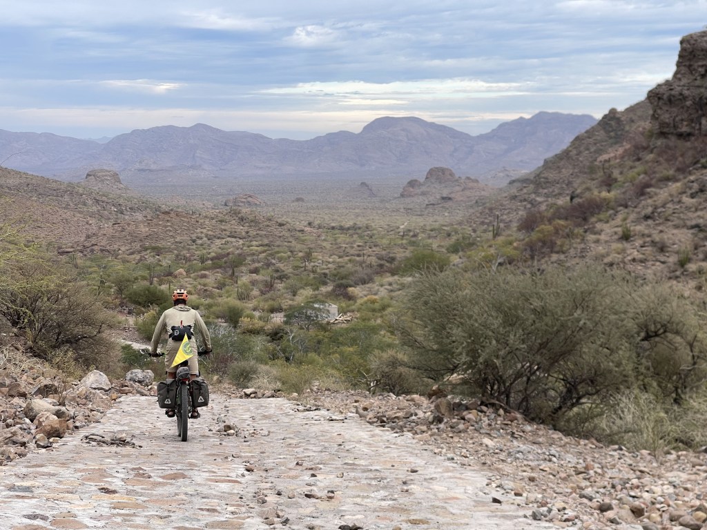
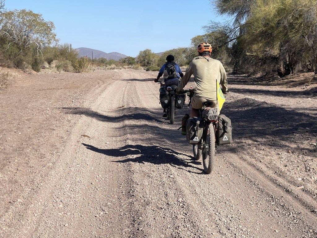
From the ranch/river of La Ballena ( most of the times dry ) the wide hilly gravel will take you to the surf village of San Juanico passing through the almost ghost town of Cadeje ( only the Mayor lives there, no supplies ). Two little climbs on gravel out of Cadeje and then fast rolling to SJ. This gravel road can have sometimes annoying washboard due to trucks passing which though gets evened up by strong winds.
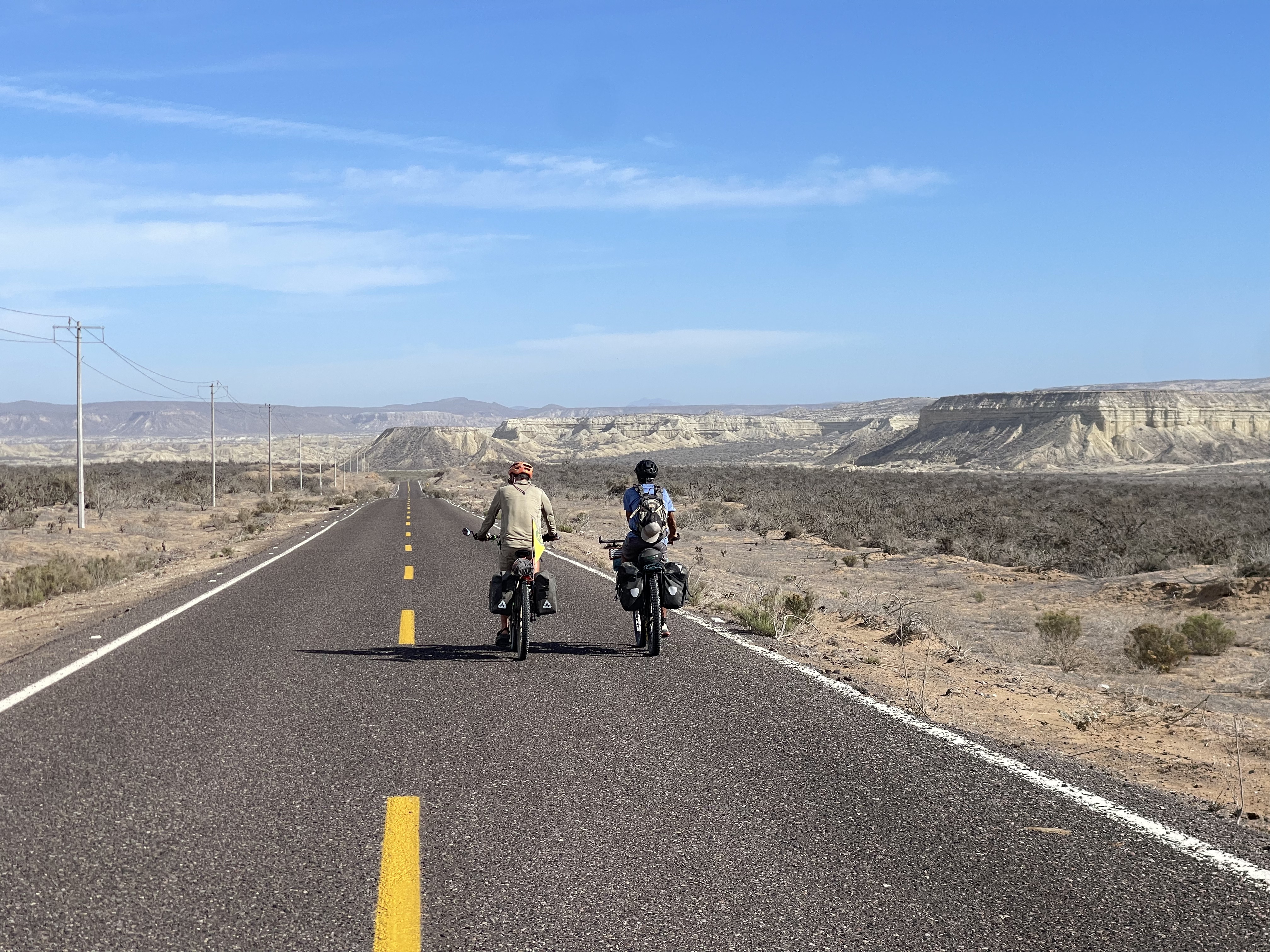
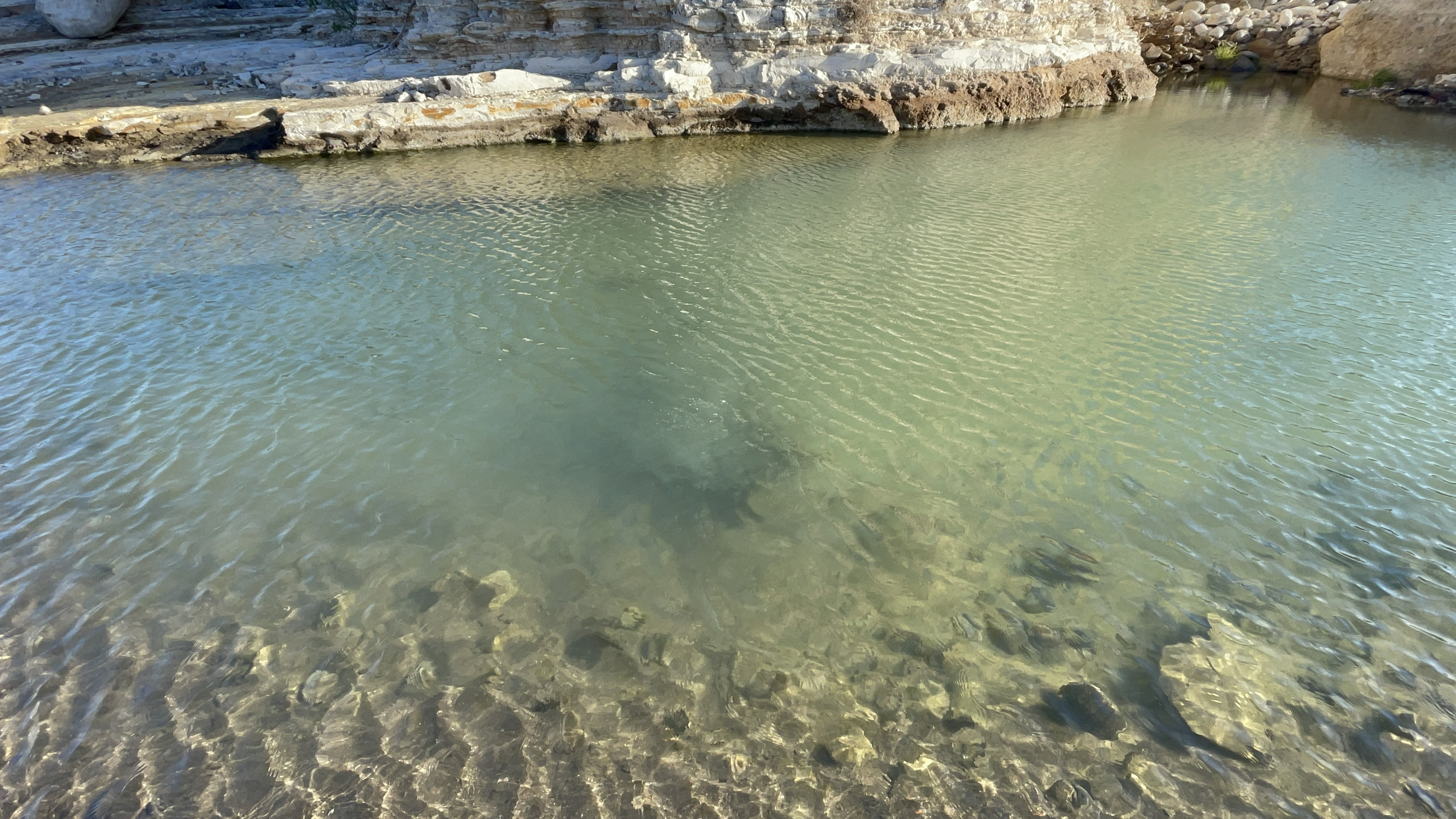
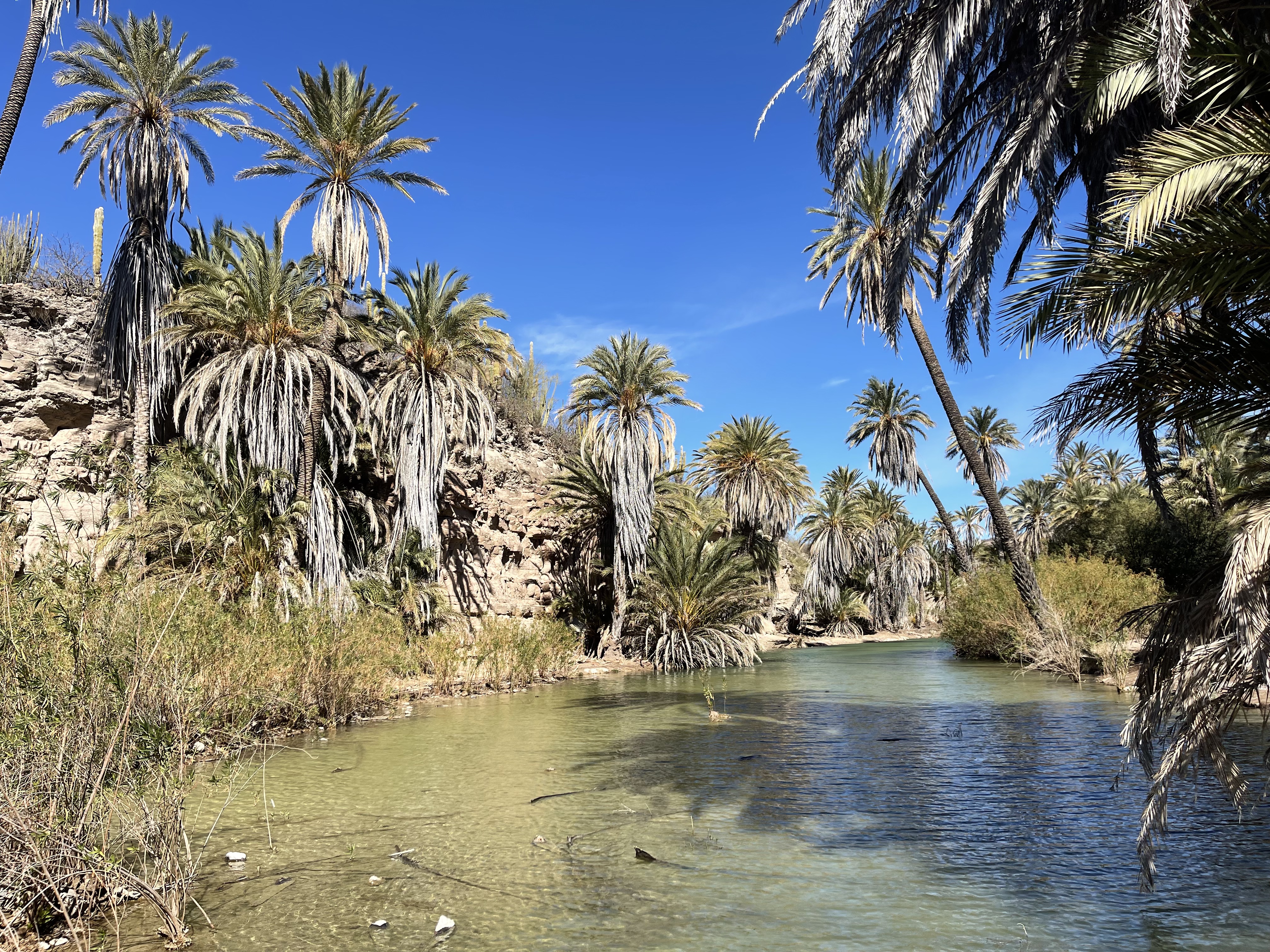
There are two different ways to get to La Purisima from San Juanico. After rolling downwind on perfect tarmac for 10 miles riders can decide to either hit the old 21 miles back road to La Purisima or the new 42 miles paved one ( blue ) that goes through the fish town of Las Barrancas. Both ways are very scenic and plenty of wild camp spots. The traffic on the paved route is very minimum ( 1 car every 1/2 hour average ) and friendly, the fish town of Las Barrancas has a wide open beach, a well furnished grocery store and wi-fi connectivity. A bit of climbing is due on this easier paved option to make it up to the mesa before cruising on a super fun downhill into the Purisima river valley enjoying a stunning high view descent. If taking the shorter off road cutoff please consider this: if you’re riding skinny tires ( 2’4 or minus ) have a look at how the road first climb begins from the pavement. If it looks like it has a lot of sport vehicles deep tracks, don’t take it. Unfortunately there are small groups of offroaders who like to go out there and shred with their trucks or motorbikes loosening up the caliche-sandy bottom for about 10 miles till the Los Burros river bed crossing making it not suitable for skinny tires. At Los Burros river crossing ( if recent rain didn’t wash it ) you can find beautiful camping and a little clean sulfuric smelling everlasting water pool with a small sparkling hot-spring at the bottom, a pleasant bath along the way. From here the terrain gets more firm and easier to roll and after climbing a couple miles it stays up on the mesa and than drops down a fairly steep , rocky very scenic downhill into the Purisima River. The river, couple miles before town, has ever flowing water ( Definitely colder the the bath at Los Burros! ), plenty of camping areas and a ranch with nice people to refill drinking water.


2. LA PURISIMA – AGUA GRANDE CAVE PAINTINGS

Before deciding to go this way please read the full article and the recommendations we give about the last section of the route.
A little stretch of tarmac will take you through the little village of San Isidro that has an incredible tropical lush look thanks to the ancient Roman style irrigation system that still works very efficiently. there are a couple of tiny stores here for those of you who forgot to buy goods in La Purisima.

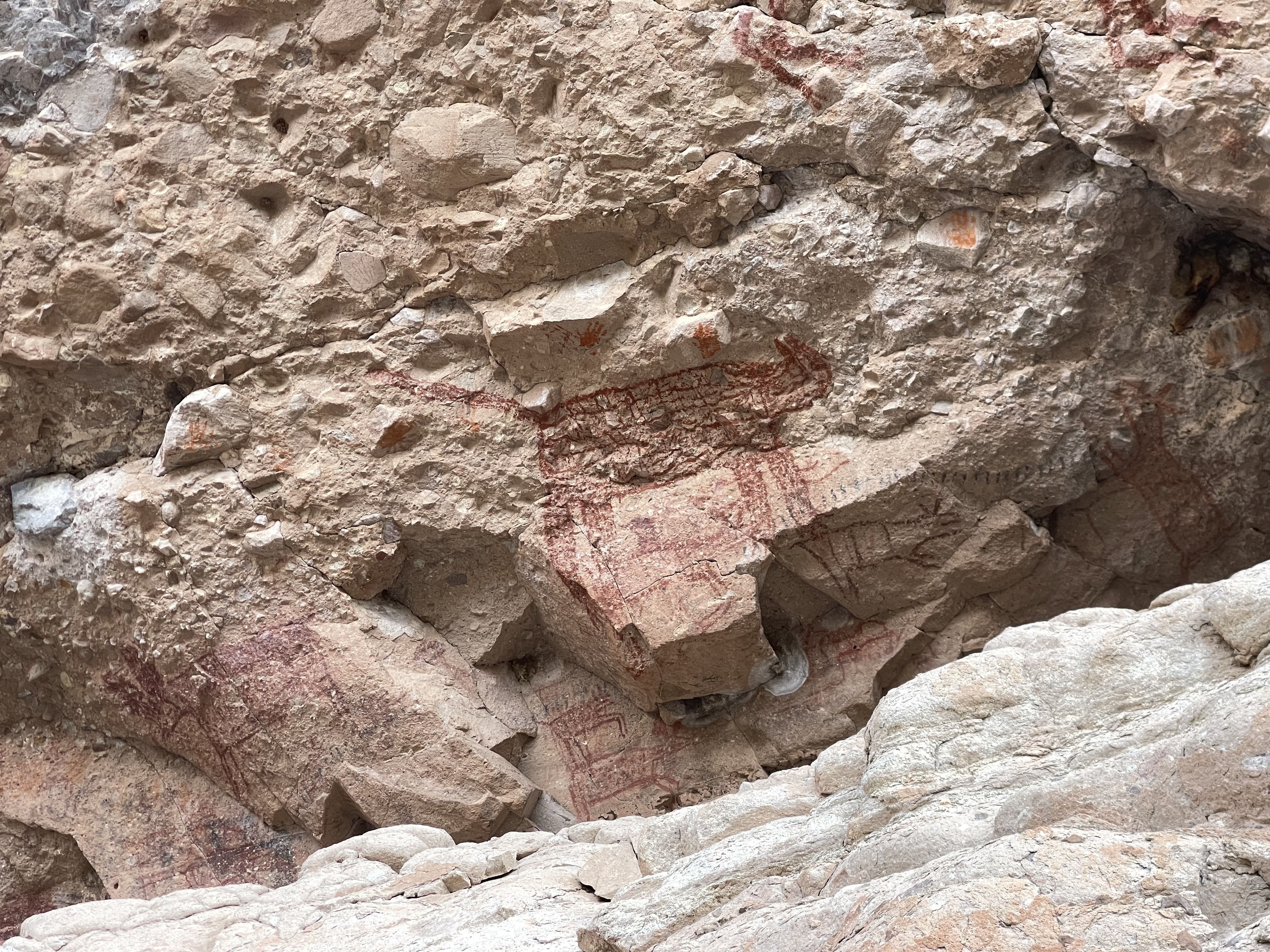
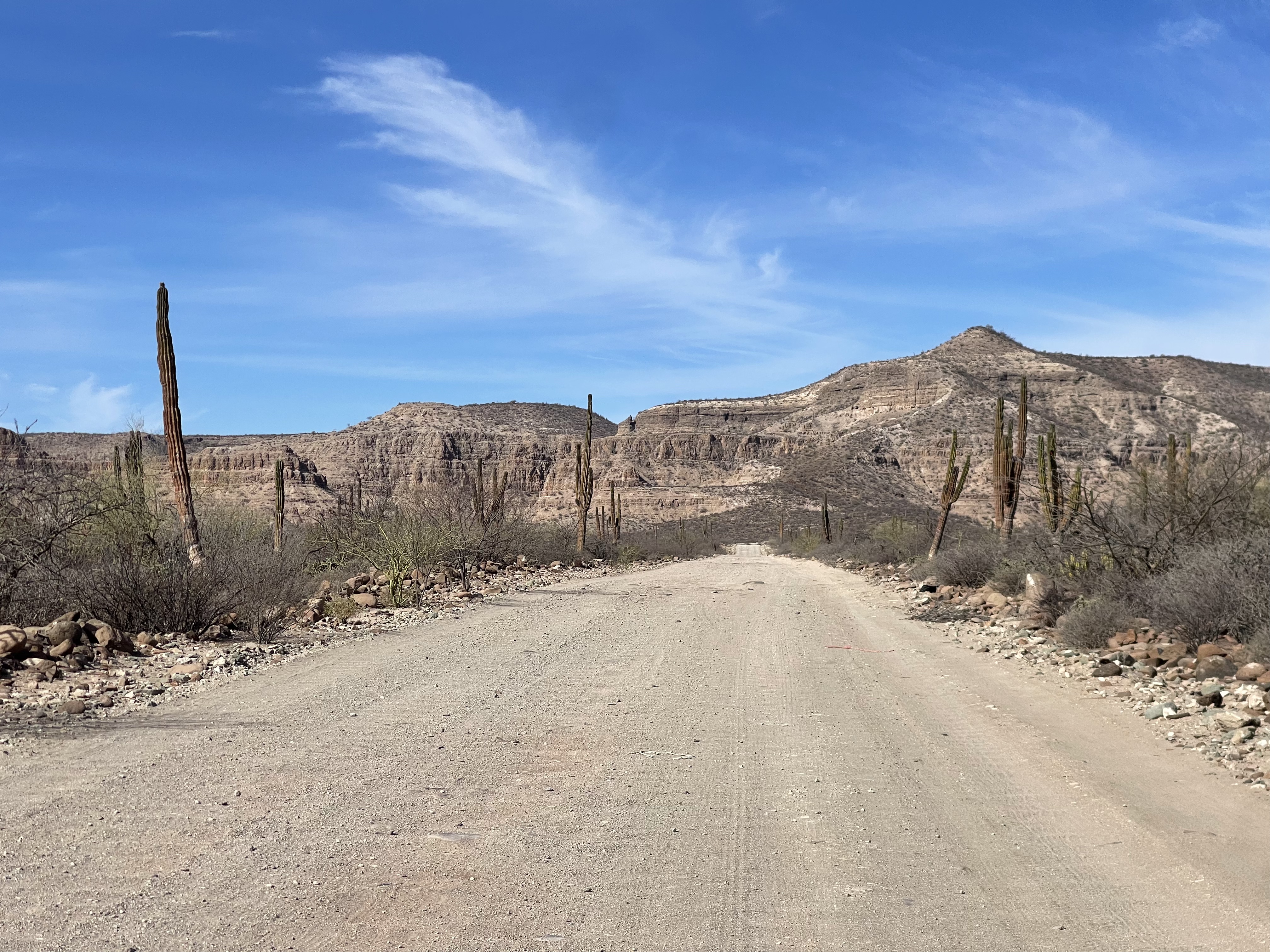
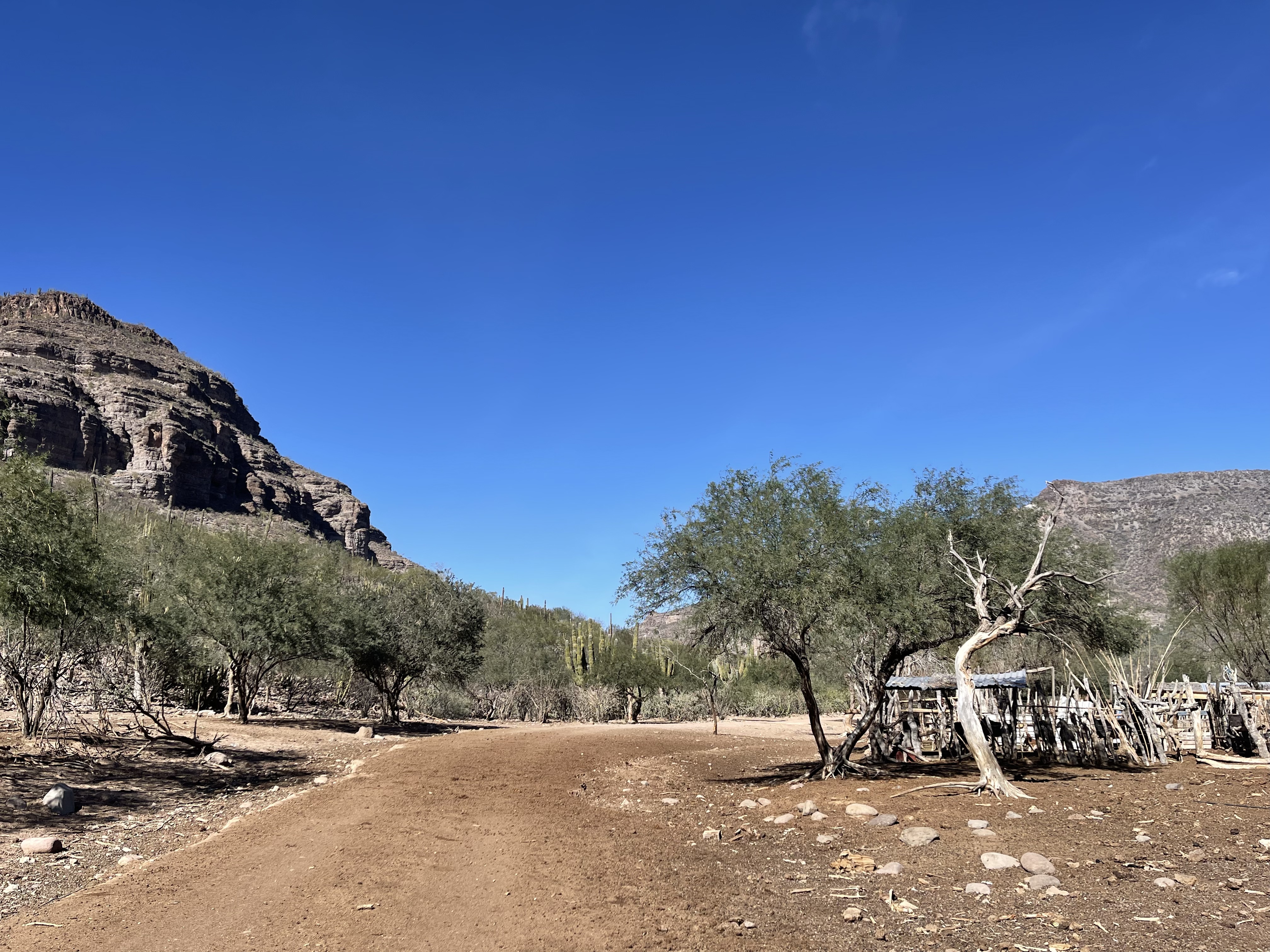
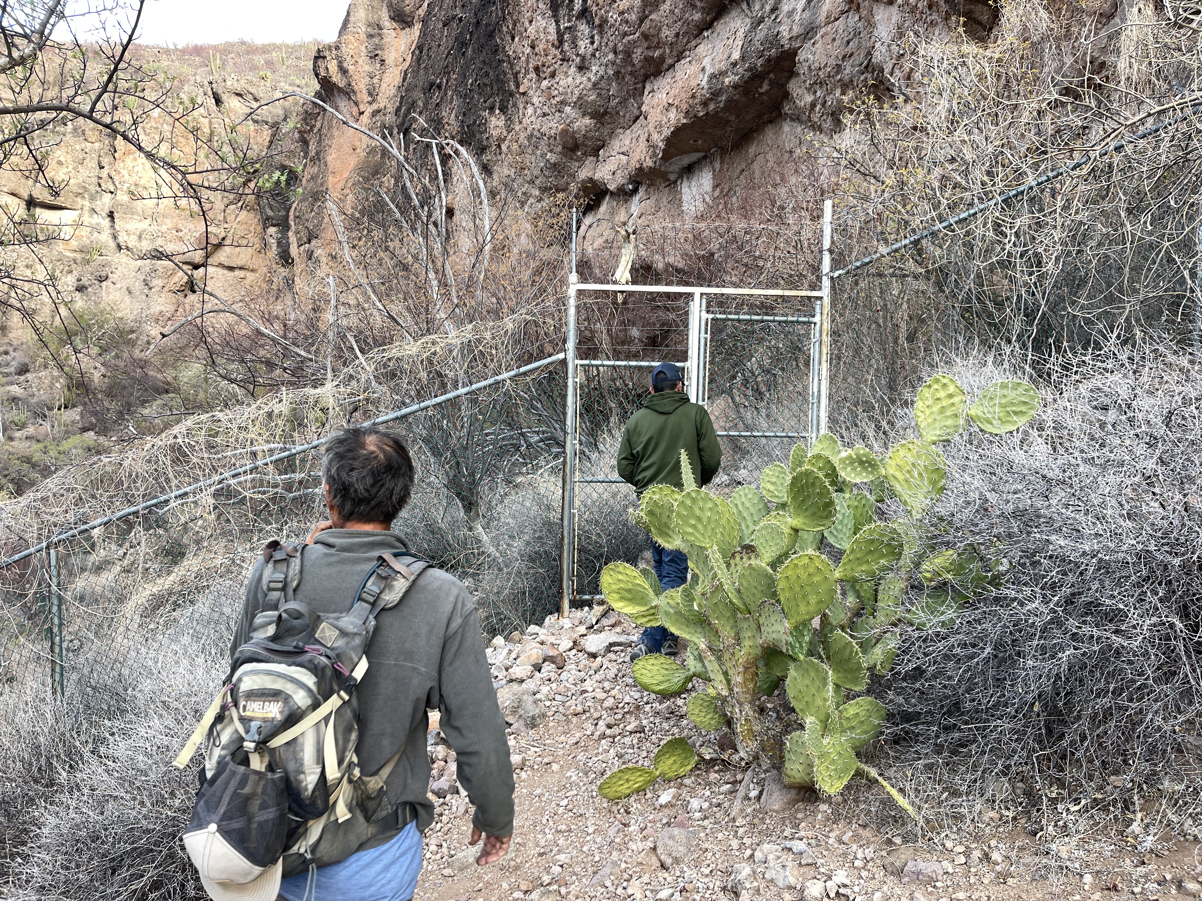
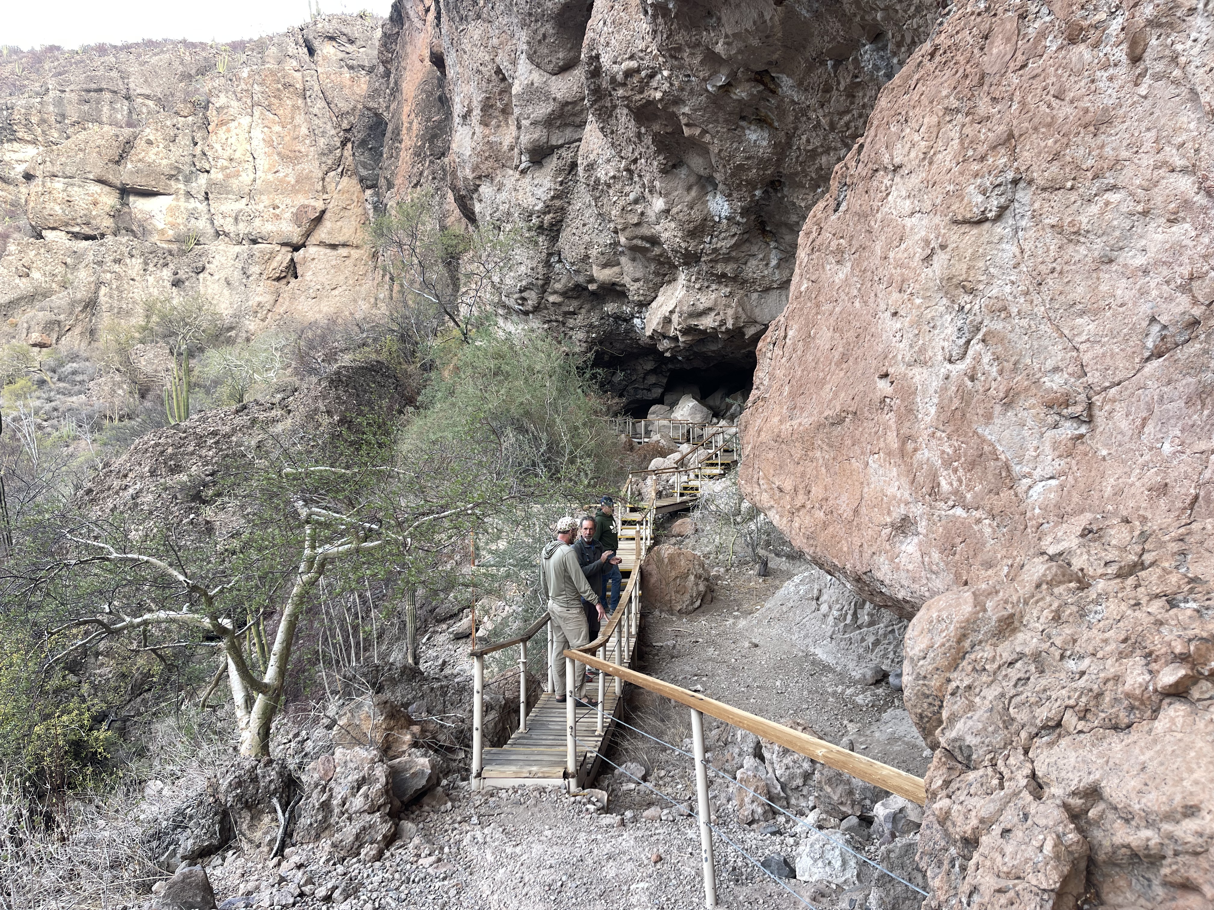
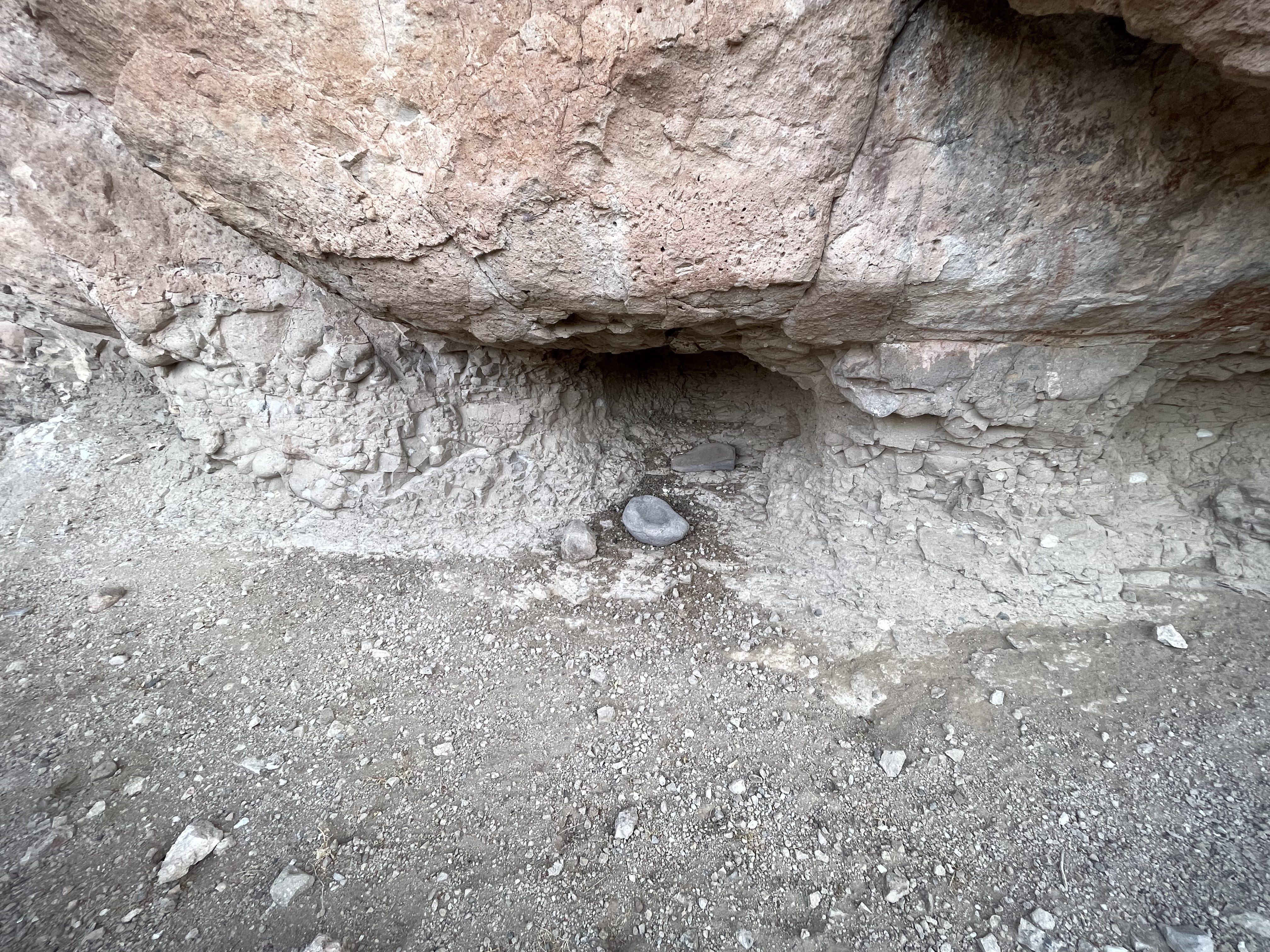
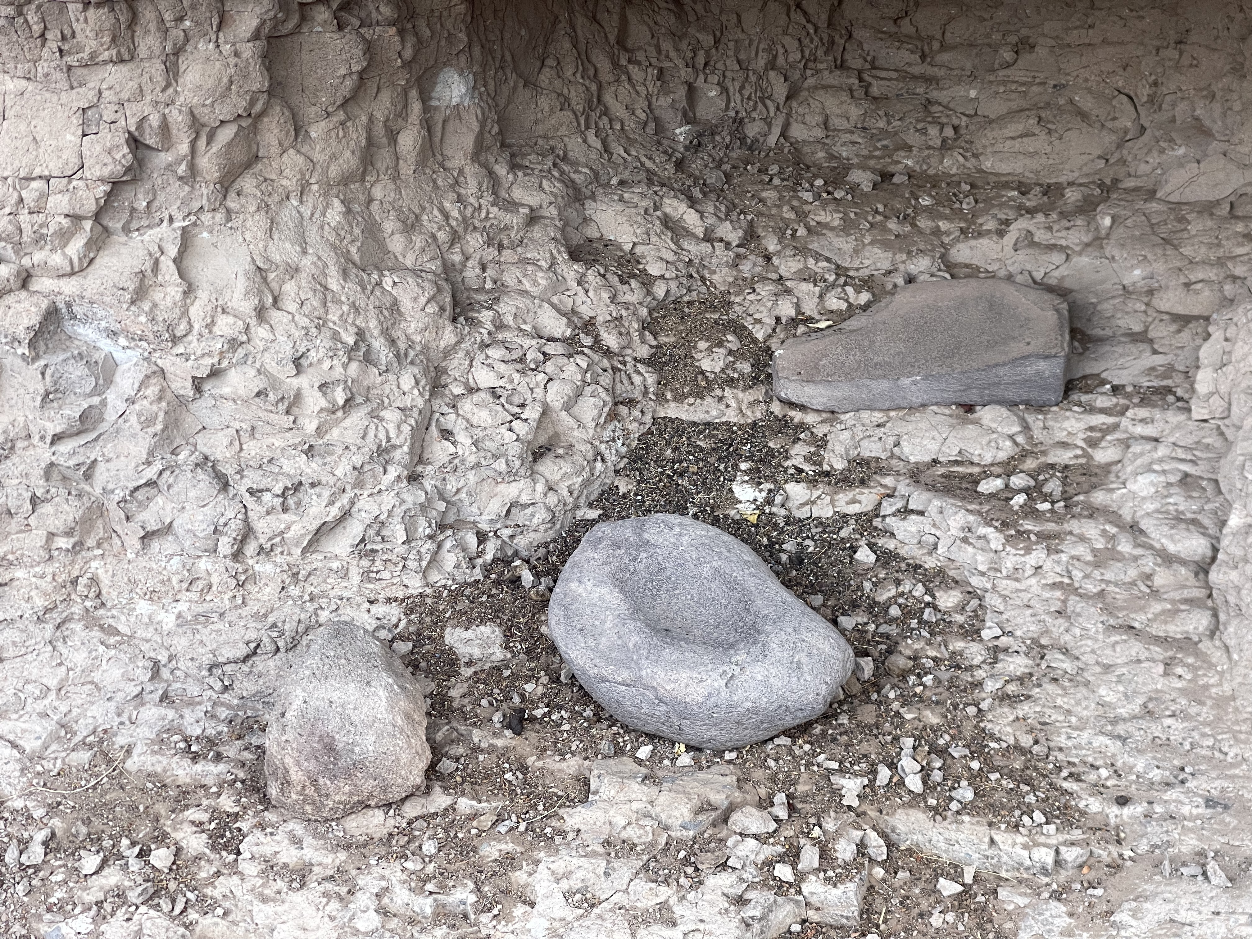
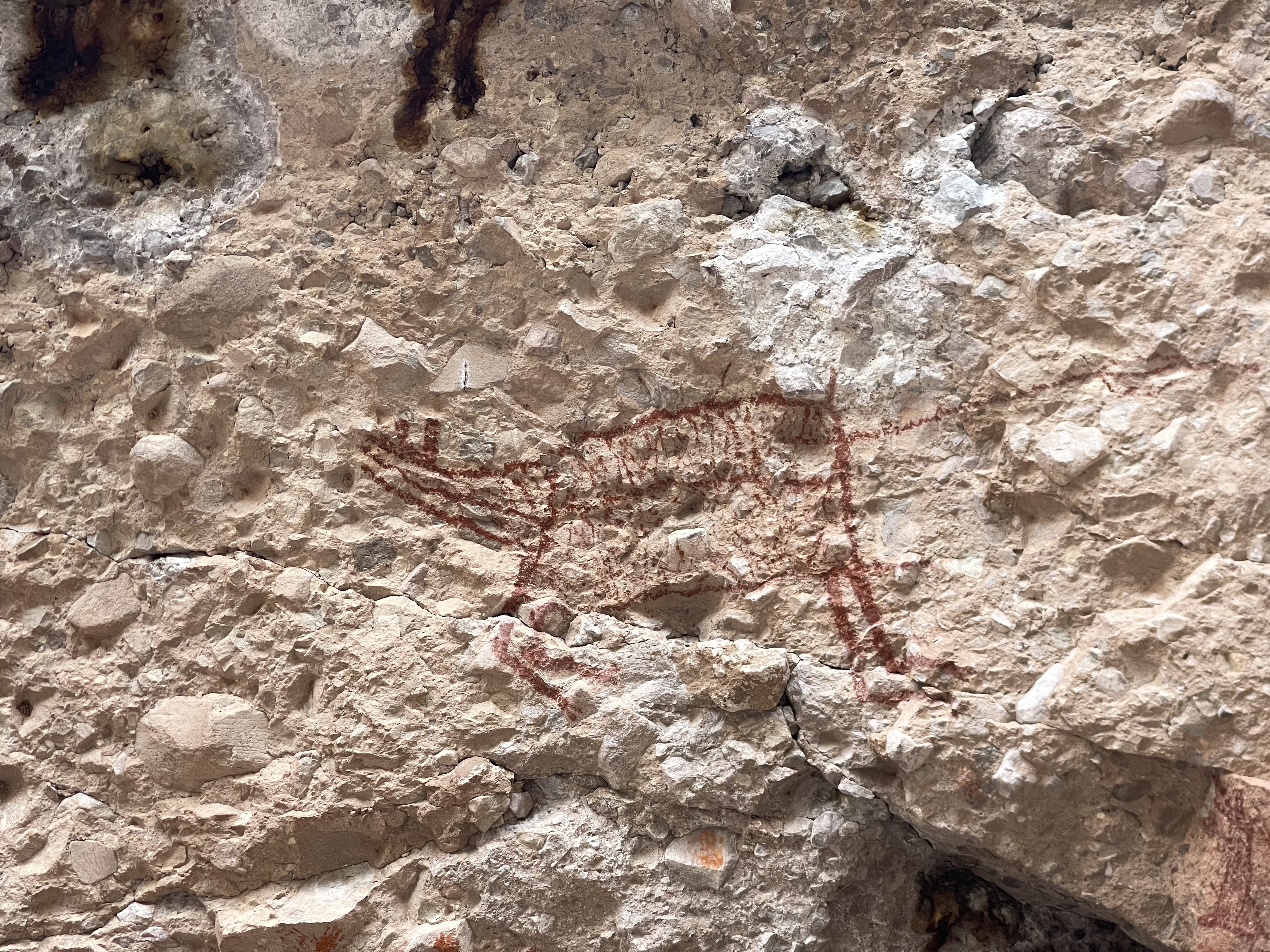
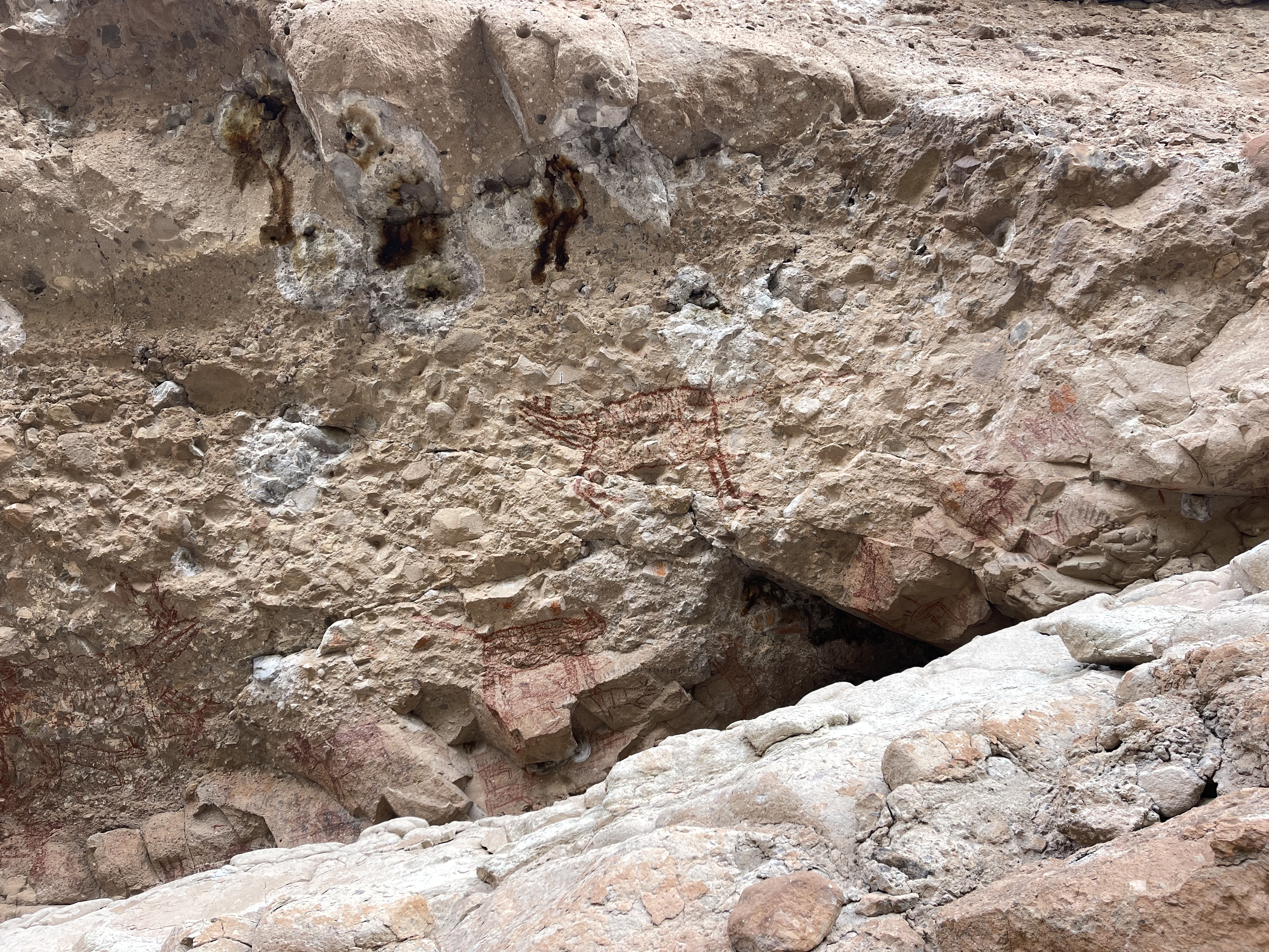
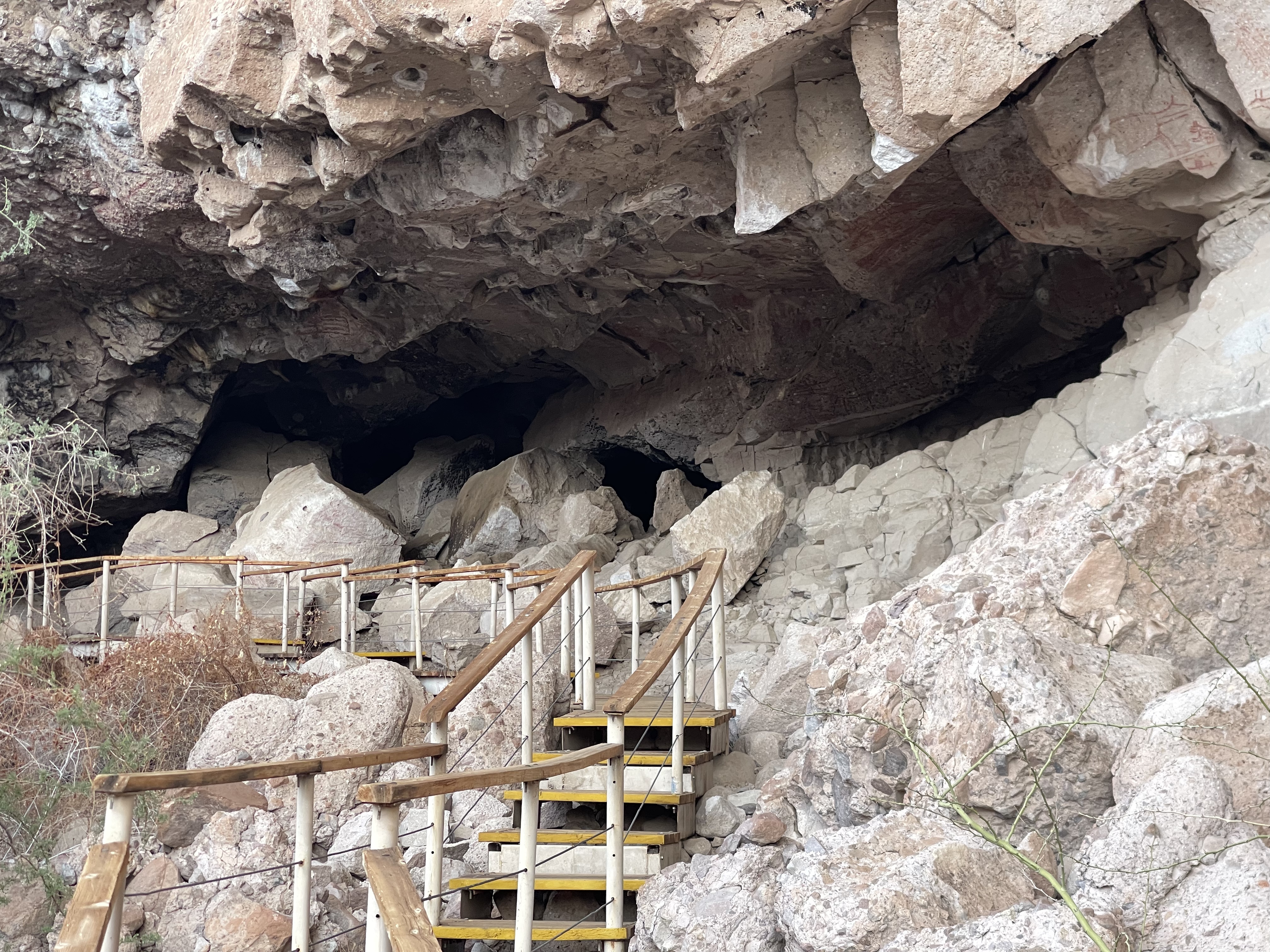
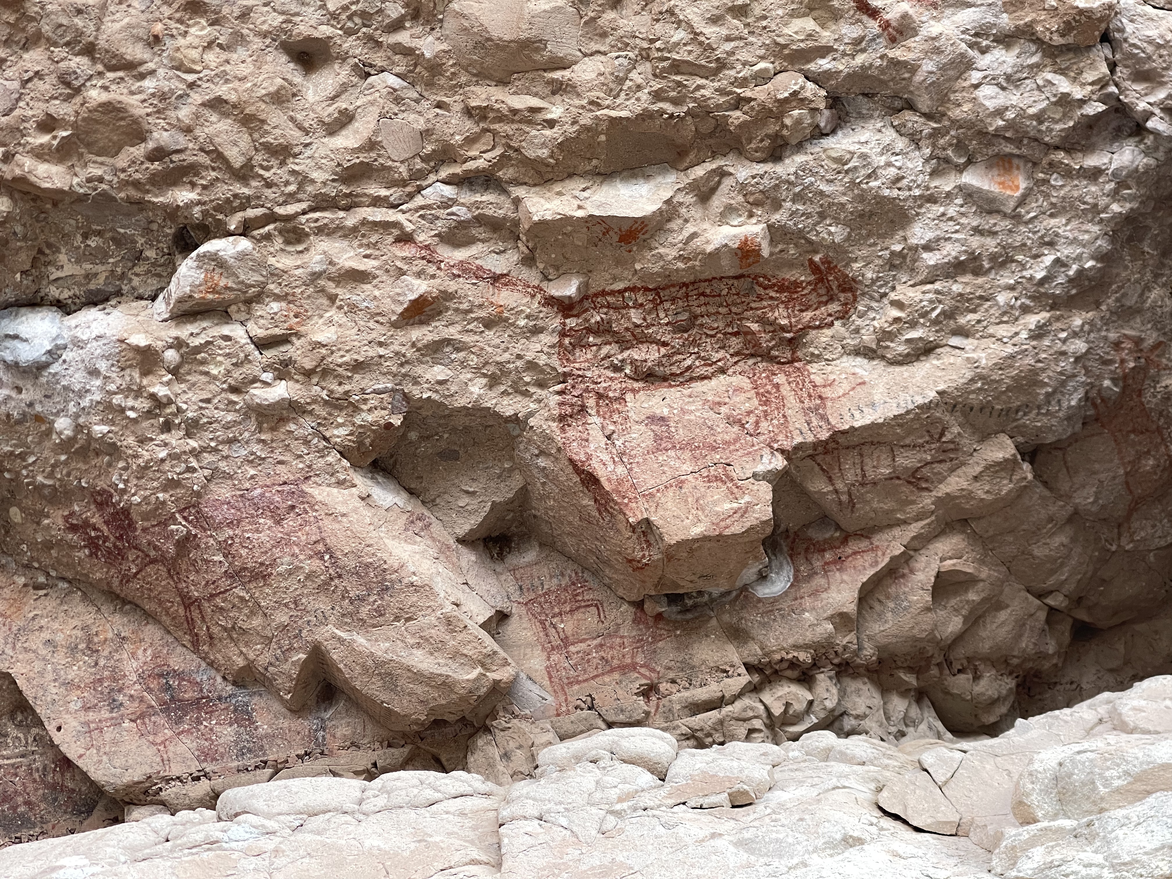
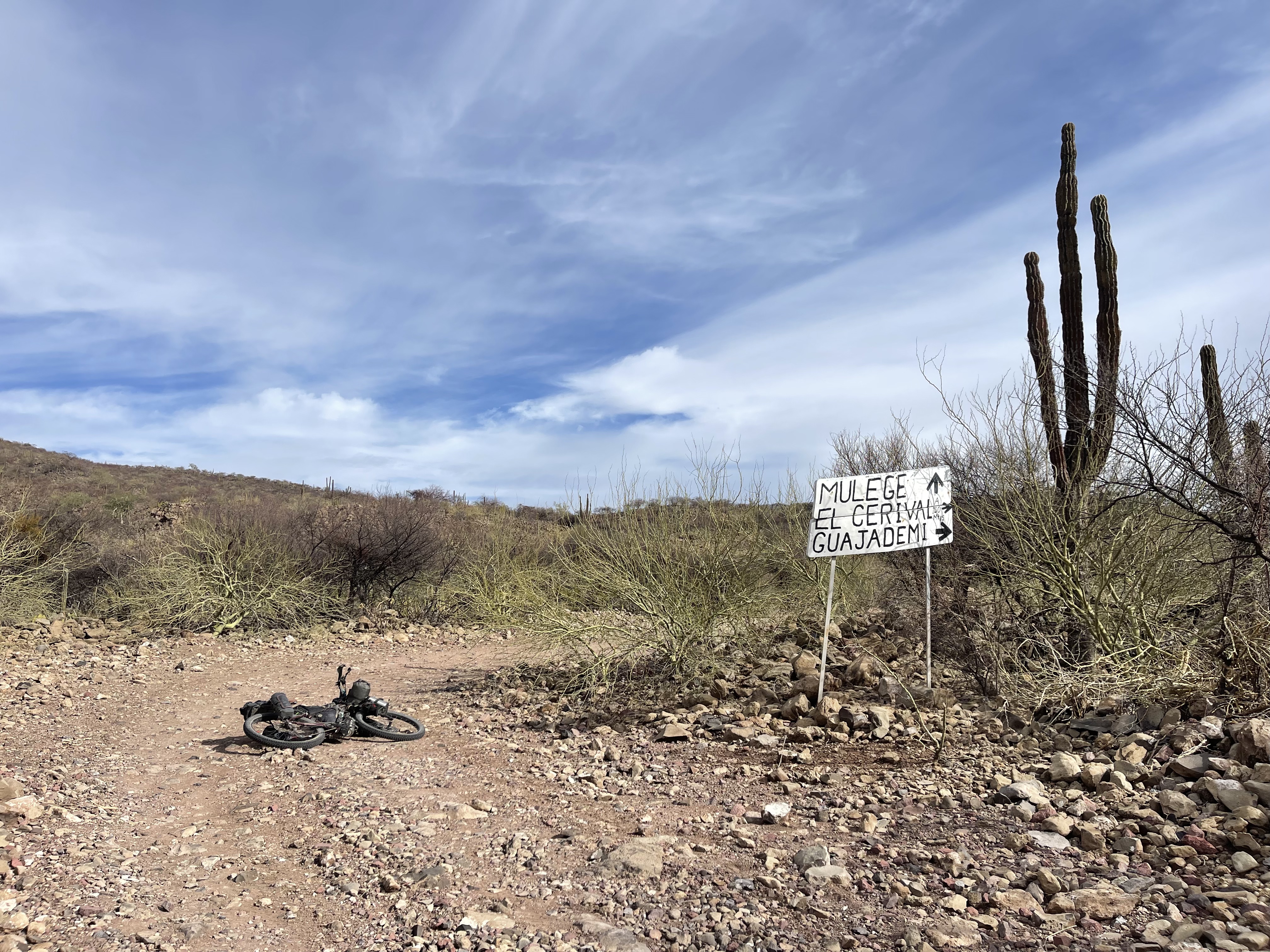
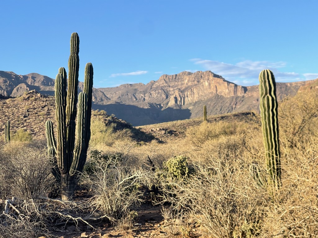
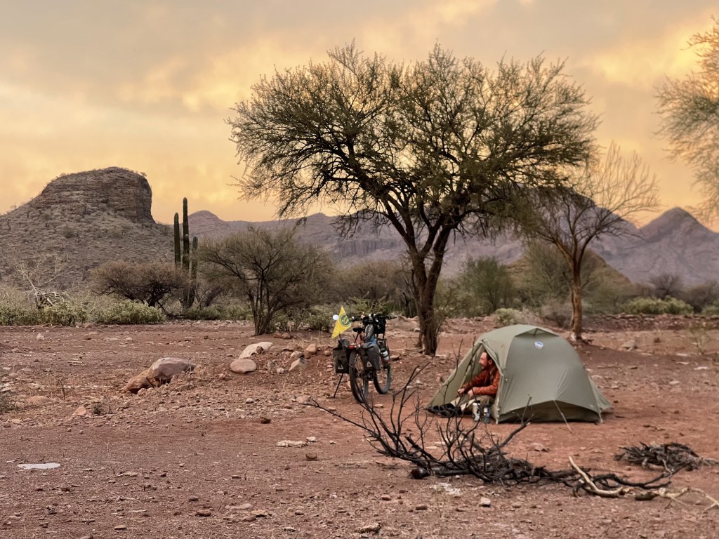
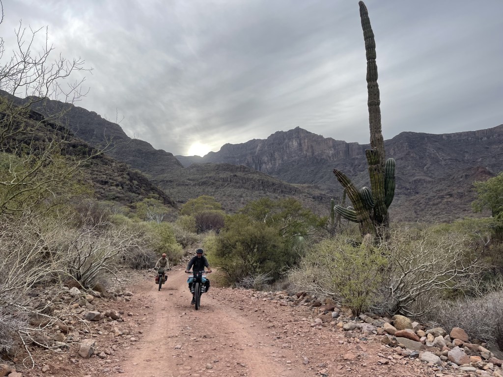
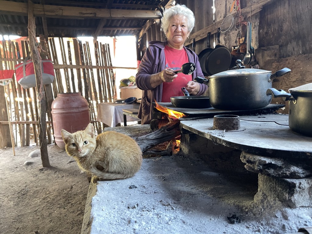
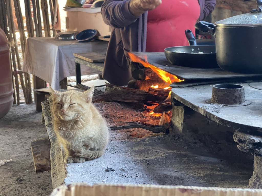
Between San Isidro and Carambuche, just 1 mile before joining the southbound Baja Divide, is the turnoff to start heading towards the fantastic site of the Agua Grande cave paintings. This road is one of the best roads I’ve ridden in Baja! great hardpack reddish gravel rolling through tiny ranches and villages for many miles. The old abandoned ranch of Purisima Vieja it’s quite a place with a pristine small surface water pool and the people at Paso Hondo little village are very stoked to see cyclist ride by and bring a different type of tourism in the area. Unfortunately the village of San Josè de Guajademì ( which is different than the just “Guajademì” ranch that sits way up on the Sierra and that could cause confusion when asking for indications ) is now a tiny ghost town as everyone left due to lack rain in the last few year and harsh conditions for the cattle. Drinking water can be found and refilled at the Agua Grande ranch where Jorge Mayoral ( Whatsapp +52 613 124 8467 ), the guy in charge of guiding visitors to the cave paintings site, lives. We highly recommend to contact Jorge ahead to make sure he will be at the ranch and not visiting family in other valleys as it would be a shame to miss the tour at the paintings ( 250 pesos fee per person ) and also to double check on his water supply. The area has a proper locked fence that block the access which was installed by the Federal Government to protect the site form people that were stealing ancient indigenous artifacts. The last 2 miles before Jorge’s ranch see the road deteriorate into a bumpy rocky double track that could be annoying especially if getting there after a long day of riding. The 20 min hiking trail to the cave paintings starts from a nice wide flat parking areas with trees about 2 miles past the ranch. What we recommend is to stop at the ranch to fill up all your water bottles and plus ( this is the water you’ll be drinking through the tuff next section of the route ), ride to the trail head ( road will remain rocky and bumpy from here ) set camp at the trail head parking lot and have Jorge show up in the morning to guide you up to the paintings site. You could also camp close to the ranch, hop the bikes in Jorge’s pickup truck in the morning and drive to the trail head depending on how late you get to the ranch. Everything is at pretty close distance even if the road is rough and the riding is slow.


3. AGUA GRANDE CAVE PAINTINGS – MULEJE
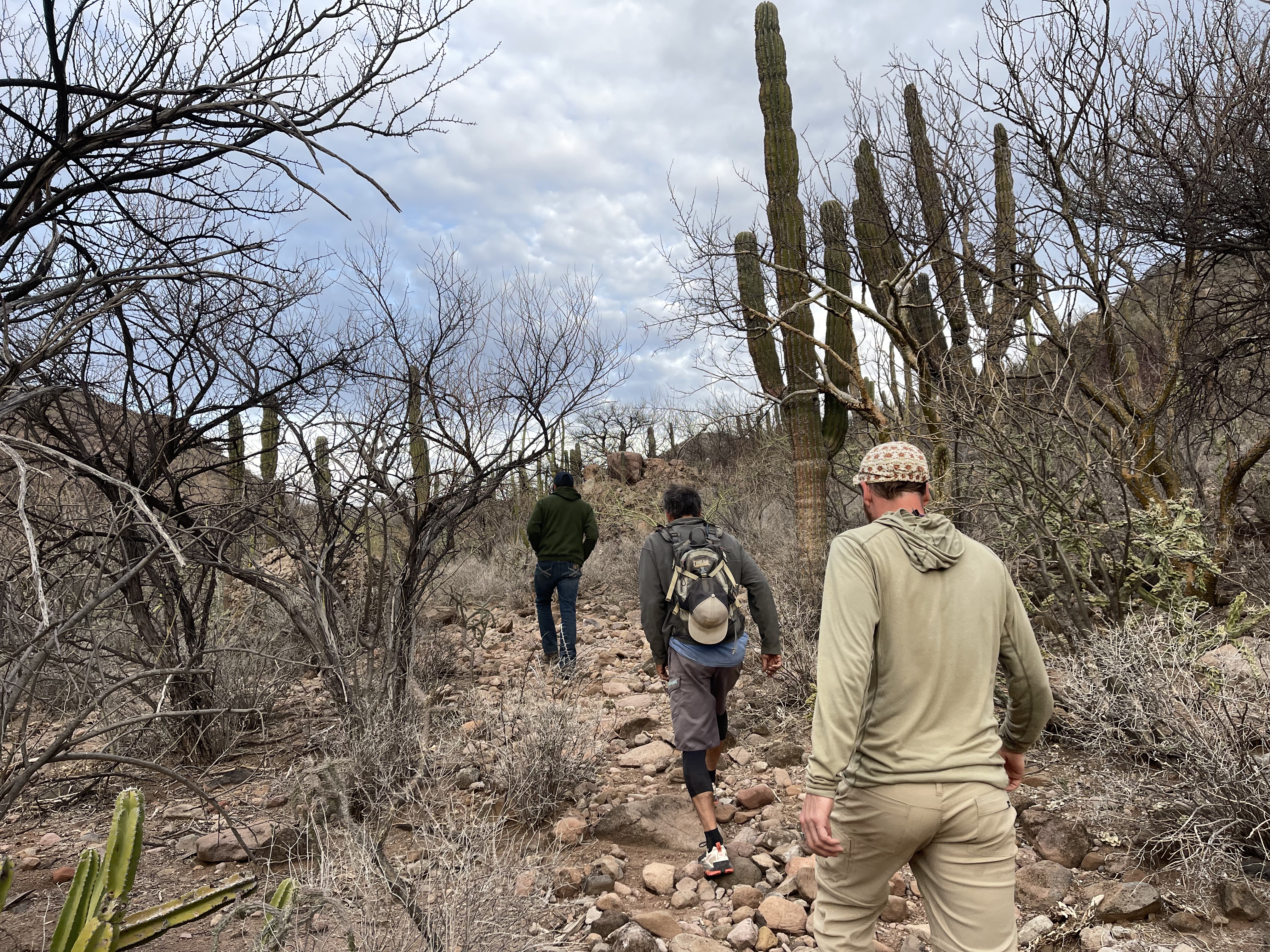
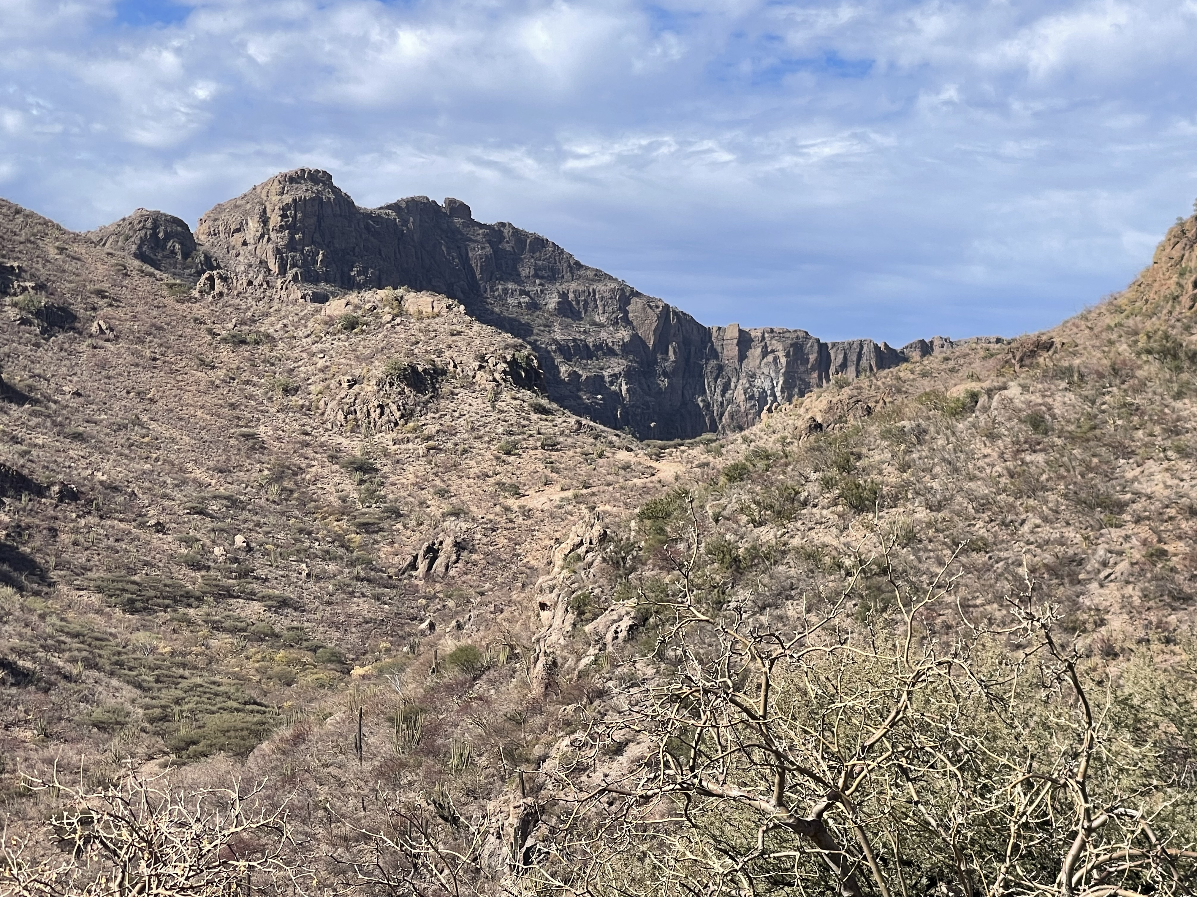
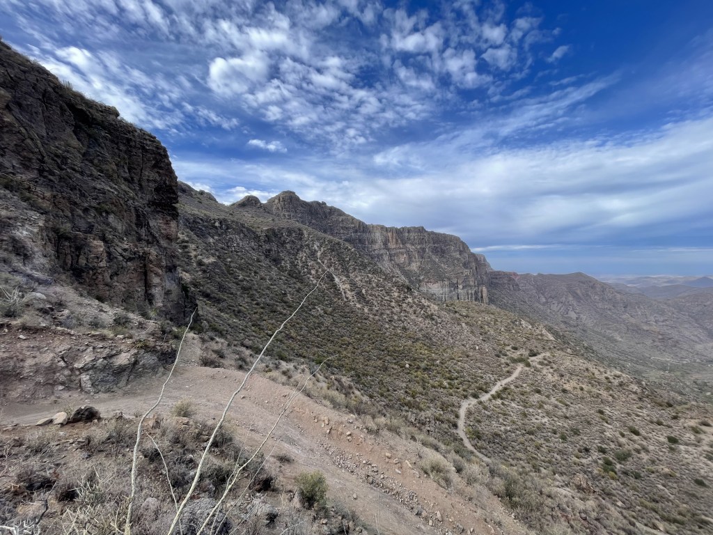
Please be alert that this part of the route requires good physical conditions, good amount of water and some good climbing skills due to rough terrain on the first long climb, to the very demanding hike-a-bike section and to the very steep, tilted and loose final downhill stretch.
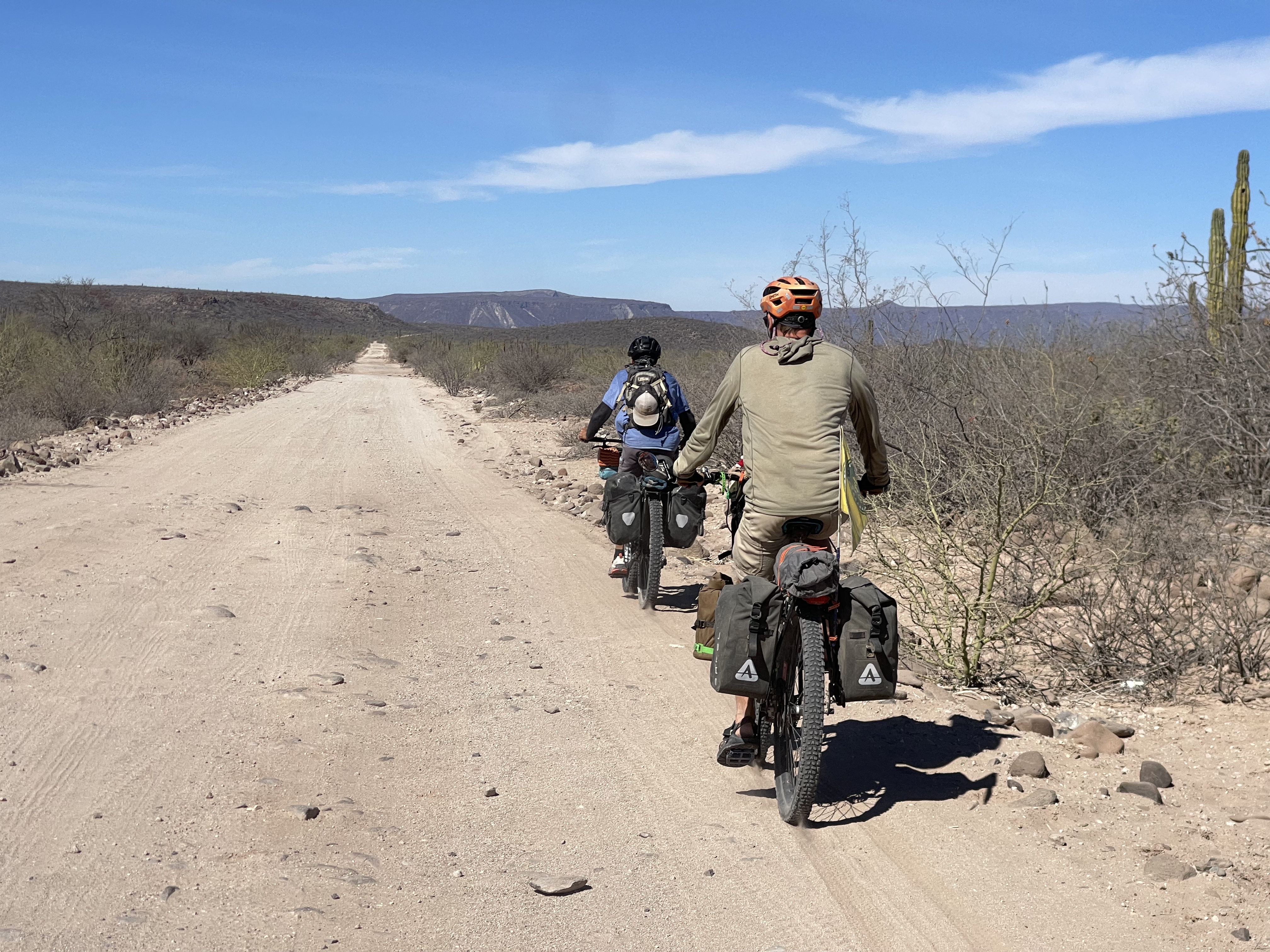
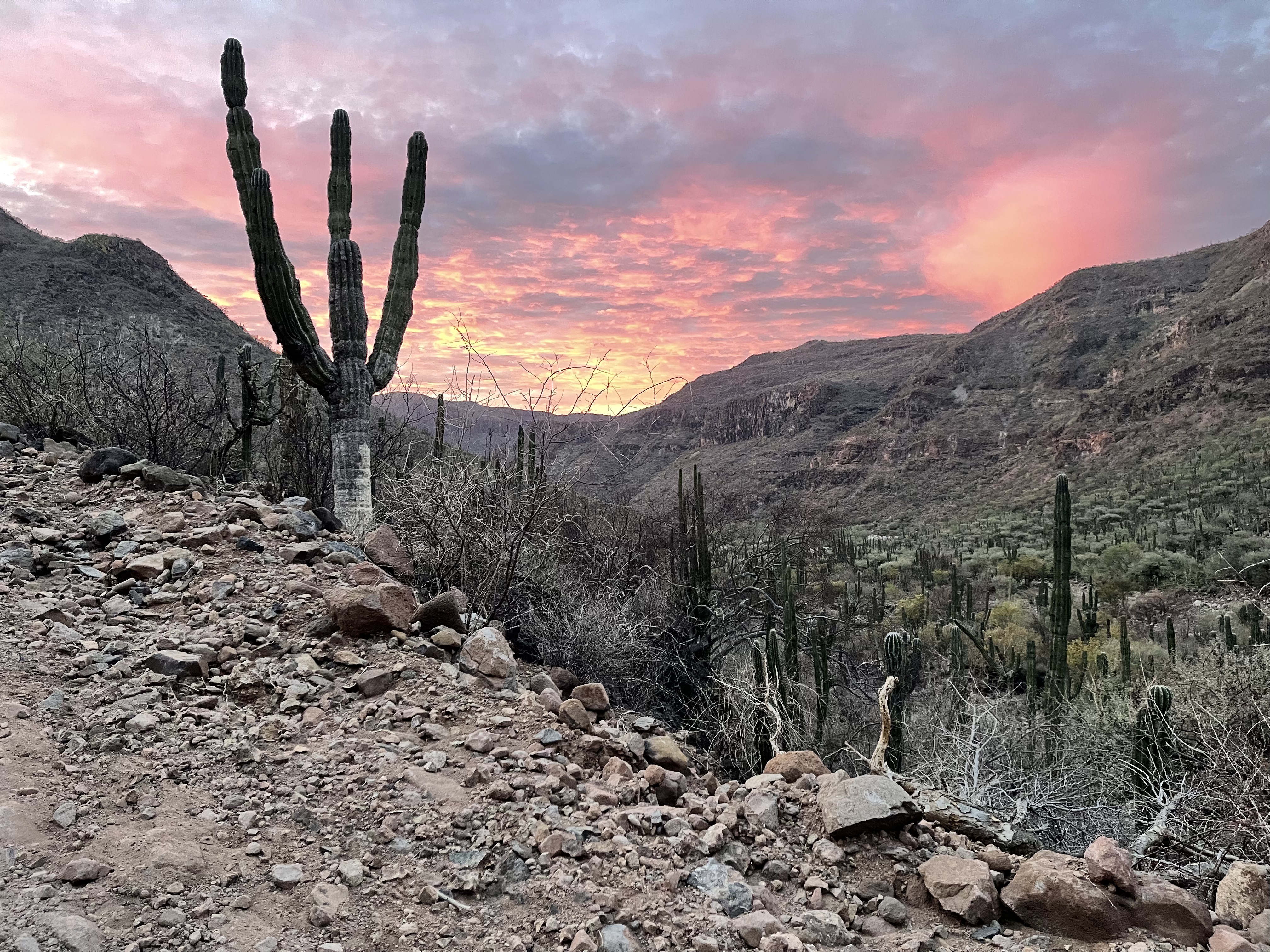
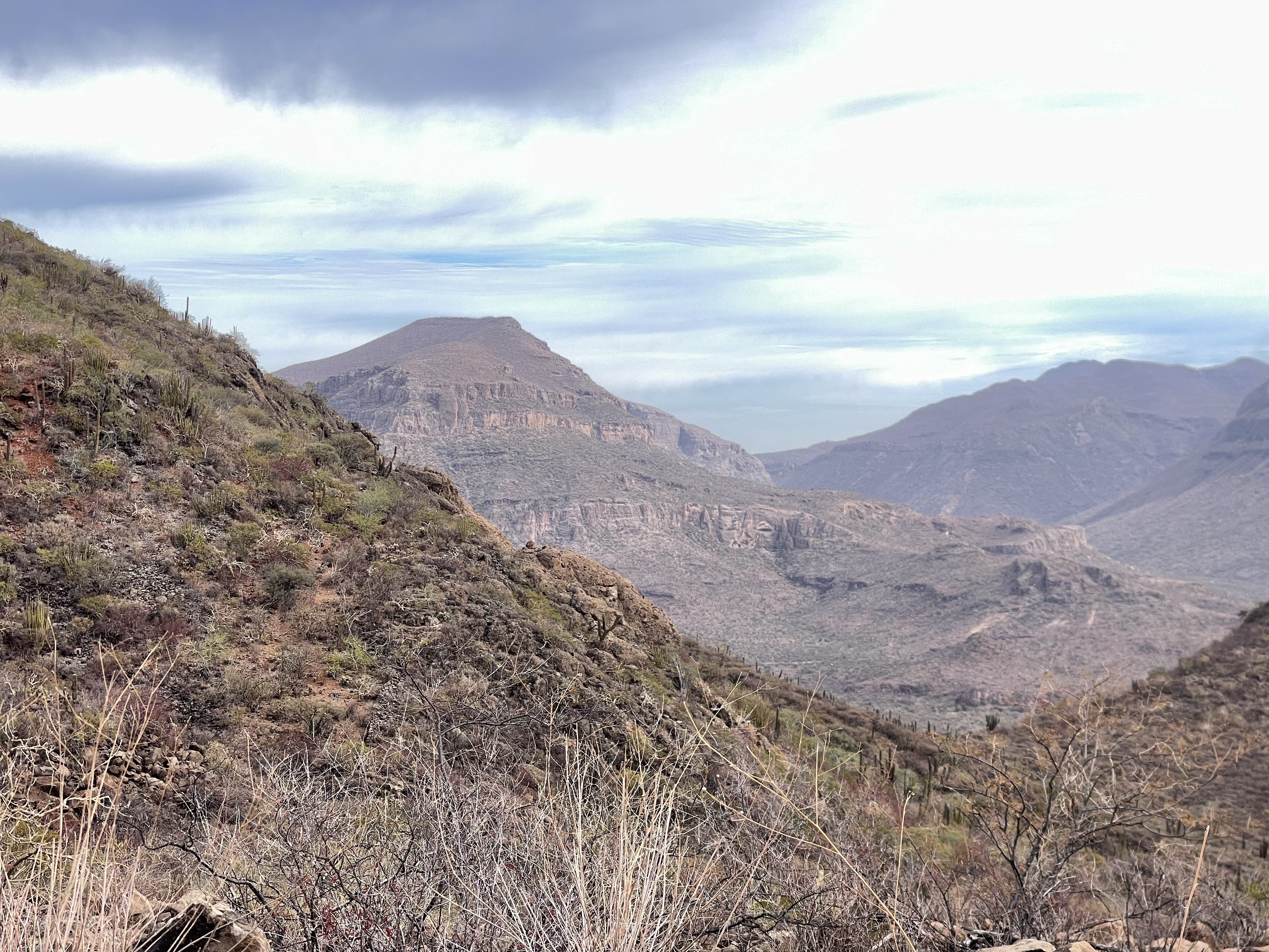
Welcome to the most challenging part of the route! Remember that you must refill all your water down at Jorge’s Agua Grande ranch because there will be no water supply until El Llanito ranch on the other side of the mountains about 18 miles ahead and past all the technical climbs, hikes and downhill.
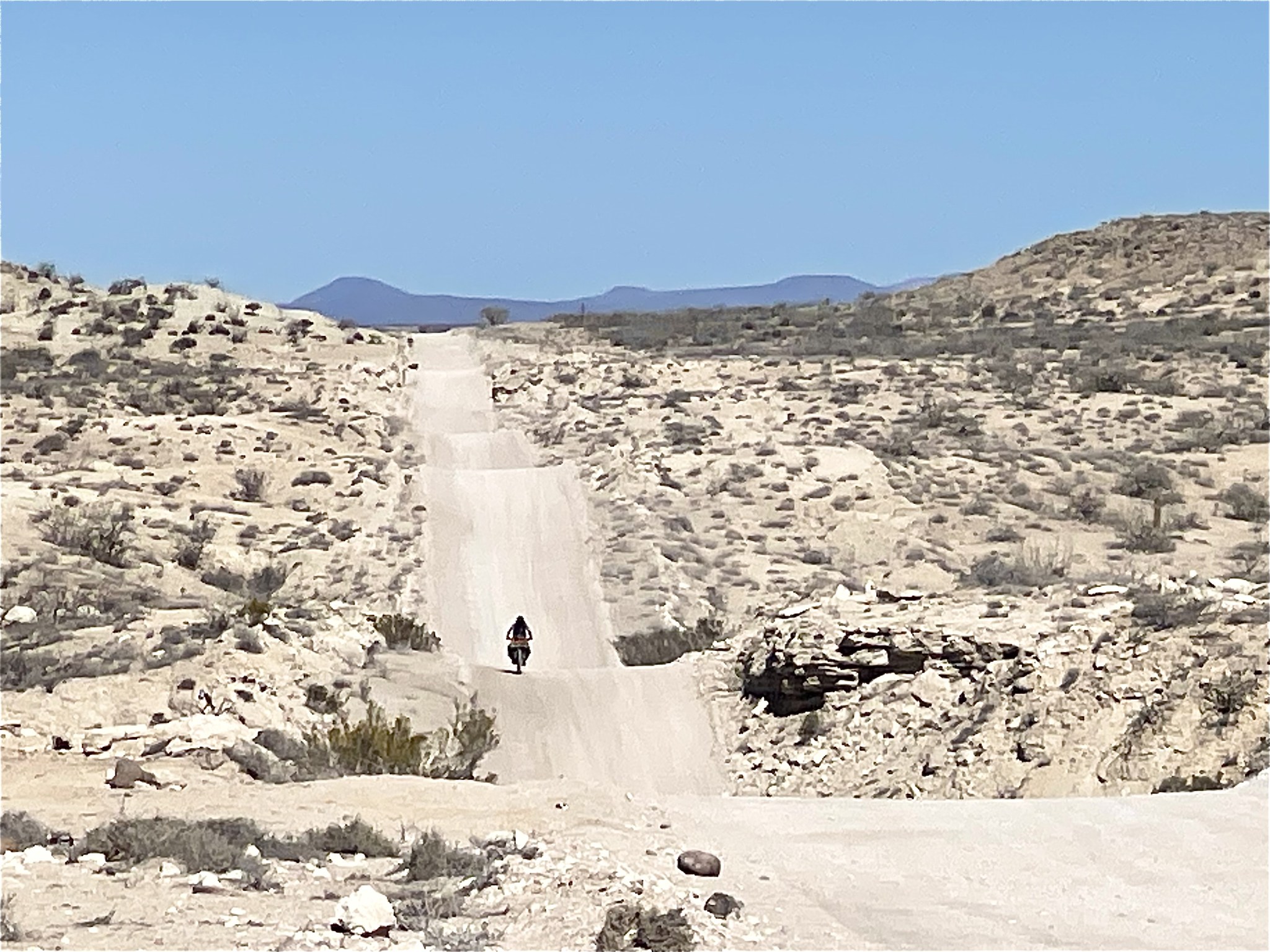
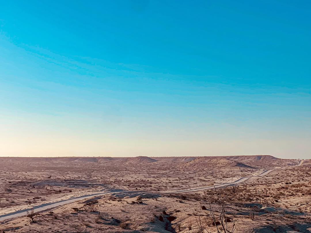
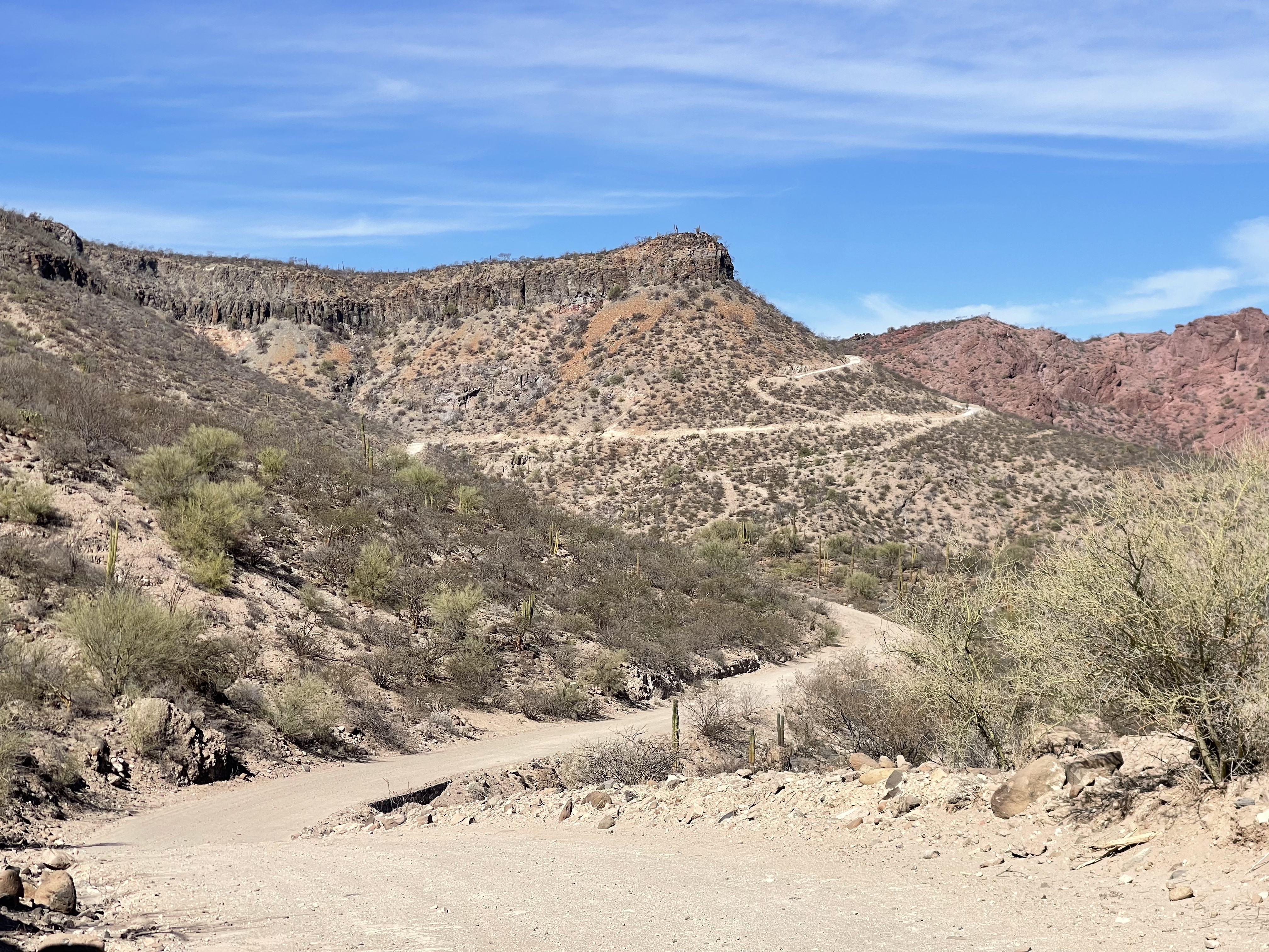
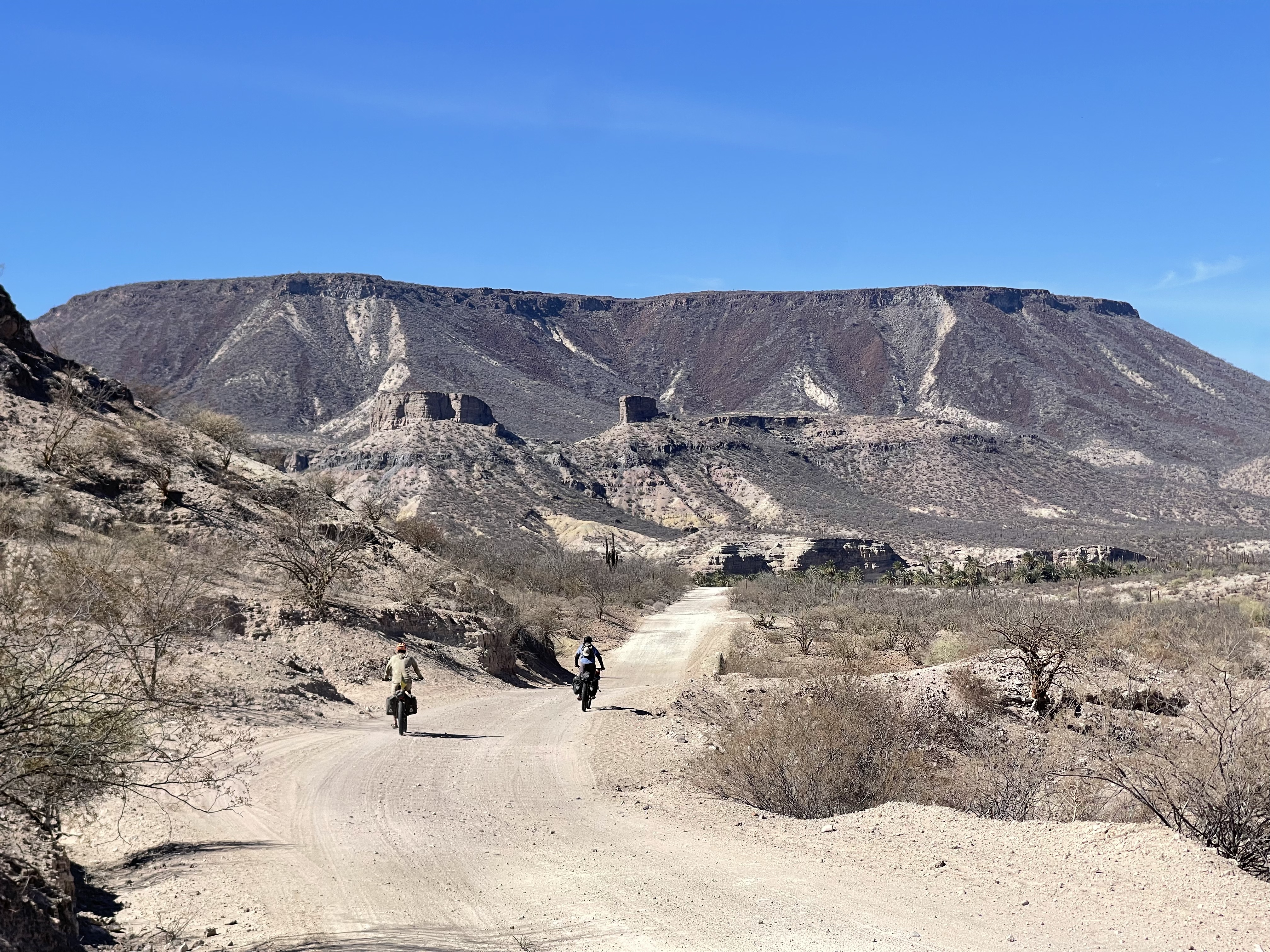
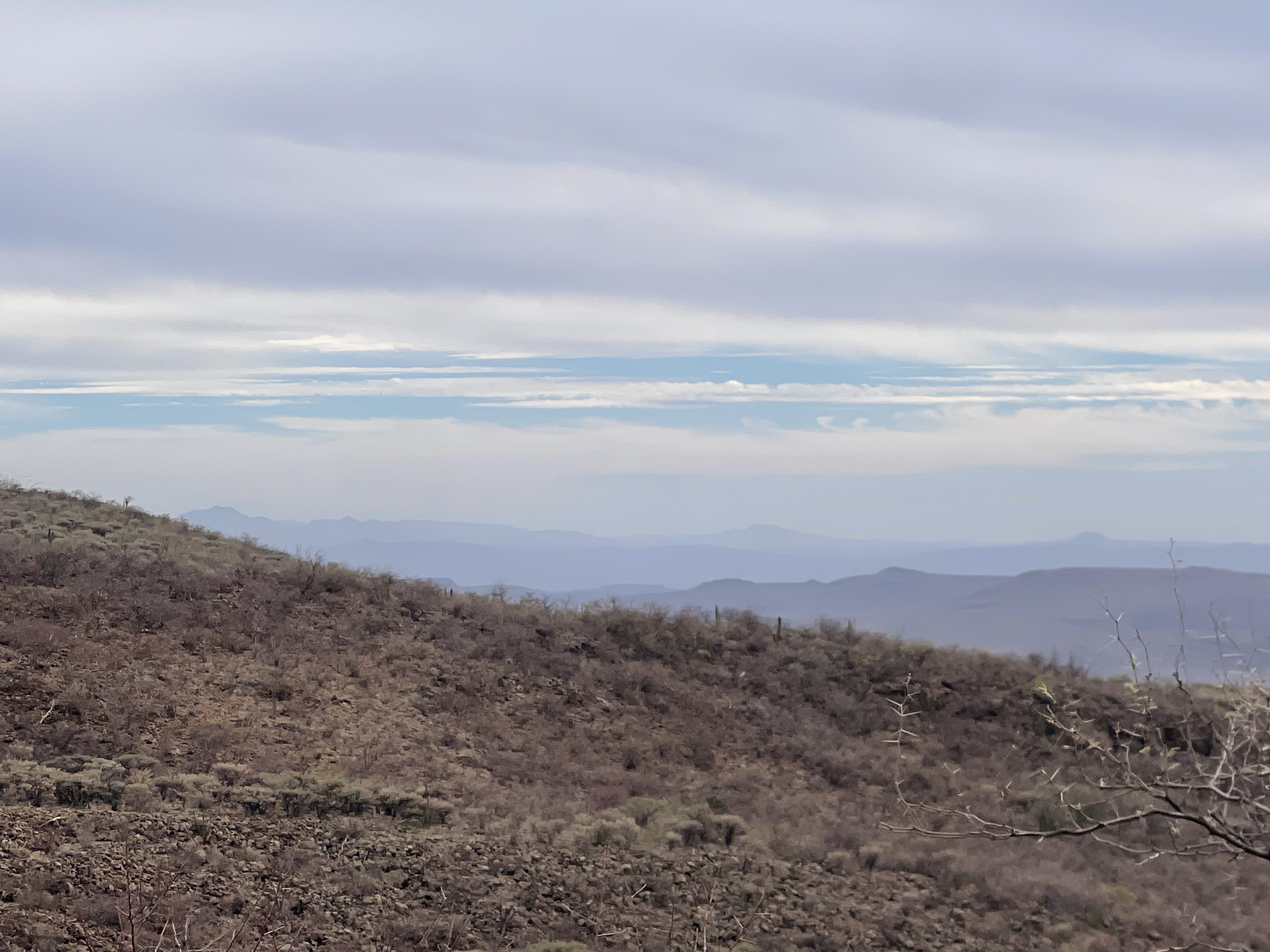
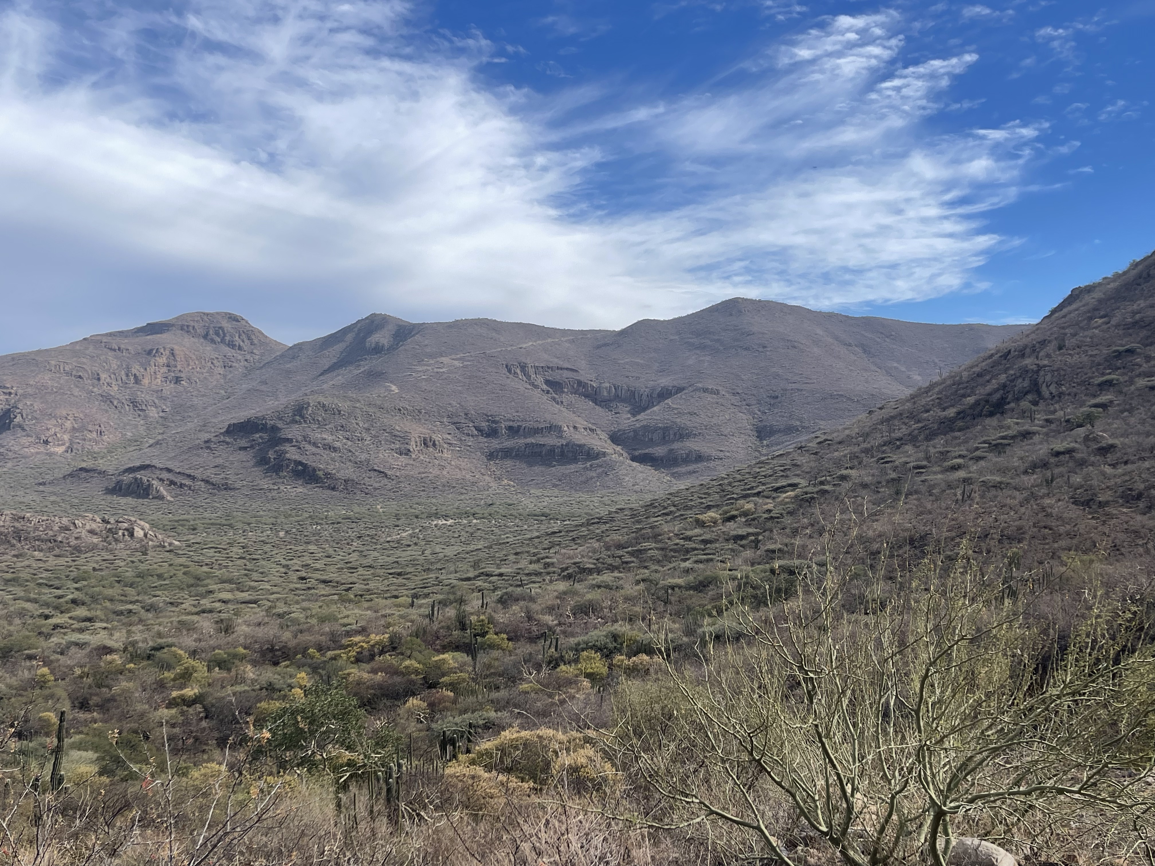
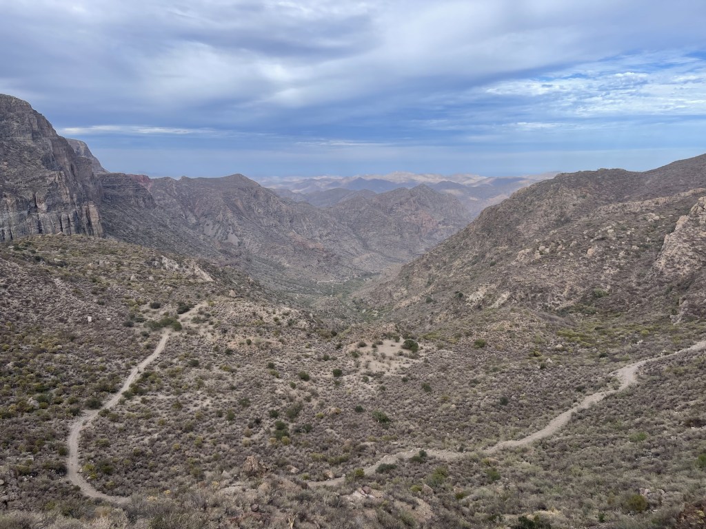
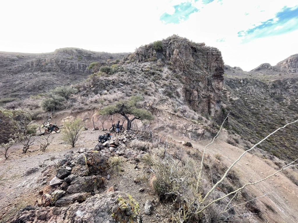
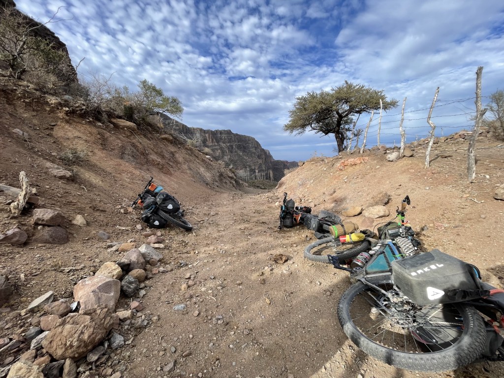
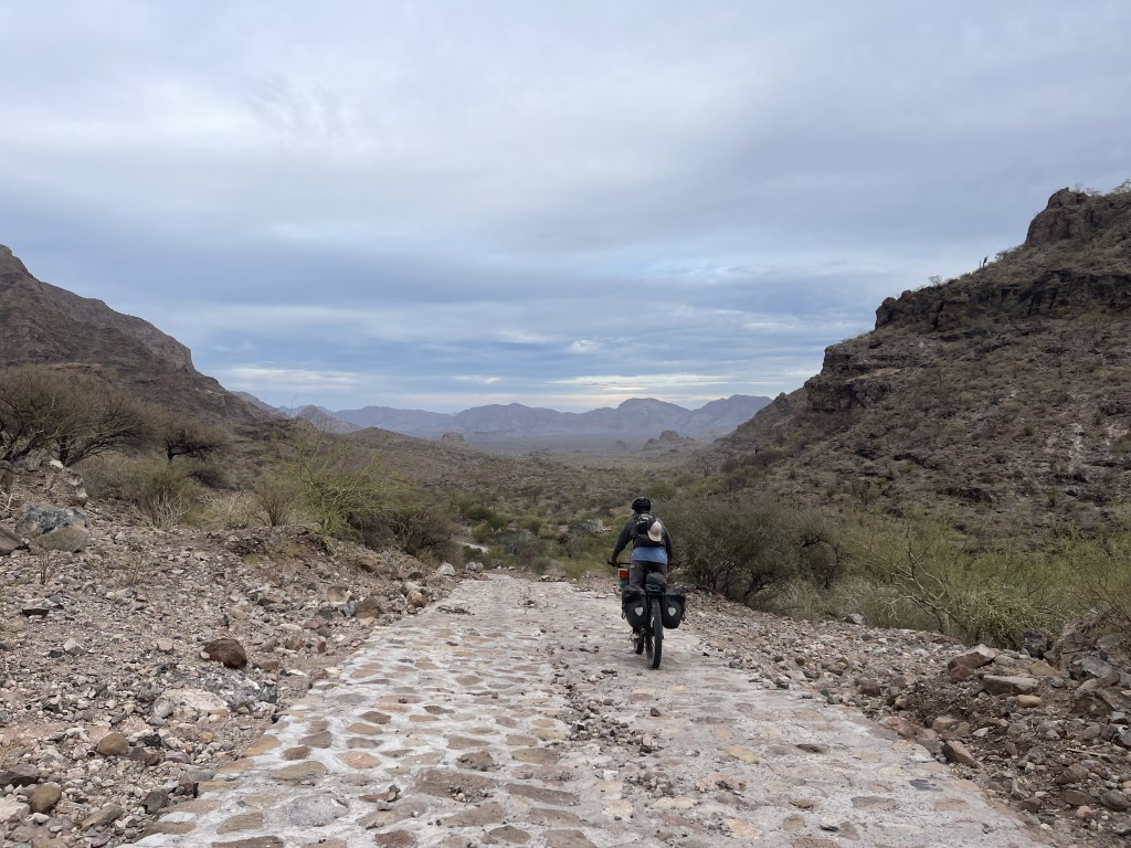
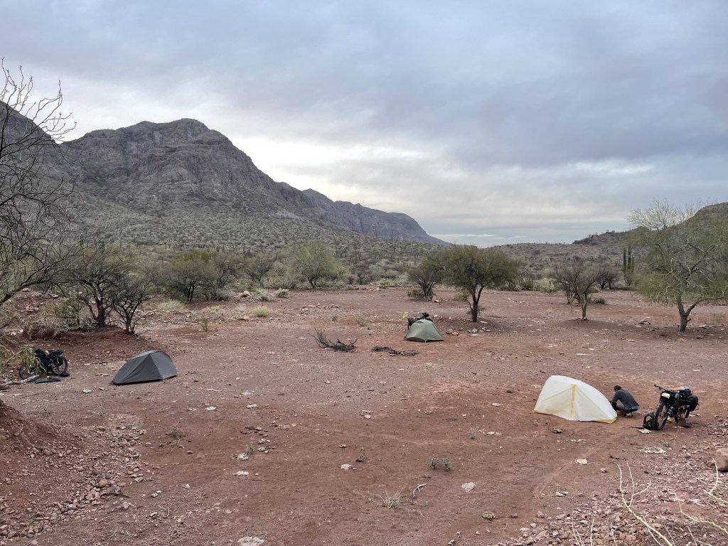
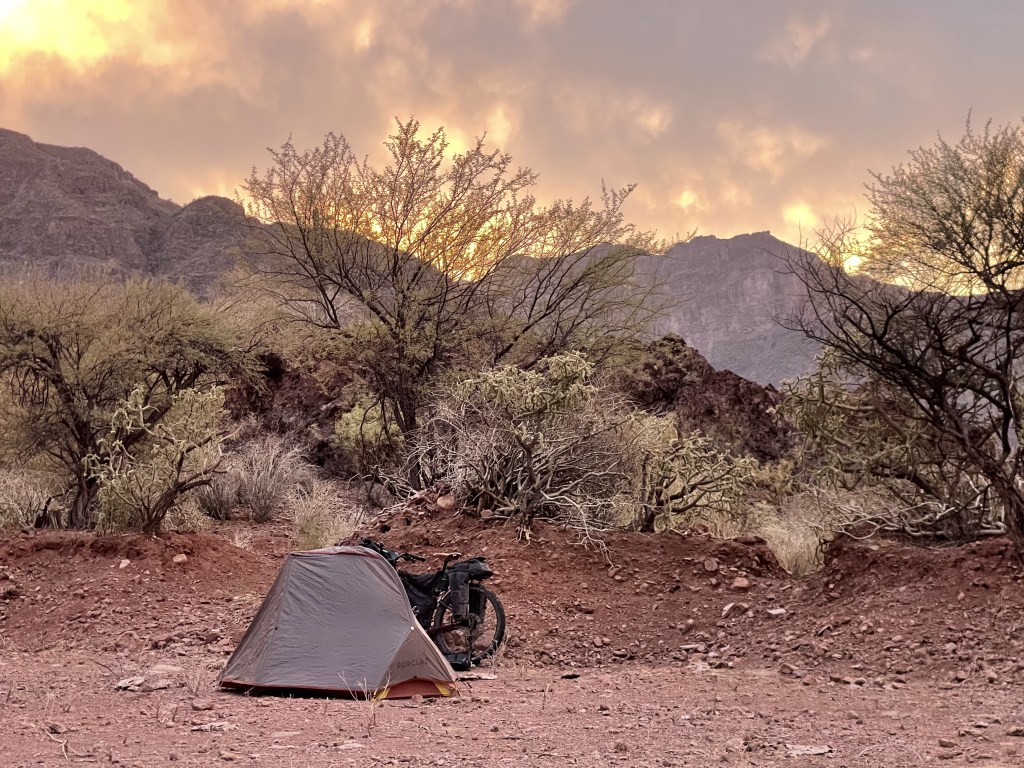
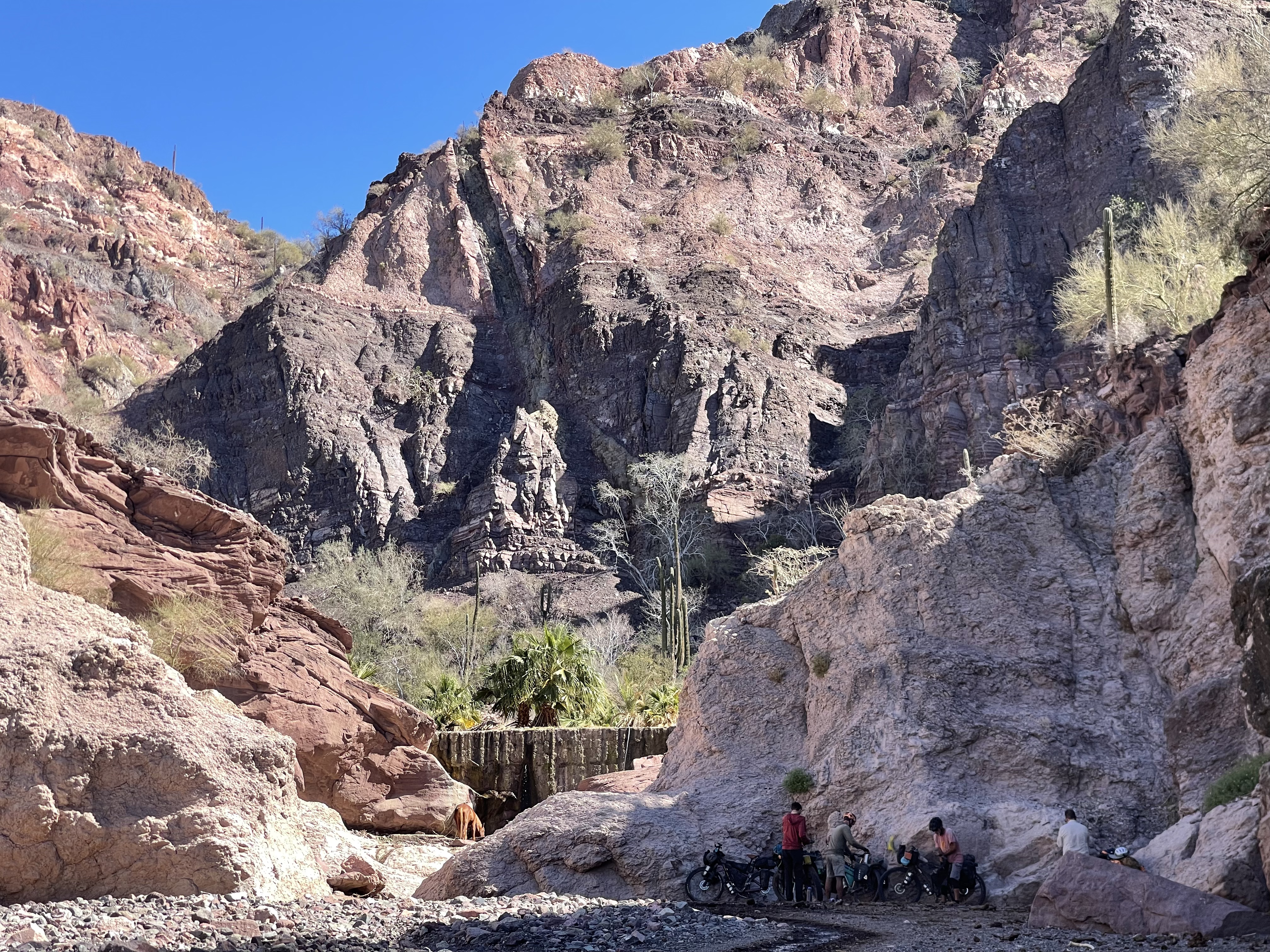
From Agua Grande the climb is about 8 miles long and about 85 % rideable. Luckily the terrain in this ascent is mainly flat rock flakes that ranchers trucks even up driving on it making it not so bumpy. The ranch almost at the very top is called El Contadero, we found people there but they were sad to tell us that they were about to abandon the place because of lack of rain in the last few years so do not expect to find any people or water up there. A couple miles past this ranch you will reach the highest point of the route at a 3700ft pass that can be very cold ( below freezing ) at night and can see even snow precipitations every now and then. From here you can clearly see the upcoming hike-a-bike section as the view of the next valley is incredibly wide and beautiful. Dropping from here needs a bit of focus and it’s quite fast. The valley down low is pretty charming, dry, a bit sandy and has a much different climate and way higher temperature more suitable for overnight camping than the previous high pass. If you made it down here you’re pretty much fully committed to hike your bike, because even if you decide to turn around you will have to push your bike up the way you came down which is quite steep. For the same reason getting hurt on one of these downhills or hikes is something to be avoided as any rescue vehicle is gonna have a tough time to come get you. From this valley up arm your self with patience, hydration, neck shade and stretch your shoulders because is gonna be a full body workout. First hike-a-bike of 1/2 mile took us about 50min, than the road looses a bit of elevation and turn into the last 0.6 mile hike-a-bike that took us about 35 min to clear. The view from this second high pass is unmatchable, so wide over the all sierra and till the Sea of Cortès that not even my wide angle lens could get it all.
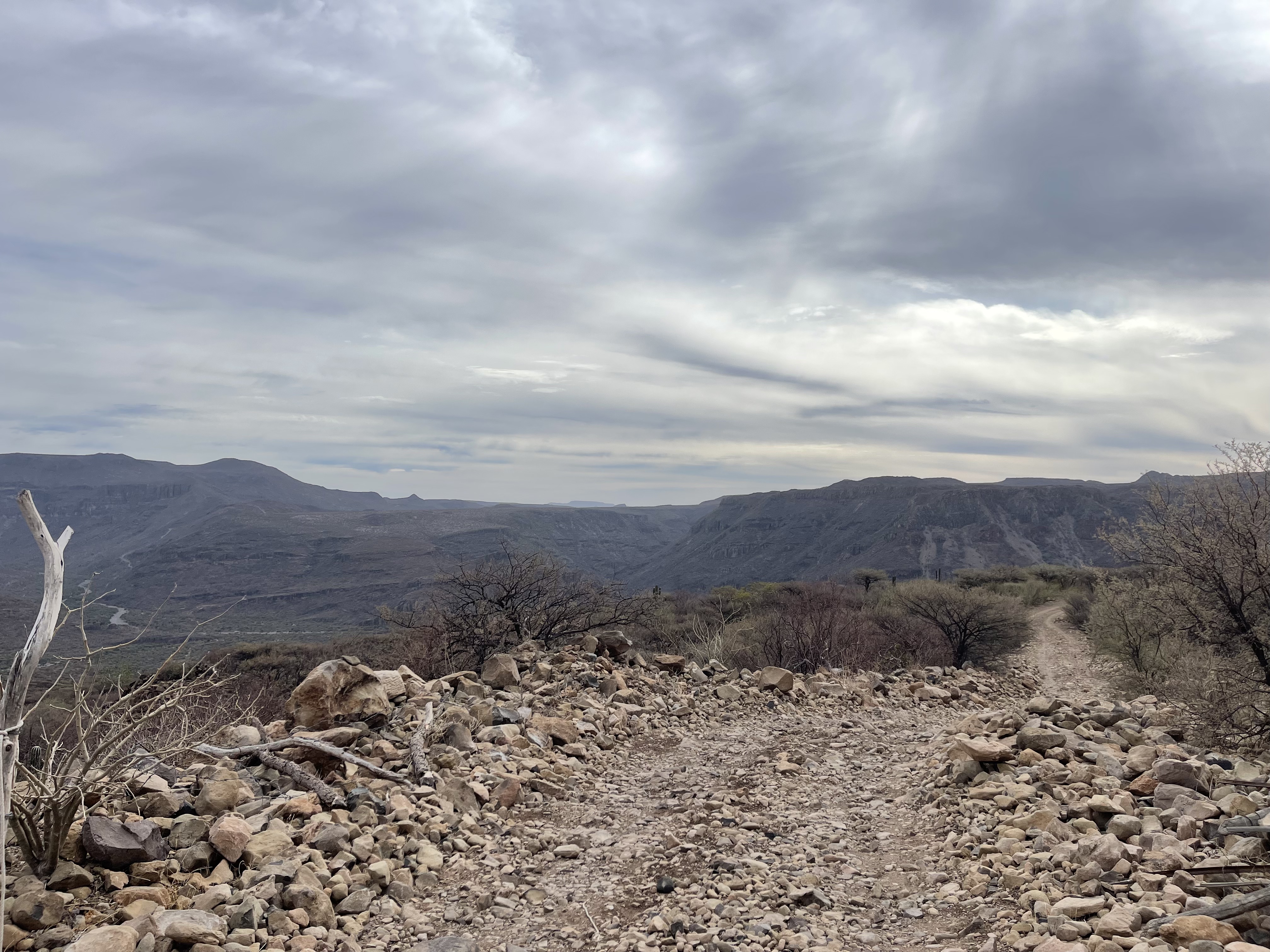

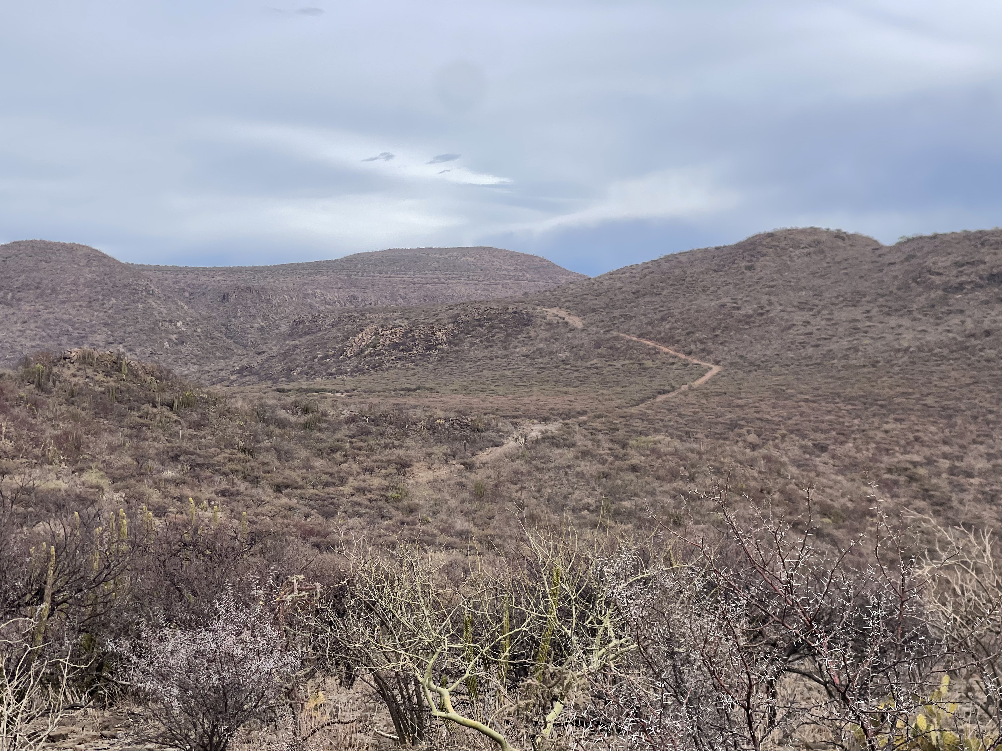
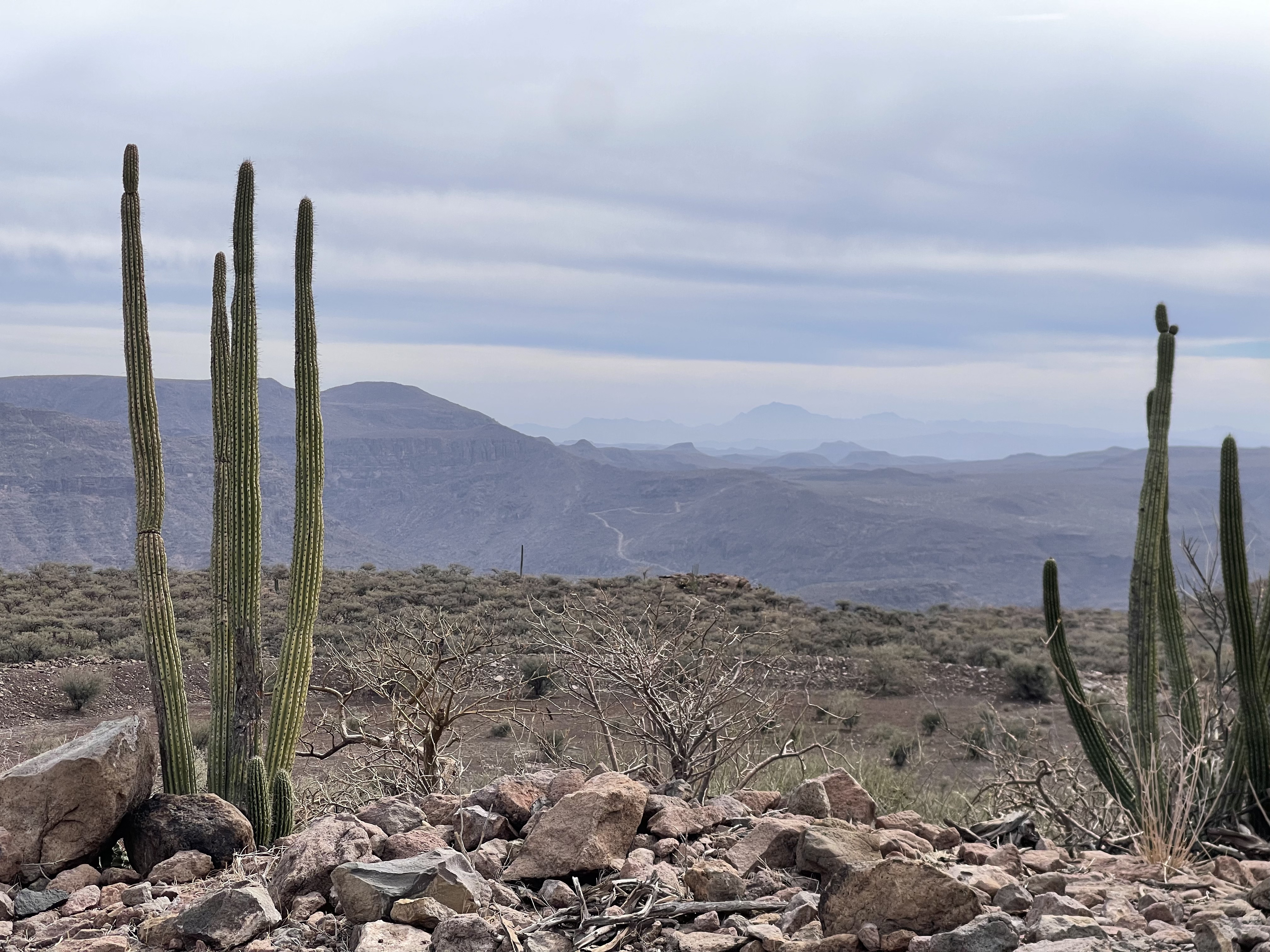
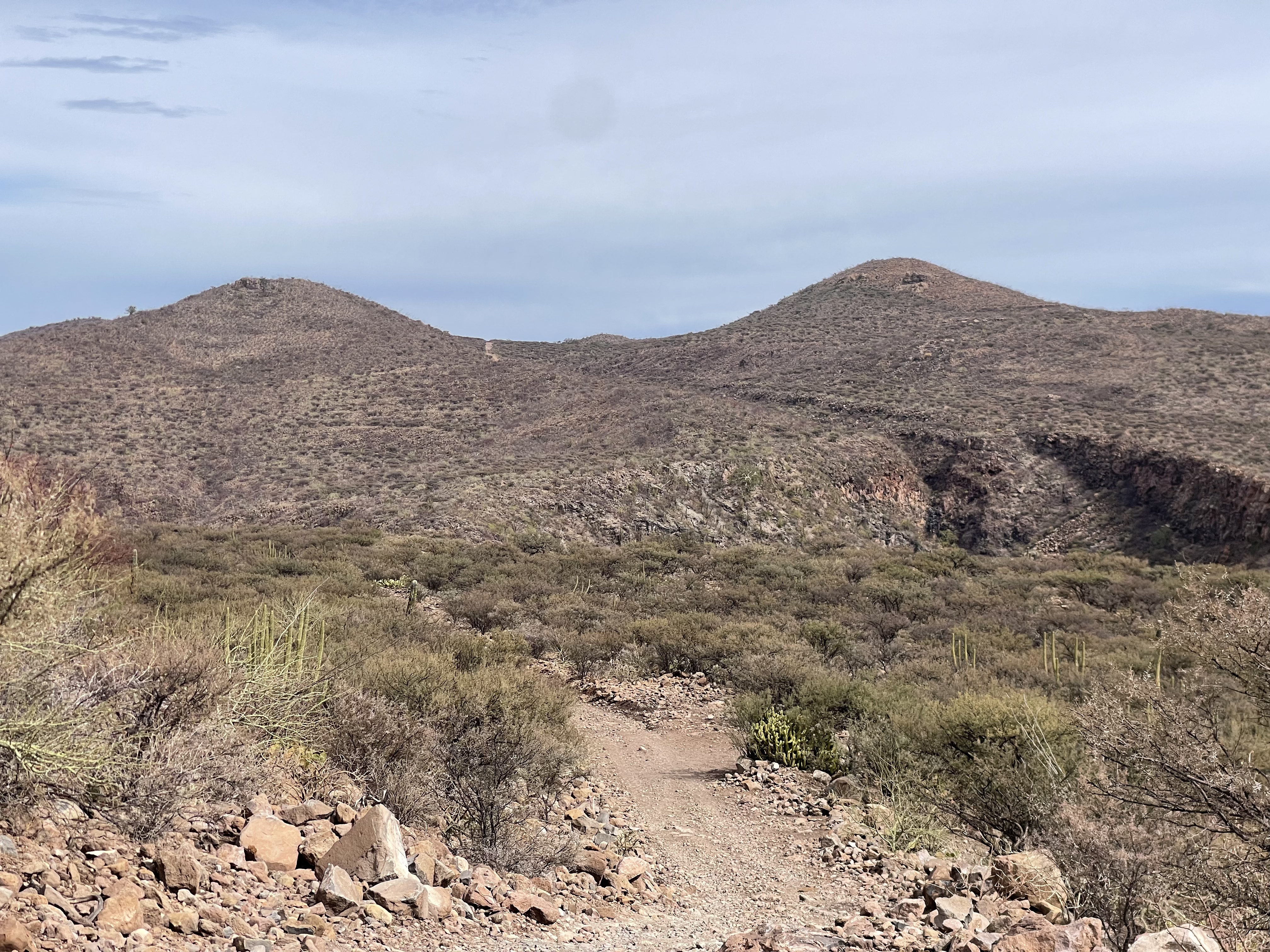

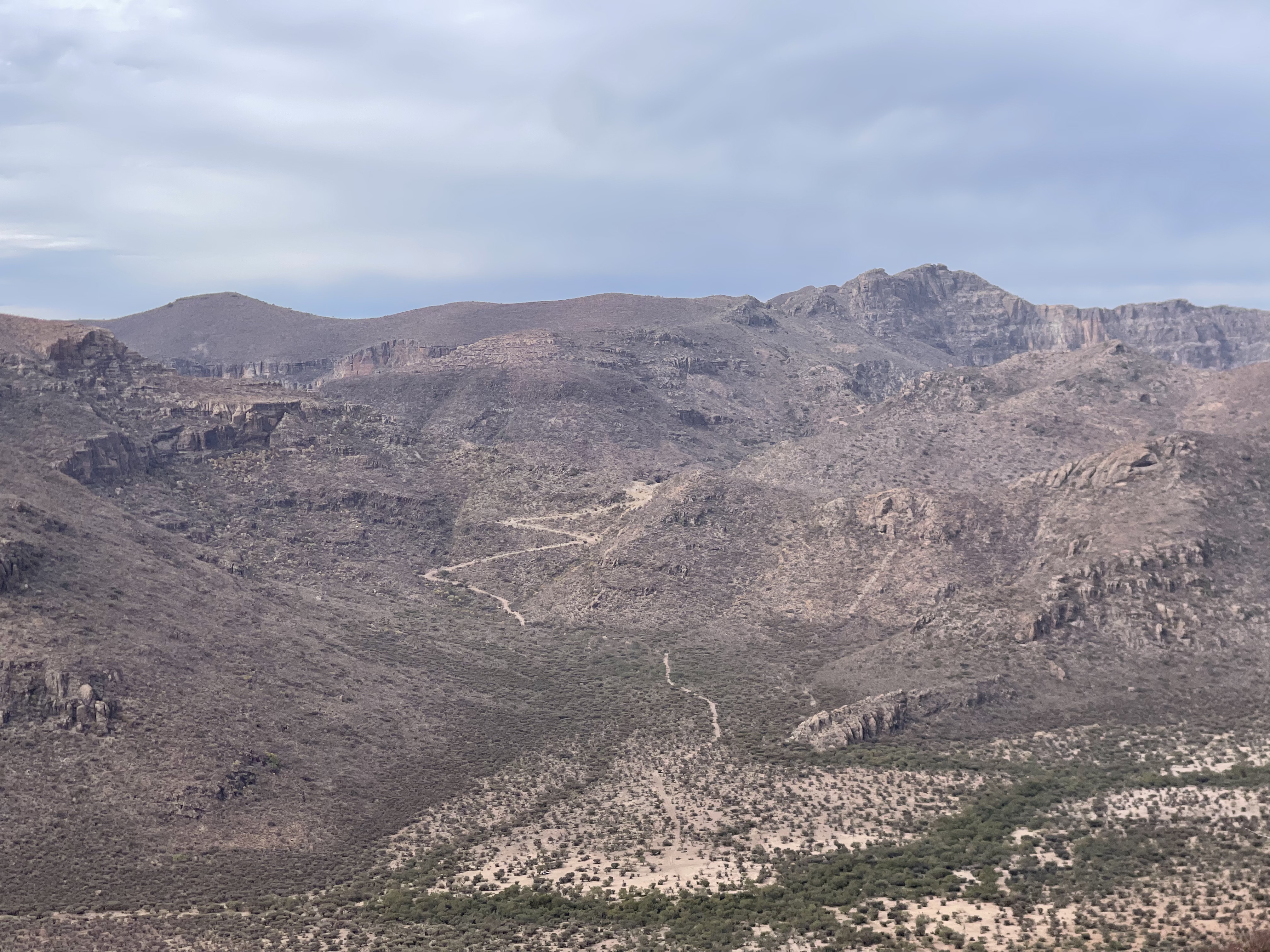
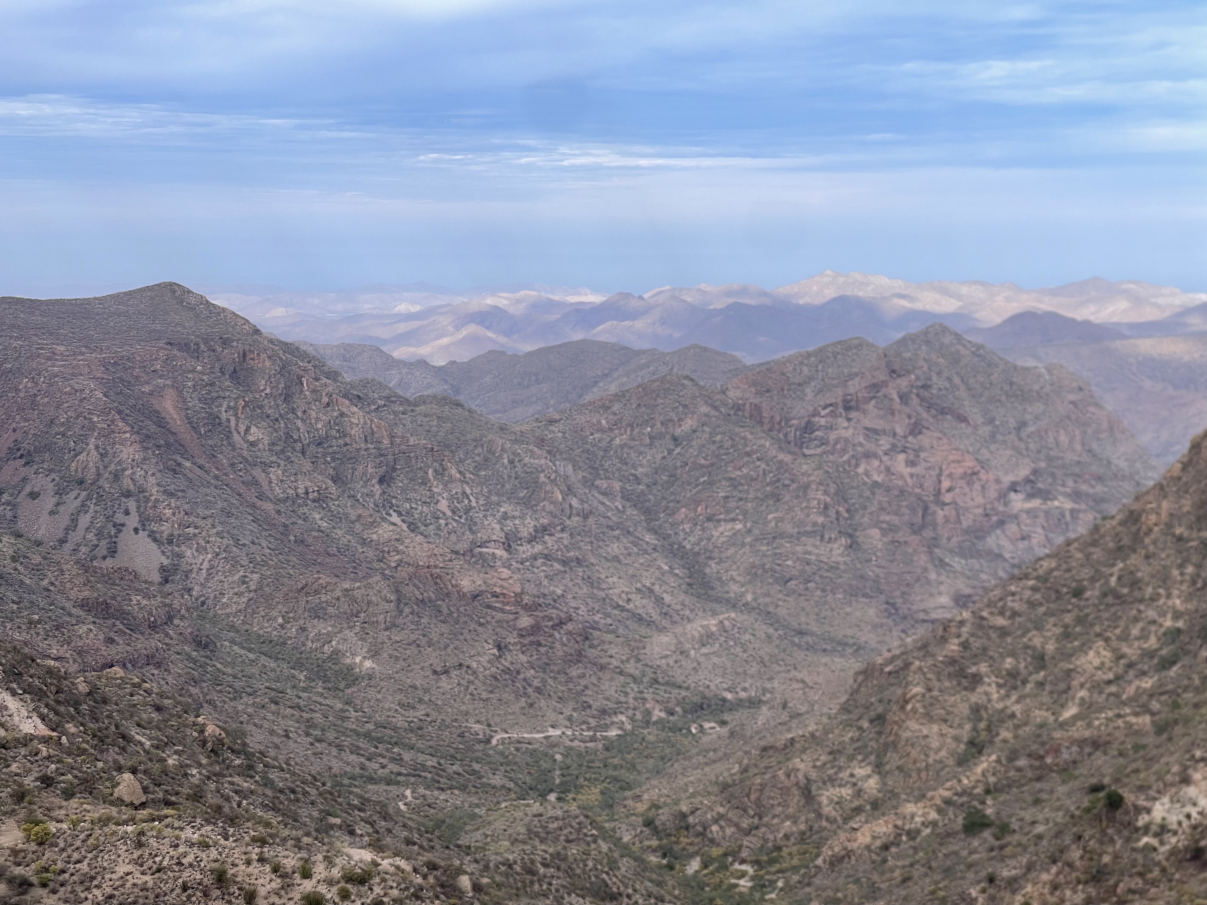
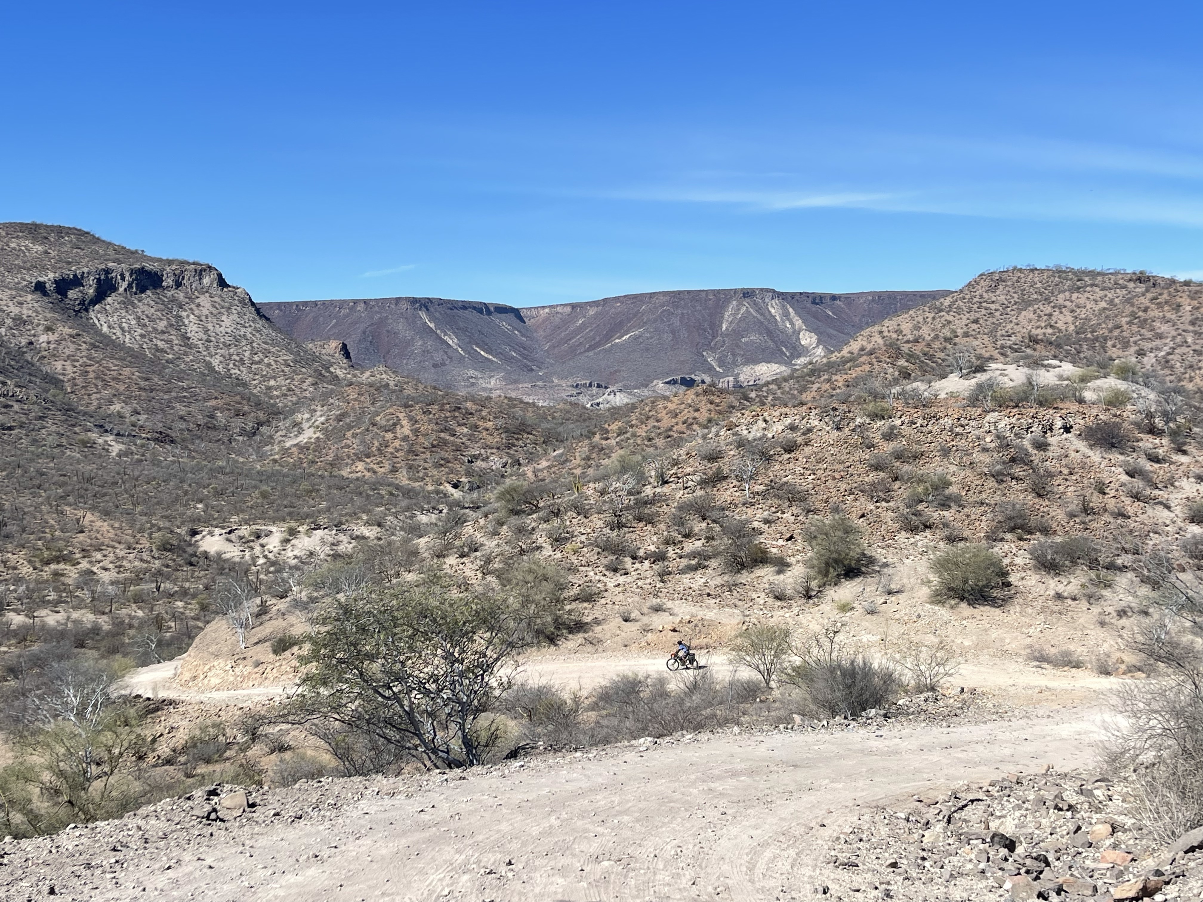
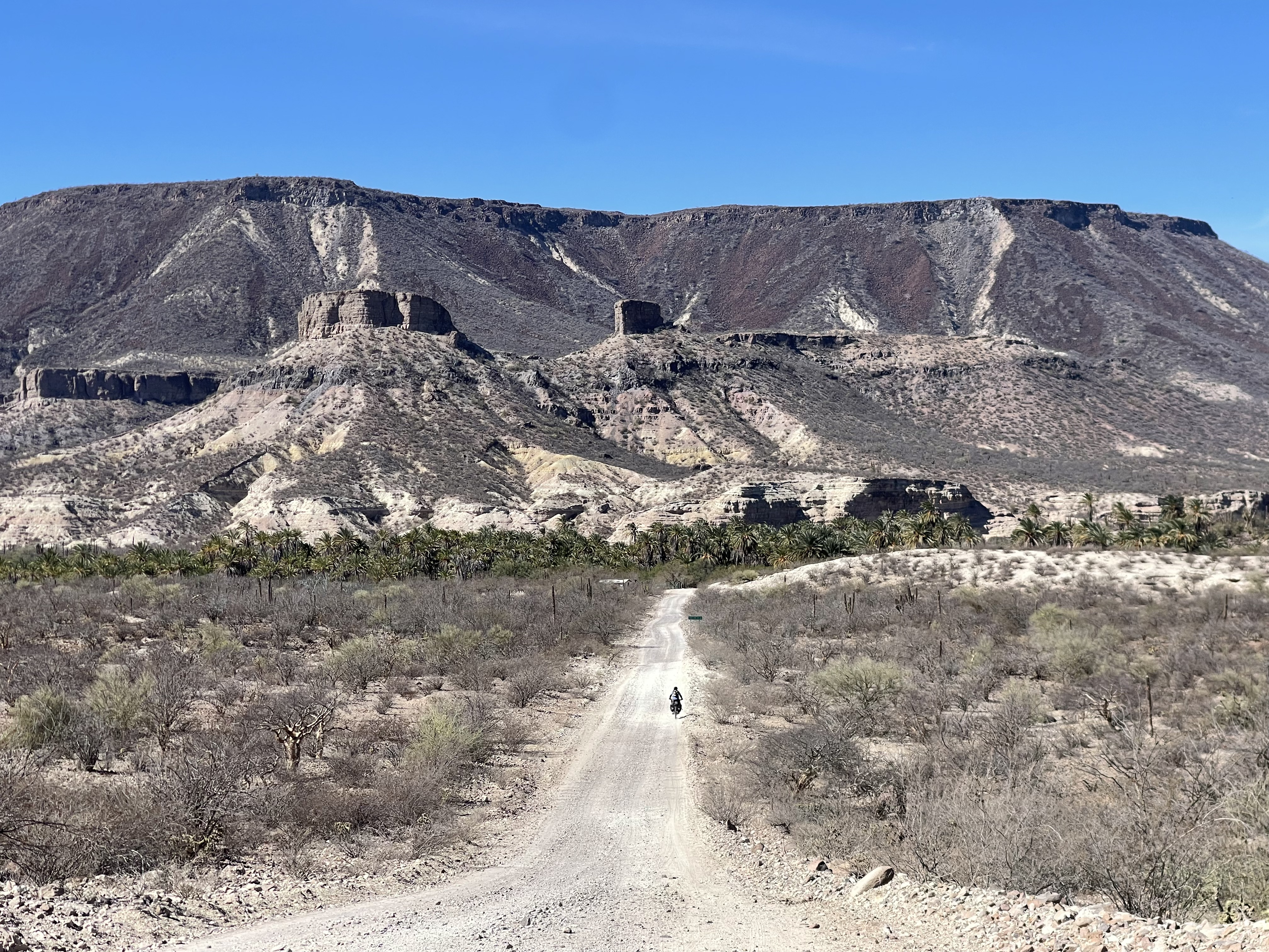
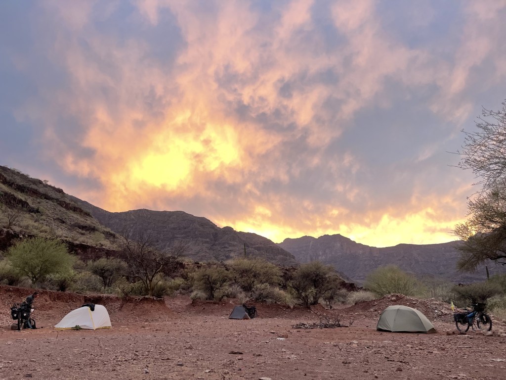
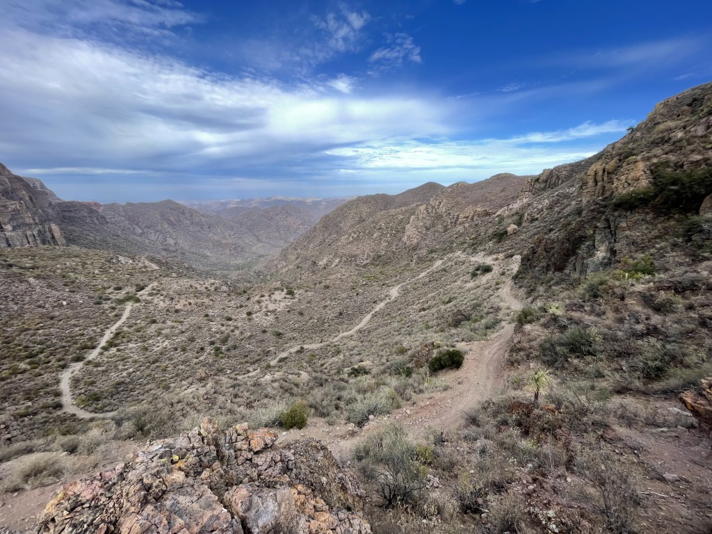
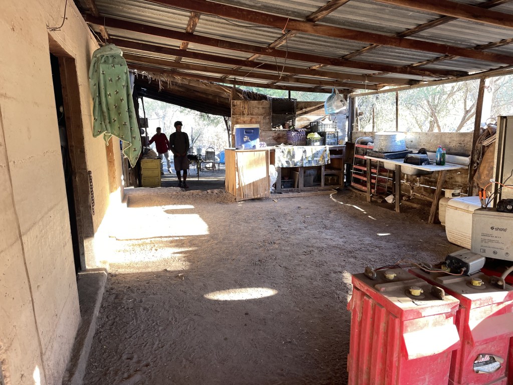
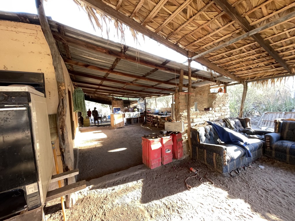
The way down from here ( about 4 miles until it gets smooth ) is a workout too and definitely a cold wake-up shower on your brake pads. Rocks are loose and the road is not tilted only downwards but also sideways which makes bikepacking rigs kind of hard to manage to the point that we had to actually walk the bikes down in many spots. The reward after all this is a great sense of satisfaction, body exercise, amazing views and a beautiful long fast rolling smooth downhill with wide open flat red clay ground camping areas surrounded by astonishing peaks. A very cool camping spot 5 miles from the last high pass is the big flat area to the right side right at the junction with the small road that takes you to the El Llanito ranch. There normally are people and water at El Llanito but in case there’s not there will be people at the next ranch down along the route called the Dibugòn where a family produces fresh goat cheese highly demanded by the grocery stores in downtown Mulegé. There is a sign to a ranch called El Potrero but that has been abandoned.


The last stretch of this part of the route rolls pretty much on flat land all the way to Mulegé. Depending on the conditions and when the last rain occurred the road could be either sandy or hard with washboard.
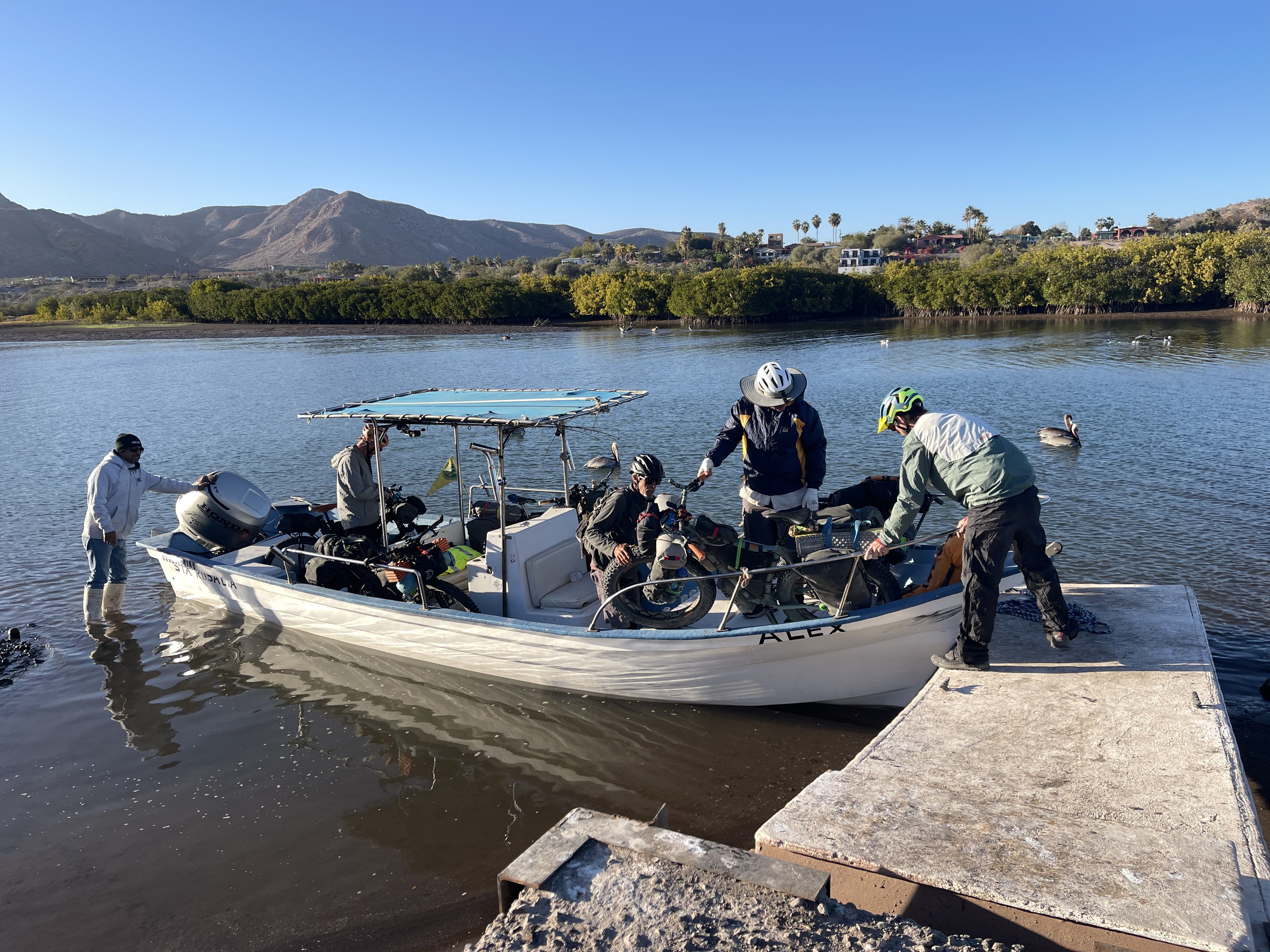
ABOUT MULEGE’ AND THE BOAT RIDE
A little paragraph here is due on the Mulegé boat ride logistic. First important thing to say is: check the wind forecast for the Sea of Cortes a week ahead. This can save you days of layover in Mulegé spending extra unplanned money and stiffening your legs. There are very cool things to see in town though, but one or two days maximum is plenty of time. Things that must be visited in Mulegé:
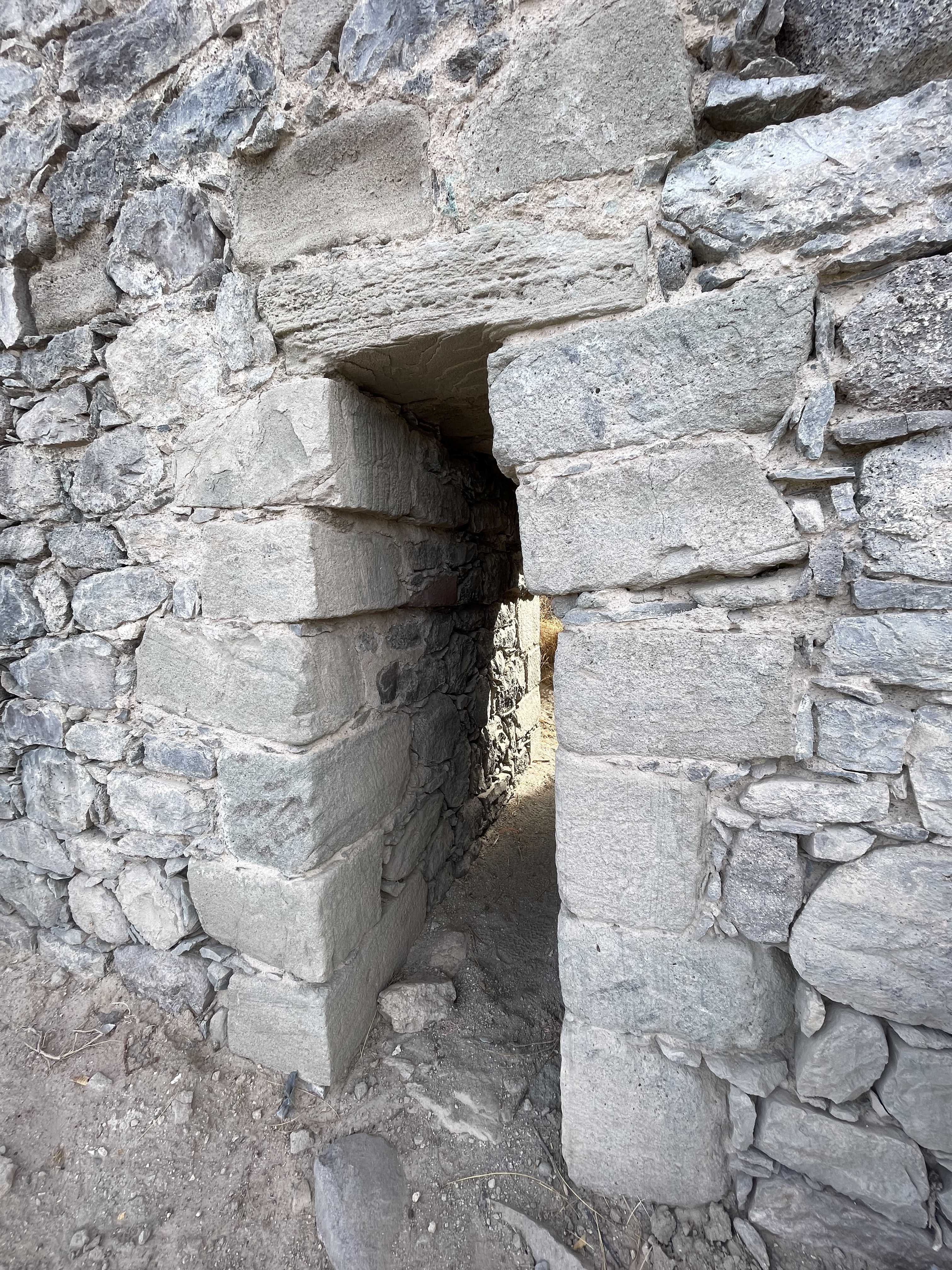
- The mission with its crazy lookout on the oasis.
- The old prison/museum with it.
Plenty of hotels and restaurants, one ATM machine and the Pinguino store that lets you cashout untill 11pm in case ATM is out of order. There used to be a bikeshop called Pacman’s but is now permanently closed.
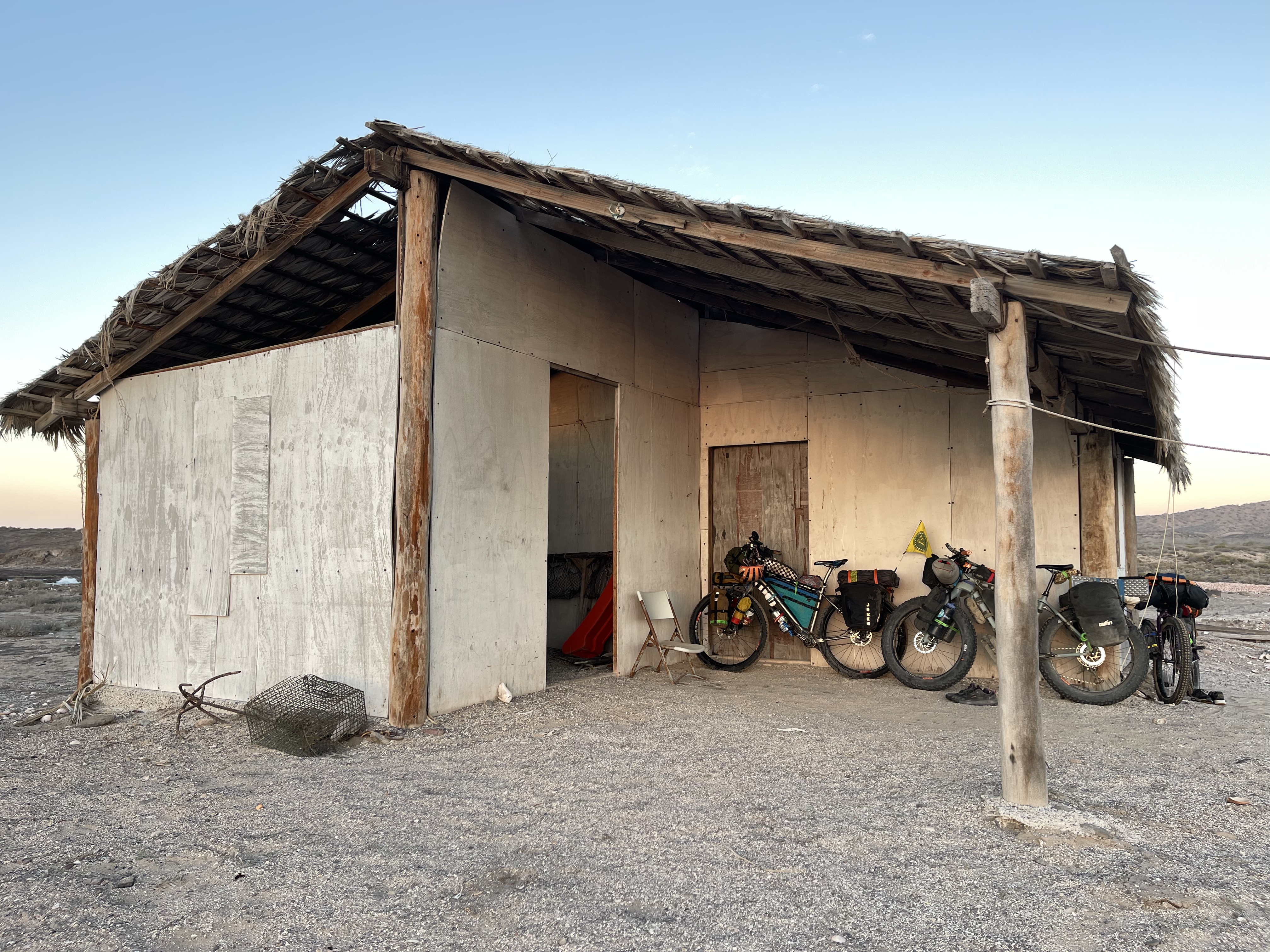
As we were saying the wind forecast check is crucial basically because if it’s blowing a hard North wind ( called “Norte” ) fishermen don’t move. So there is no way you can get a ride across to the peninsula and if someone offers to do that it may be very risky and a little shady as nobody is allowed by the coast Guard to do so in rough sea. The best thing to do to make sure everything works out good and to have a good forecast opinion is to call the main bikepackers boat crossing guy Alejandro Bukovecz known as “Buko” ( whatsapp +52 615 104 3979 ). This guy speaks good English and legally owns all the updated permits and insurance to take passengers on board besides being also a fisherman. He’s really working hard to do things straight and to make sure that the boat crossing for bikepackers is safe and covered. He also told us the we could camp inside the fisherman shack on the landing beach which was very cool and helpful as we did the crossing before sunset this time. A very smart call is to bring an extra liter of fresh water – doesn’t have to be potable – to rinse the moving parts of the bike once you land because it’s almost inevitable that some salty sprays reach everyone’s rig. LITTLE TIP ABOUT THE PENINSULA: The El Salto ranch oasis is worth a check to get some possible fresh spring water and to rinse up!!!
I have to say that the overall experience on this alternative route was thrilling. The places we cycled through in this remote canyon had a unique charm and offered a pleasant sense of bike pioneering without pushing us to extremes. It felt incredibly rewarding to bring hope for a new, small wave of sustainable bicycle tourism to these deep, forgotten valleys of Baja — a concept at the core of the bikepackingbaja.com project.
REMEMBER. If you want to make sure your rig is ready for this route, check-out our BAJA-PROOF series of tips and tested products !
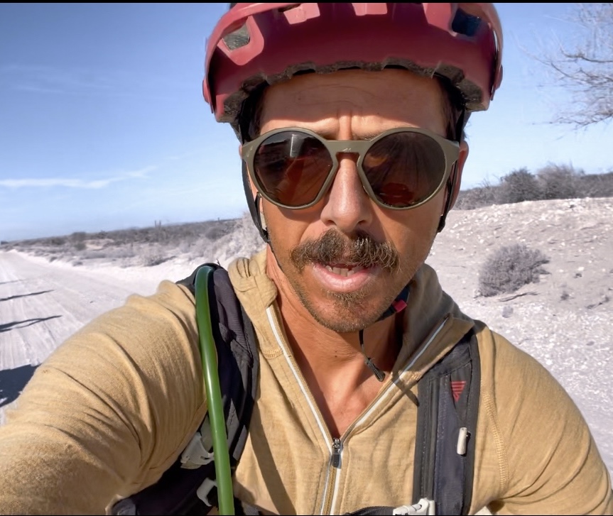
Mattia Dalvit ( @busyerode )

Leave a comment