
All of us Baja lovers share great respect for the invaluable work done by Mr. David Kier and his lifelong mission of exploring and documenting the entire Baja Peninsula. Through his meticulous research, he has revealed its deepest historical facts, geographical details, and relevant information in such a precise way that one might ask, “How long did it take this guy to figure all this out and put it together?”
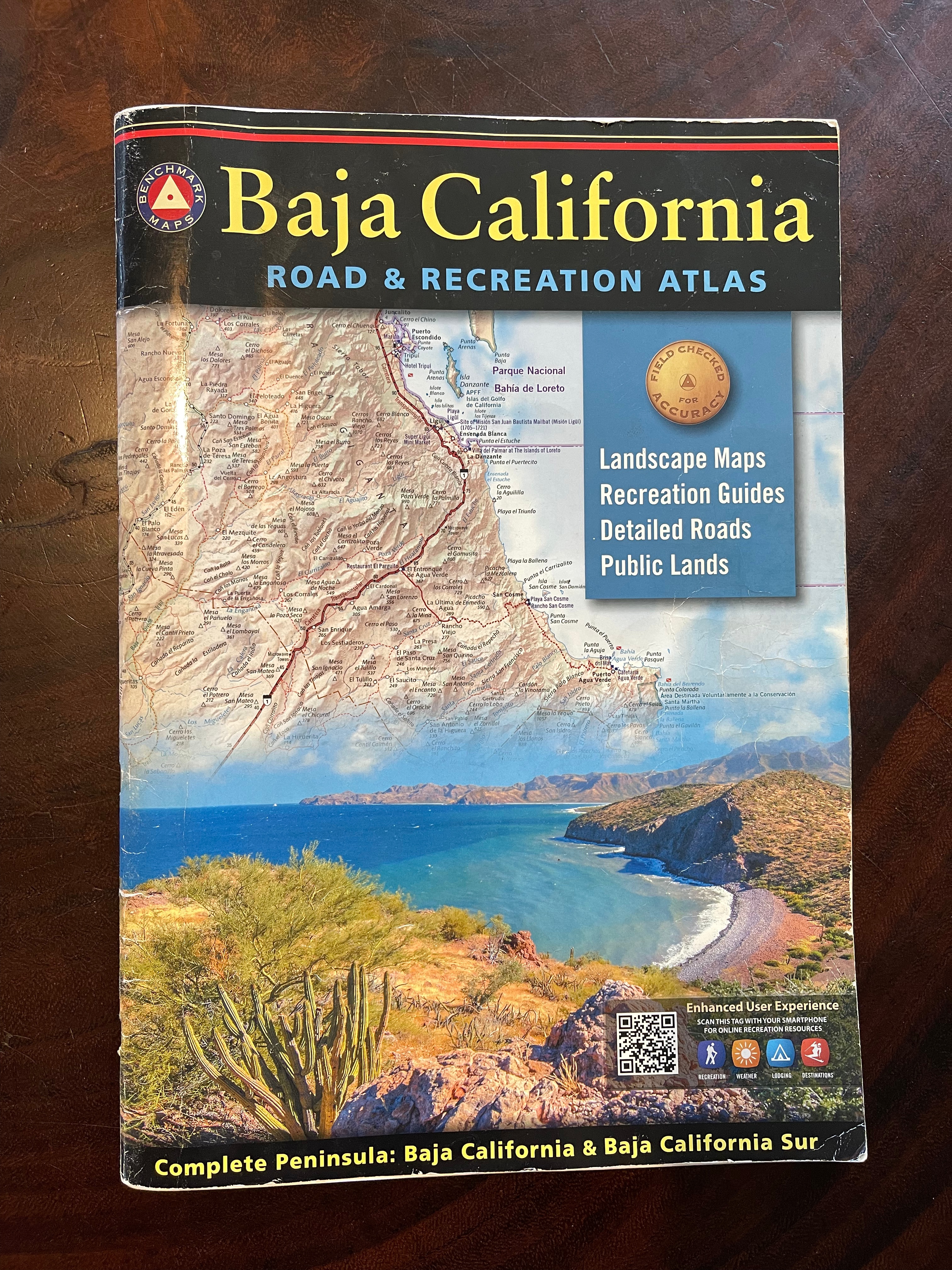
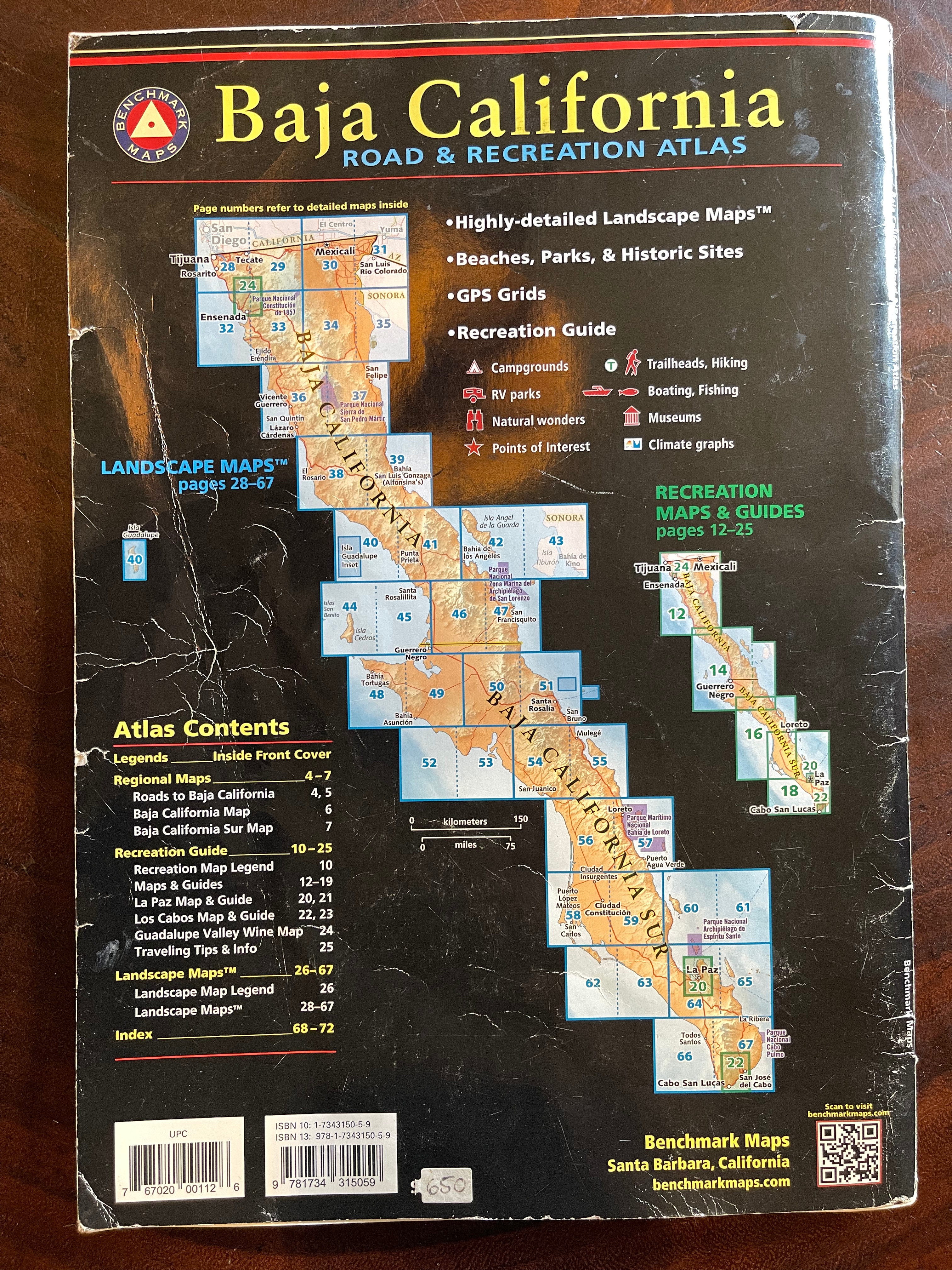
Kier’s efforts materialize in two main publications: the book Baja California: Land of Missions and his co-editing of the Baja California Road & Recreational Atlas by Benchmark Maps—the quintessential trip-planning tool for anyone preparing to travel in Baja, whether by bike, foot, horse, plane, or motorized vehicle.
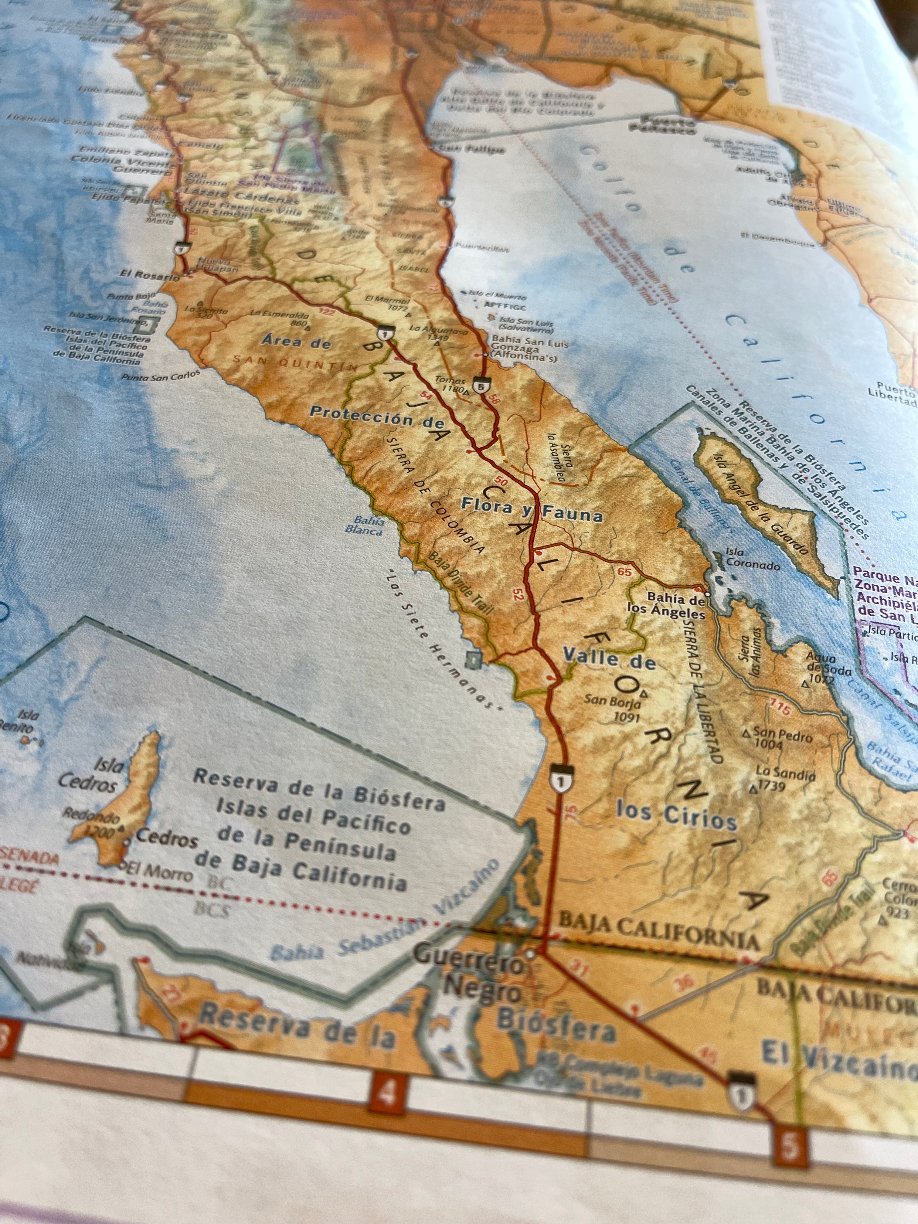
The latter is what this article is about, as the paper map in question undoubtedly deserves our BAJA-PROOF shield award for its loyal service in helping people becoming BAJA-PROOF! No matter what route we’ve been planning, we always open the Benchmark paper atlas of Baja first—before turning to any technological device. Whenever we talk about Baja with a cyclist, we grab this atlas to quickly locate their doubts on the map. It is so clear and straightforward yet detailed and well-organized that it has become the most essential tool for planning, from which every new project starts.
Sometimes, we find ourselves sitting for hours, letting our imagination hover over the pages of the atlas as if our eyes and mind were aboard a private micro-aircraft, cruising above the peninsula and scouting for incredible new routes and lost ancient mission ruins.
The atlas is thin, measure about 11”x15”, weighs 345g (about the same as a lightweight synthetic puffy jacket) and costs between $27–$35, depending on where you buy it—an unquestionably worthy investment. It would be a crime to rip a few pages out to carry on your bike. Carrying the entire book could mean one of two things: either a bikepacking policy violation or that you are a pure sentimental Baja lover.
So, what’s the best way to incorporate this Baja tool into bikepacking? The key is to study it before your trip, letting curiosity be your compass. Then, take high-quality photos of the pages covering your intended route and save them in a separate folder on your phone for easy access. We always do this before any trip to Baja, and to be honest, there have been a couple of times when we were very, very grateful for this decision, as it saved us from getting lost and proved invaluable when asking for information.
Please do not limit yourself in simply downloading the gpx file of the Divide when packing for your trip. Take a few relaxing hours ( or days! ) to sit on the sofa exploring this very well made atlas and discover also what’s around!
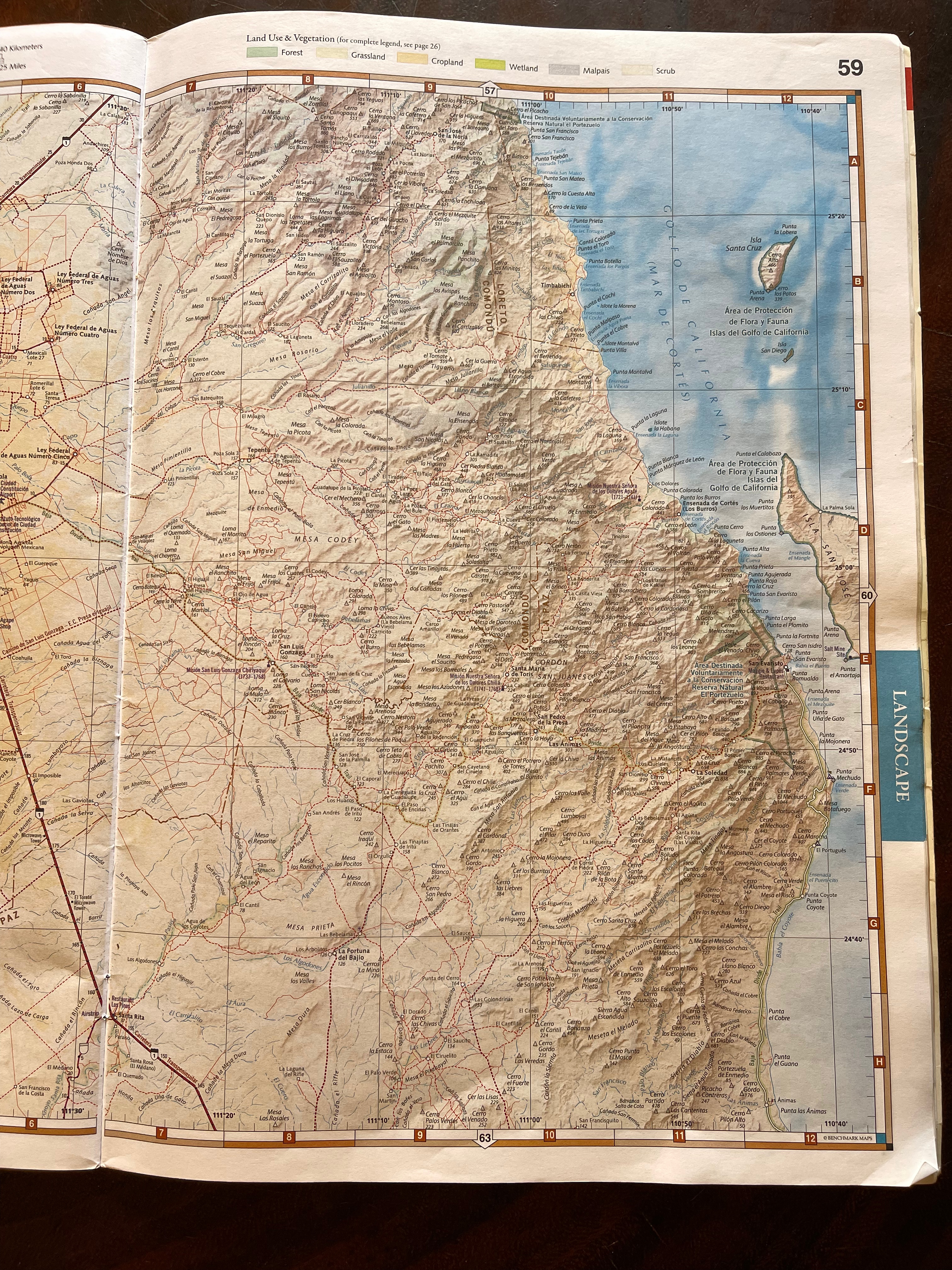
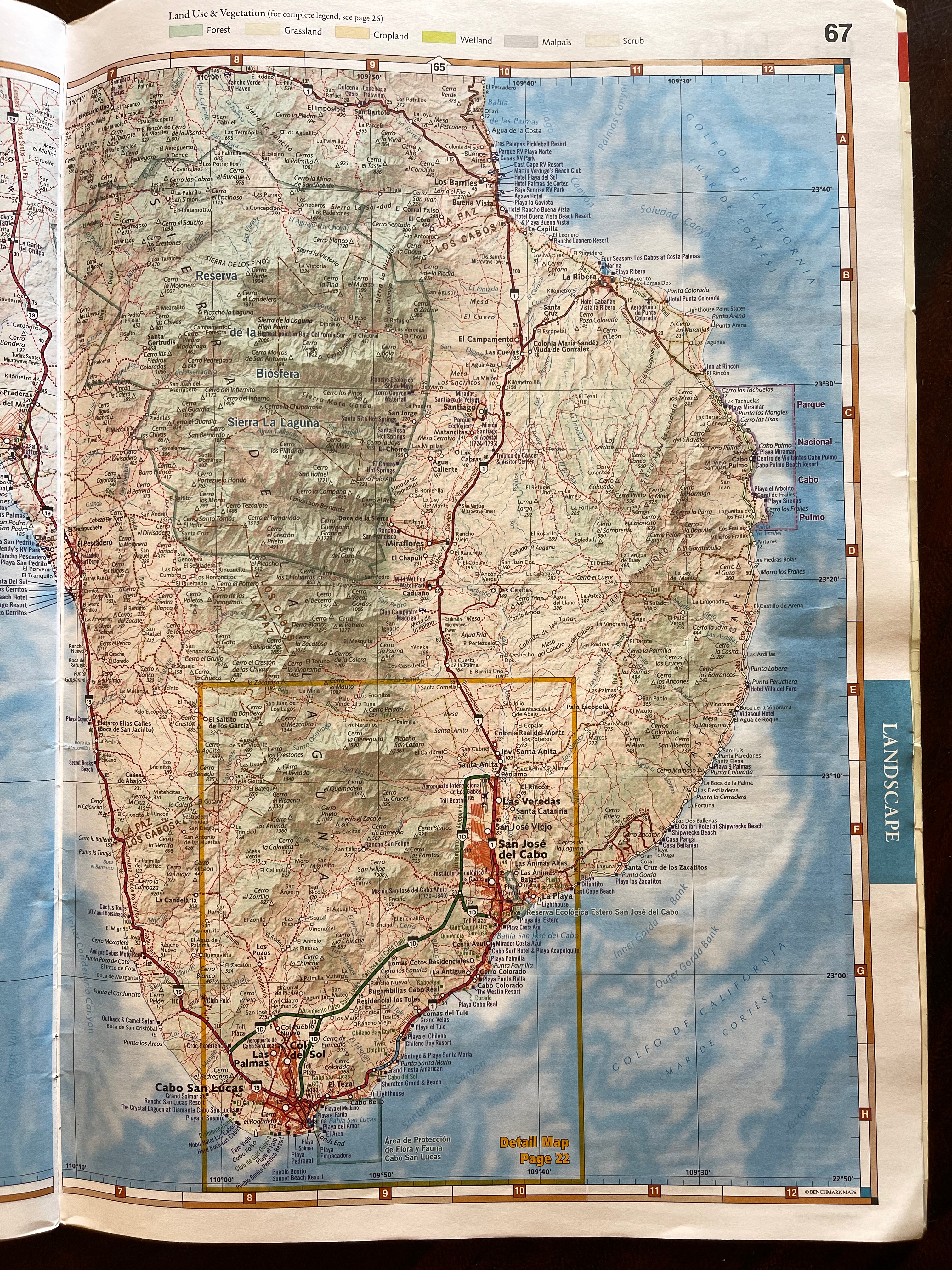
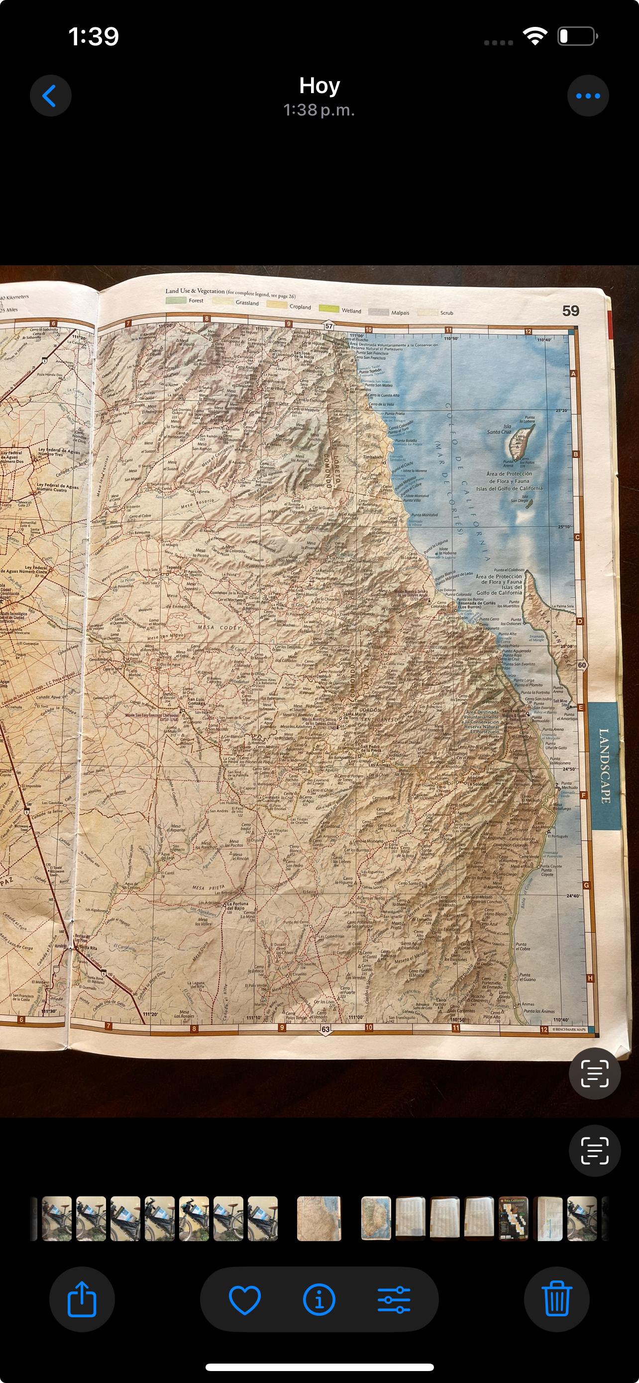
The 1:300,000 scale might make one think the map lacks precision, but this is where the true mastery of the editors shines!
Even though we must admit that some of the most remote ranch names are not always the ones locals use (which often depends on which side of the mountain the person you ask is from), the map is so detailed that it is practically all you need to navigate Baja. You can use it to converse with locals about place names they recognize—not just ones made up for tourists.
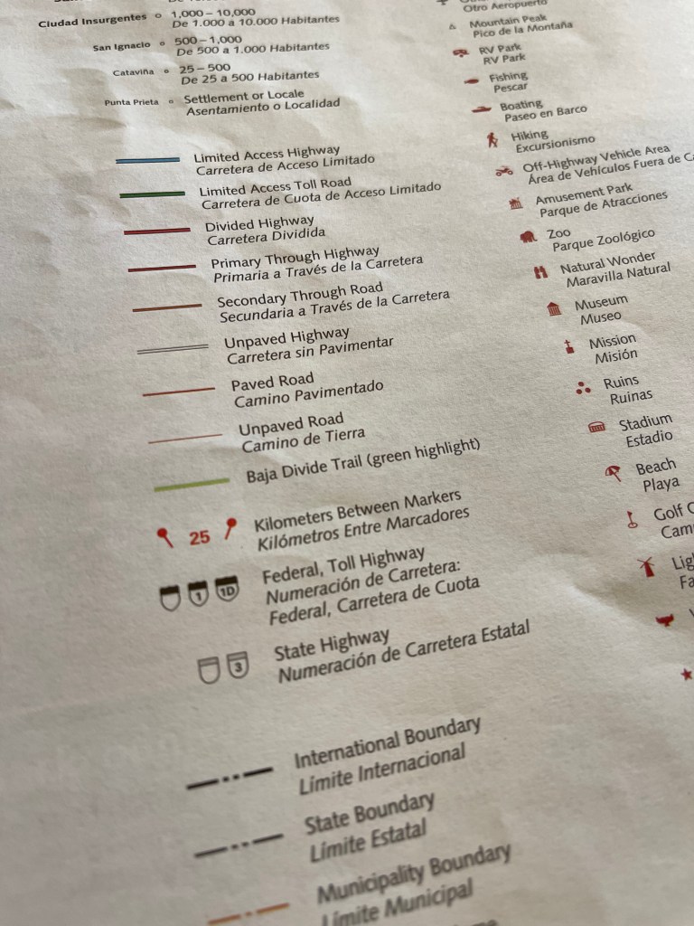
And guess what? Besides the famous Historical Camino Real, It even features the Baja Divide route!
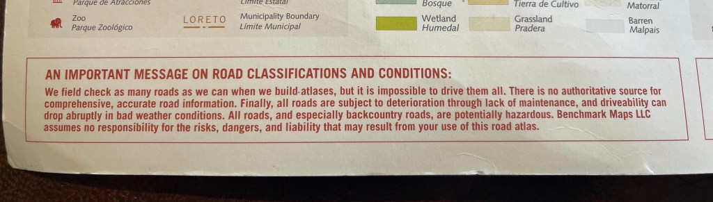
As for updates, the warning on the first page makes it clear:
Besides this, the map now has a 2nd edition, published in 2024. Considering that the first edition was released in 2021 and that a yearly update would obviously be unaffordable for the company, the Baja Divide route displayed may not match the latest version available online. However, it will still work efficiently for most sections. And for the few that don’t, grabbing a pencil and tracing your own route on paper will be part of the unforgettable experience you’ll have with this amazing print!
To find more about Benchmark’s Baja California atlas project you can also check out Micheal’s famous Slow Baja podcast in this episode.
For more infos on David Kier books you can check-out his website http://www.vivabaja.com or purchase the book here.
To physically buy the map if you’re in Baja, even if the resupply is limited, you can try to score at Tacos El Muelle in Guerrero Negro ( off the Divide ) or at Allende Books library in La Paz.
To order the Baja California atlas you can check http://www.benchmarkmaps.com or buy it directly here.
Mattia Dalvit ( @busyerode )

Leave a reply to ctkyle309 Cancel reply